(Update 11:20: Amended maps showing approximate line of crack, following Steve Blamire having re-visited the site this morning.)
A massive crack has developed on Headon Warren, north east of the Needles.
It was described to OnTheWight yesterday as a 6″ (15cm) wide crack running about half a kilometre (0.3 mile) long.
The drop at the crack has been variously described as between 6ft and 30ft.
Potentially largest landslip
Unsurprisingly people living in Freshwater and Totland are very concerned about the potential of it slipping further, with the total loss of the land being discussed. Those with a strong local knowledge described it as having the potential of becoming the largest amount of land to slip in recent times.
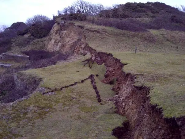
Last night Ashley Cooper, who was up on the Warren and took the photo above, described it as follows to OnTheWight:-
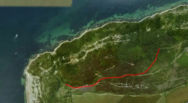
“It does indeed seem to run a good part of the way over the Warren, from Hatherwood Point Battery, up the ridge, and along the north side of the hill, fading out about 1/4 mile from Totland!!”
Approximate length of the crack
For those not familiar with the area, that area may be hard to visualise, so based on Ashley’s description, we’ve created an approximation of where the crack runs. As you can see from the map below, it’s major.
(Click to enlarge)
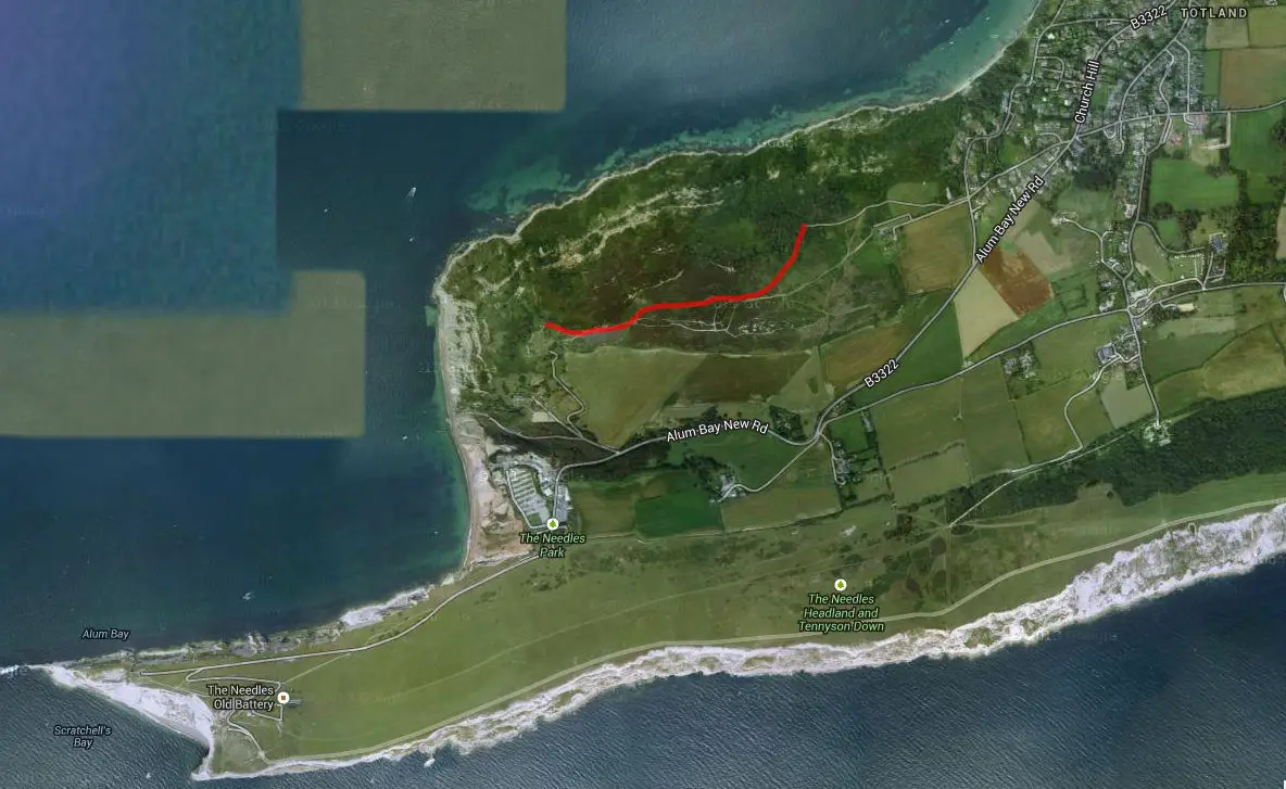
Update 11:20: Amended maps showing approximate line of crack, following Steve Blamire having re-visited the site this morning.
Maps: Drawn in Scribblemaps
Photo: Ashley Cooper, as first seen on The Price is Wight