Two flood alerts for the Isle of Wight have been issued by the Environment Agency. The warnings come after a night of very heavy rain on the Isle of Wight.
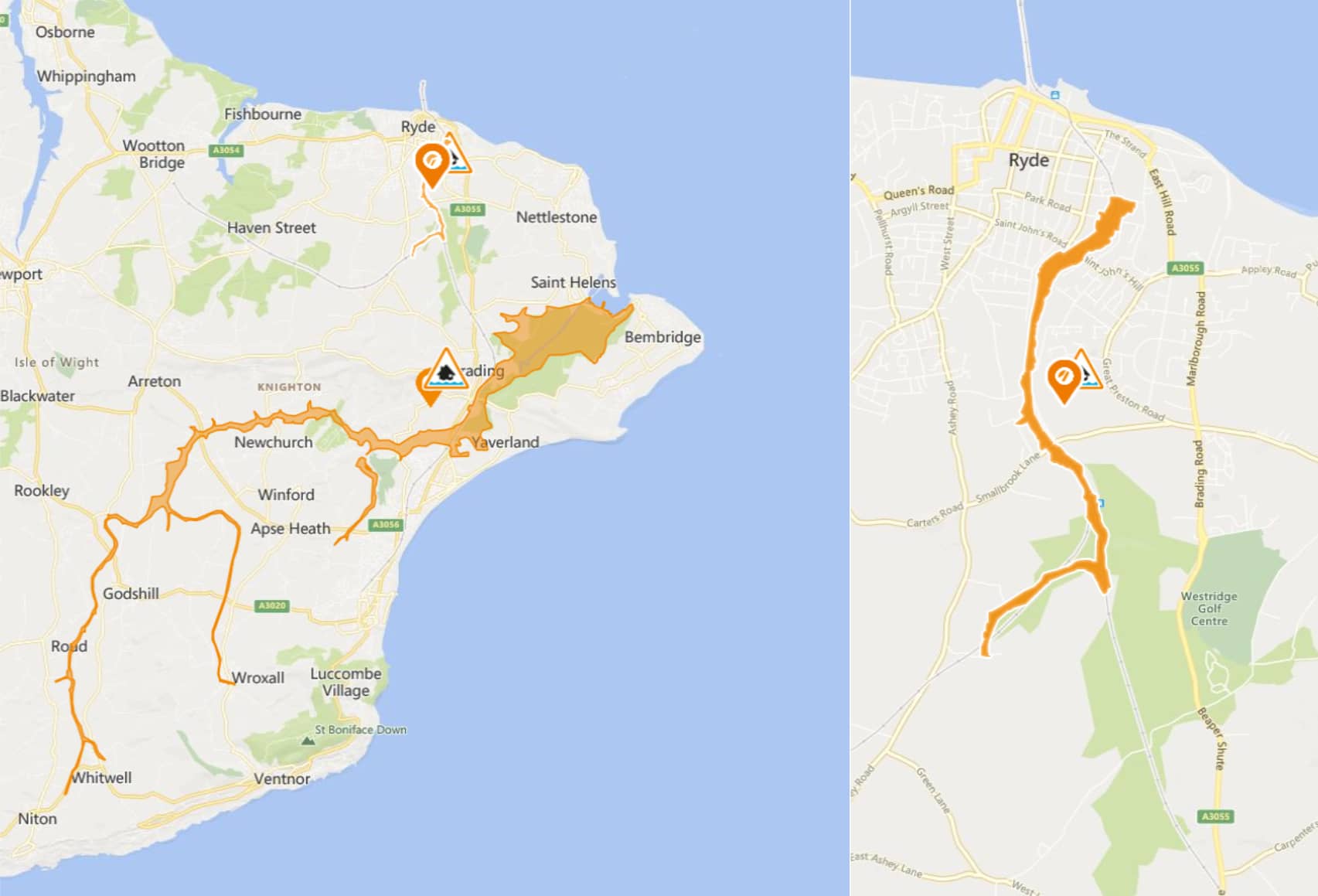
Monktonmead Brook
The first was issued at 5.18 and reads:
Flooding is possible for: Monktonmead Brook at St Johns Road, St John’s Station and Park Road.
Be prepared.
The water level in the Monktonmead Brook is high and rising. More intense rain has fallen with nearly 30mm in the last four hours recorded at Ryde. This is about half a month’s total. In the next hour, water will begin to flow across the railway tracks, upstream of St Johns Station. Surface water may already be causing impacts as drains become overloaded. Property flooding is not currently expected at this time but we will keep under review.
Further thundery showers are still possible over the next 24 hours. Water levels will remain very high until at least 06:00. Our operational staff will keep the Monktonmead Brook clear of reported blockages. Please consider moving vehicles from depots located next to the river and railway line. We will update this message by 11:00 27/07/2021.
Follow and updates to the alert by visiting the Environment Agency’s Website.
Eastern Yar
The second flood alert was issued at 7.04 and reads:
Flooding is possible for: Eastern Yar and tributaries from Whitwell to Bembridge.
Be prepared.
The water level in the Eastern Yar is high and rising again after a further 27mm of rain recorded at Knighton overnight. At Sandown the river has only just peaked after the rainfall on Sunday (25/07/2021). Today, water levels will rise around Alverstone and Langbridge, to similar levels as those experienced on Monday (26/07/21). Property flooding at Alverstone is possible but not currently expected. Golf Links Road and Moreton Common Road will continue experience minor impact flooding. Ditches at Fort Holiday Park may also struggle to drain.
Today (Tuesday 27/07/21) and for the rest of this week, the risk of further fast moving, heavy and scattered showers continues. We would like residents to be prepared for further potential flood impacts. We are operating the sluice to manage around levels at Bembridge. This message will be updated by 12:00 on Tuesday (27/07/21) or sooner if the situation changes.
Follow and updates to the alert by visiting the Environment Agency’s Website.