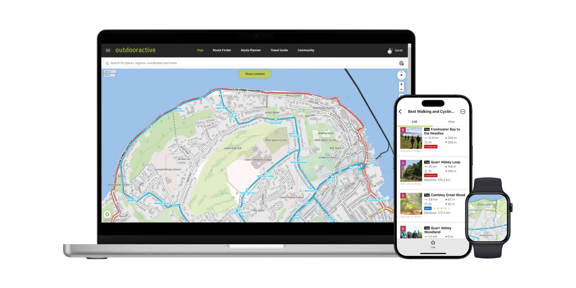
Outdooractive, Europe’s largest outdoor activity and tourism digital platform, has announced the release of its latest UK map update. This update includes work enabled by cooperation with Isle of Wight council and Visit Isle of Wight to deliver the best interactive outdoor activities map for the Isle of Wight.
Revolutionising outdoor activity and tourism experience
Outdooractive’s new UK map is set to revolutionise the outdoor activity and tourism experience, providing a comprehensive and detailed resource for outdoor enthusiasts and tourists alike. With its extensive data integration and intelligent routing capabilities, the map offers unparalleled opportunities for adventure and exploration.
Created by its own team of cartographers, the unique Outdooractive map brings together authoritative datasets from multiple data sources and suppliers. The scalable, vector map also includes a fully routable path network, specialised activity networks for hiking, cycling, mountain biking, and winter sports, along with a range of useful map overlays including a photo map layer and public transport.
The Outdooractive app
The Outdooractive map is available in the popular Outdooractive app, where consumers also have access to OpenStreetMap and Ordnance Survey maps, used to find adventure inspiration and for planning and navigating those outdoor activities.
It can also be used by tourism destinations and other business partners to embed maps, routes and attractions in their websites, or in their own-branded tourism app. Visit Isle of Wight use Outdooractive to power a range of interactive tourism and route maps on their own website.
Streamlined process
Whilst creating this new UK map, Outdooractive cartographers worked with Isle of Wight council to include data from the Island’s Definitive Map and to ensure that information such as rights of way (which can often be missing or misrepresented in crowd-sourced map data) is accurately included.
This project follows a similar cooperation with Suffolk County Council and means that Outdooractive has created a streamlined process that can now repeatedly be used to greatly improve the map experience rapidly across the country. Outdooractive is now inviting other definitive map data holders to work with its team.
Comprehensive map
In contrast to other outdoor apps, that usually rely just on OpenStreetMap as the vector data source for their map data, working with the Isle of Wight council’s data and other data owners means the new Outdooractive map includes all of the detailed rights of way paths, including footpaths, bridleways, restricted byways and byways open to all traffic (BOATs).
As well as appearing on the map, this path network is fully routable using Outdooractive’s intelligent routing engine – including Outdooractive’s new “Magic Roundtrip” route planning tool that makes it simple to plot a personalised new route with just two taps on the screen.
All of which contributes to a better picture of the landscape for outdoor enthusiasts and tourists, and more opportunity to discover the perfect outdoor adventure.
Wimmer: It is great to work with forward-looking organisations
Hartmut Wimmer, Outdooractive Founder and CEO, said,
“Outdooractive has a team of highly experienced cartographers and software engineers focused on creating the best outdoor activity interactive map and routing engine.
“We work closely with thousands of destination and data partners, and it is great to work with forward-looking organisations on the Isle of Wight to improve our UK map.”
Jordan: Modern technology has an important part to play
Councillor Phil Jordan, Isle of Wight Council Leader with responsibility for Transport and Infrastructure said,
“This represents a significant contribution from our Rights of Way Team to improving information for visitors, residents and local business in how they find their way around our beautiful Island.
“Modern technology has an important part to play, especially ensuring people have the most current information and quick means to access.”
Summers: Helps us to showcase the wonderful opportunities
Amy Summers, Sustainable Travel, Trade and Exhibitions Manager at Visit Isle of Wight, commented,
“As a popular destination for families and people seeking to enjoy time outside, our goal is to ensure that visitors have the best information available so that they can enjoy many of the amazing sights and experiences when they visit the beautiful Isle of Wight.
“Working with Outdooractive helps us to showcase the wonderful opportunities for walking, cycling and other activities on the Island and gives us valuable insights into our visitor interests.”
Wareham: Providing detailed, accurate and up-to-date information
Craig Wareham, Director Global B2C and UK CEO, said,
“Our commitment is to deliver the ultimate map for outdoor activities.
“It means we can deliver – at scale across Europe – detailed, accurate and up-to-date information on protected areas and rights of way that are not available elsewhere.
“It means we can use ferries data in our routing engine when planning coastal cycle rides and intelligently route using ski lift networks in the Alps for summer hiking or winter sports.
“Our platform also includes dynamic data on path closures and information on restricted areas (e.g. due to seasonal nesting birds), so we can automatically route around or avoid these.”
Editor’s note: The Outdooractive app offers an Open Street Map version for free, but to access the features mentioned above, you have to pay for the pro version.
For free access to information about footpaths, bridleways and other rights of ways on the Isle of Wight, one clever Islander has for a number of years been providing the free-to-use and easy to use WightPaths website,
News shared by Simon on behalf of Visit Isle of Wight. Ed


