
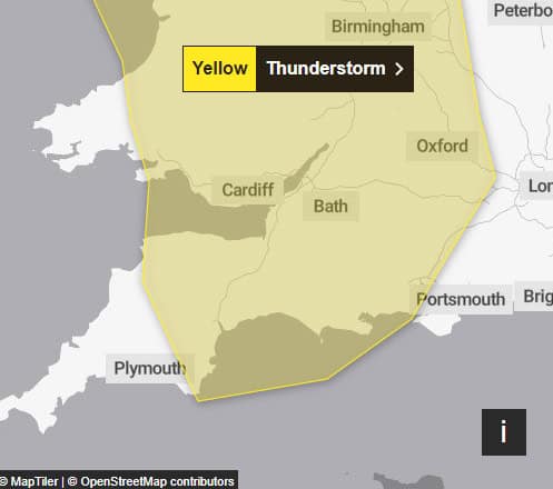
A quick heads up that the Isle of Wight is on the edge of a Met Office weather warning on Sunday for more heavy showers and thunderstorms.
The warning, valid from midday to 10pm on Sunday reads:
Heavy showers and thunderstorms are likely to break out in the south of this area late Sunday morning and early Sunday afternoon, moving steadily north whilst growing into larger areas of rain before clearing the area.
Some intense downpours are possible in a few places, giving up to 30 mm in less than hour and perhaps 40-50 mm over 2 to 3 hours leading to surface water flooding.
Hail, frequent lightning strikes and strong wind gusts will be additional localised hazards.
What to expect
- Spray and sudden flooding could lead to difficult driving conditions and some road closures
- Where flooding or lightning strikes occur, there is a chance of delays and some cancellations to train and bus services
- There is a slight chance that power cuts could occur and other services to some homes and businesses could be lost
- There is a small chance of fast flowing or deep floodwater causing danger to life, particularly in places such as road and railway underpasses.
- There is a small chance that homes and businesses could be flooded quickly, with damage to some buildings from floodwater, lightning strikes, hail or strong winds
You can stay up to date with the weather warning by visiting the Met Office website.