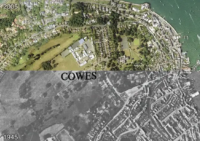
We’ve all heard the phrase …. “when I were a nipper, this here was all fields”.
Like us, we expect you’ve stood somewhere and tried to imagine what an area really was like 50 or 60 years before.
Split screen wonders
Well you need not wonder anymore.
Grant Selby, by using Google Earth mapping and data, has been able to create a brilliant split screen aerial video of different areas of the Isle of Wight between 1945 and 2005
The videos are a brilliant idea and are gripping to watch.
Follow the development
It’s really interesting being able to see which areas have – or have not – been developed over a period of 60 years.
The first video takes us from Cowes down to Carisbrooke.
Grant has also carried out the same treatment from Newport to Freshwater on the old railway line. Follow the train in the centre of the screen and be taken on a refreshing journey from Newport to Freshwater.
Excellent work Grant, we love these videos and can’t wait to see more.
Thanks to Andrew Day for sharing on Twitter.


