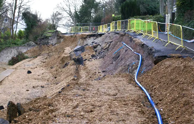
An Island resident has submitted a Freedom of Information (FOI) request to see what risk assessments were carried out prior to the major roadworks that took place on several sections of Undercliff Drive at the end of 2013 and their subsequent collapse.
The information, shared with OnTheWight, provided to the resident by the Isle of Wight council – namely Geotechnical Design Reports produced by Ramboll for Ringway Island Roads – uncovers some apparently worrying information.
Risk Register revelations
Within the Risk Register for the Woodlands site (the section that underwent major excavation over the 2013/14 winter), is a line concerning ‘Geological Failures’.
For this, the column labelled ‘Pre-mitigation’ contains three values, 5, 5 and 25.
Relating these values to the other table on the page (the Probability Impact Risk Matrix), they correlate to the ‘Risk Likelihood’ and ‘Hazard Severity’ – ie How likely is it to happen? and How big an impact would it have, if it happened?
‘Very High’ ratings
Both of these 5s equate to ‘Very High’ ratings. The highest possible rating for ‘Risk Likelihood’ and just one off the highest for ‘Hazard Severity’.
Those 5s are multiplied together to provide an overall risk score of 25.
This combined score is the highest risk score on the Risk Register and well within the red marked zone on the risk matrix (below), only one off the highest possible score.
Click on image for larger version

No proposed action
Under the ‘Mitigation’ column (Defined: lessening the force or intensity of something unpleasant – ie what are they going to do about the risk.) it states,
‘None proposed’
The initials ‘IOW’ are also placed next to this.
Under ‘Risk Description’ there are three columns. ‘Geological failures’ and ‘Geological failures downslope and upslope not stabilised’ are the first two.
Rainfall highlighted
The final box is written in an apparently abbreviated form, ‘Geological failures overwhelming proposed works’. Clearly we’re not experts, but that appears to read that they’re concerned geological failures could overwhelm the proposed works.
The rest of the text in that box, “Timing likely to be dependent on future rainfall and groundwater”, is clear enough.
Information missing
The way the report has been copied by IWC and provided under the FOIA request, not only is the printing of the Risk Register incredibility small, and therefore very hard to read, but it looks like the original sheet was printed in landscape.
As the paperwork provided by the council has been copied onto a portrait page, it appears that the table provided is incomplete. Other relevant information might be in those right hand columns hidden from view.
Why carry out works over the winter?
Many residents and Islanders will surely now be asking why, when the Isle of Wight council was seemingly aware that the probability of risk was ‘Very High’, did they sign off geo-technical roadworks to take place over the winter period, when the likelihood of heavy rain was higher than summer.
Questions that need answers
The disclosure of this document by OnTheWight today, where in a risk register prepared by a well-respected third-party, poses many questions. The two most pressing are:-
- Who at IWC signed off this report?
- Who had sight of the report between it being produced, and the landslip in Jan/February 2014.
- Who then authorised the Undercliff work to be carried out in a rainy time of year, being fully aware of the high risk of geological failure that depended on future rainfall?
We’ve put these to IWC and hope they give the answering of them the urgency required.


