Although the worst of Storm Eunice has already hit the Isle of Wight, the Island is still subject to Yellow weather warnings today (Saturday), Sunday and Monday.
The adverse weather is impacting on cross-Solent travel, with Hovertravel services suspended, and the lunchtime RedJet cancelled due to strong winds. You can keep up to date with service details by visiting each of the operators’ Twitter feeds: Red Funnel, Wightlink and Hovertravel.
Saturday’s warning
Saturday’s weather warning for strong winds is valid between 6am and 6pm and reads:
A short-lived area of strong winds looks likely to track quickly eastwards across southern parts of England and Wales on Saturday, accompanied by a spell of heavy rain. The strongest winds are expected through the Bristol Channel and along the south coast of England with gusts of 60 mph likely here, and 40 to 50 mph inland. The winds themselves could cause minor disruption; but given the expected impact from Storm Eunice on Friday, these conditions on Saturday may hamper any clear-up operations.
Sunday’s warning
Sunday’s weather warning for strong winds is valid between midday and 3pm and reads:
Winds are likely to strengthen across England and Wales ahead of a band of rain, which itself will turn increasingly squally, as it moves southeast on Sunday afternoon. Gusts of 55-60 mph are expected widely around south and west facing coasts, some of which may be more vulnerable than usual in the aftermath of Storm Eunice. Some places inland may see similar strength gusts, and on the squally rain band itself, gusts potentially as high as 70 mph. Blustery showers will follow with further gusts of 60-70 mph mainly confined to coastal areas in the west during Sunday evening. Whilst a temporary reduction in wind speeds is likely for a time overnight into Monday, winds will again strengthen from the northwest during the morning. Gusts of 50-60 mph are probable inland, especially Wales and western/central England.
Monday’s warning
Monday’s weather warning for strong winds is also between midday and 3pm and reads:
Winds are likely to strengthen across England and Wales ahead of a band of rain, which itself will turn increasingly squally, as it moves southeast on Sunday afternoon. Gusts of 55-60 mph are expected widely around south and west facing coasts, some of which may be more vulnerable than usual in the aftermath of Storm Eunice. Some places inland may see similar strength gusts, and on the squally rain band itself, gusts potentially as high as 70 mph. Blustery showers will follow with further gusts of 60-70 mph mainly confined to coastal areas in the west during Sunday evening. Whilst a temporary reduction in wind speeds is likely for a time overnight into Monday, winds will again strengthen from the northwest during the morning. Gusts of 50-60 mph are probable inland, especially Wales and western/central England.
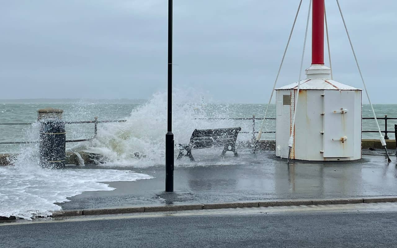
Flood alert
The flood alert for the coast today was around high tide, which is 12.40pm. It reads:
Saturday afternoon’s tide at 12:40 on 19/02/2022 is higher than normal due to unsettled weather with Gale Force 8 South Westerly winds and large waves.
The weather increases tide table values by 0.54 m. The total forecast tide is 4.81 metres Chart Datum (2.22 mAOD) at Cowes, and (1.5 mAOD) at Yarmouth.
For 1 hour either side of high water, large waves will cause minor impact flooding to sea front roads, esplanades and car parks especially at the exposed coast (Shanklin, Sandown, Freshwater, Colwell Bay, Gurnard, Ryde).
Water will be high up slipways in Cowes, affecting Medina Road and the floating bridge. In East Cowes a small amount of water may flood the road at Albany Road.
After this tide‚ no further impacts are expected. We continue to monitor the forecast. As a precautionary measure, and if you have it, we recommend that flood protection is installed at Medina Road (near the floating bridge), 1 hour before high tide.
If you do need to go out over the next few days, stay safe and watch out when driving for fallen trees and debris in the roads.
Image: © Stormy weather in Cowes by Leo Harverson