The six locations of the proposed ‘Meteors’ for the Isle of Wight Dinosaur Island App have today been revealed through the public release of the planning applications.
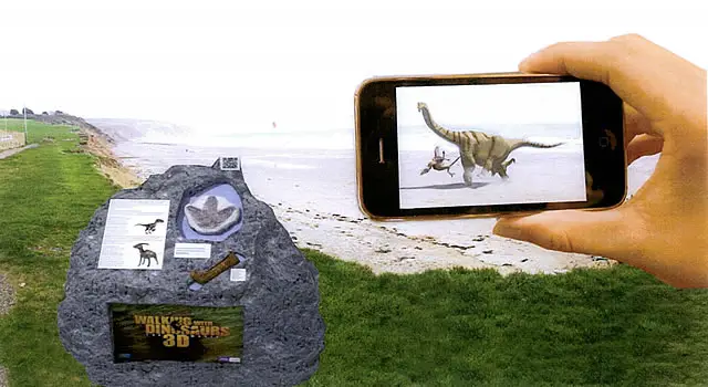
OnTheWight broke the story of the mobile phone app back at the beginning of March, highlighting the Augmented Reality element of the app. The planning application includes a mock-up of what the app might look like.
Size
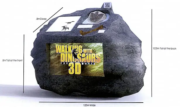
The ‘Meteors’ will be sculpted from polystyrene, then coated with a resin shell, measuring 1.25m wide, with an overall height of just over a metre. The top will angle down to 0.8m. The 50Kg structures will contain a metal frame and will be bolted to the ground.
Design

Application
The application is signed by Simon Dabell, under the company name Visit Isle of Wight Ltd, with the following description:
The proposal is to site 6 dinosaur heritage markers located along the south and south-west coast of the Island, in specific accessible view-points in order to create a heritage trail, linked with ‘Walking with Dinosaurs’ the 3D movie. The primary feature of each marker will be a built-in AR feature so that visitors can take photos of the dinosaurs that lived on the Island, alongside themselves. This trail is an inclusive element of the Island’s 2013/14 marketing campaign.
Locations
-
Site A – Land adjacent Yaverland Car Park, Yaverland Road, Sandown, Isle Of Wight, PO36
Site A planning application -
Site B – Land adjacent landslip car park, Leeson Road, Ventnor, Isle Of Wight, PO38
Site B planning application -
Site C – Land adjacent La Falaise Car Park, Bath Road, Ventnor, Isle Of Wight, PO38
Site C planning application -
Site D – Land at Blackgang Viewpoint Car Park, Blackgang Road, Niton, Ventnor, Isle Of Wight, PO38
Site D planning application -
Site E – Land adjacent Hanover Point Car Park, Brook, Newport, Isle Of Wight, PO30
Site E planning application -
Site F – Land adjacent Former Highdown Test Site, West High Down, Totland Bay, Isle Of Wight, PO39
Site F planning application
Design proposal


