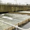
Overnight, the Environment Agency have issued two flood alerts for the Isle of Wight.
The first, issued at 2am on Monday reads,
Flooding is possible for: Lukely Brook from Carisbrooke to Newport.
Be prepared.
The water level in the Lukely Brook at Newport is high and rising. In the last 24 hours 35.37mm of rain has fallen at Carisbrooke. The river is near to bank full. From 02:00 this morning (04/12/2023) the river may come out of bank affecting land at Vicarage Walk. The river may also come out of bank from Old Westminster Lane to Hunnycross Way, flooding footpaths. Further heavy rain is forecast over the next 3 hours. If levels continue to rise, in the next 1 to 2 hours we may issue a Flood Warning, for onset of property flooding directly from the river. Vulnerable areas are Old Westminster Lane, and the Aquatics Centre at Vicarage Walk near Foxes Road. Our operational contractors will ensure the river is kept free of any reported blockages. We continue to monitor the forecast. At Vicarage Walk, we encourage residents living nearest the river to take action to protect their property. Please avoid flooded riverside footpaths.
You can follow that alert via the Environment Agency website.
The second alert, issued at 3.10am on Monday, reads,
Flooding is possible for: Monktonmead Brook at St Johns Road, St John’s Station and Park Road.
Be prepared.
The water level in the Monktonmead Brook at St John’s Station is high and rising. Heavy and intense rain has fallen with 32.87 mm in 24 hours recorded at Ryde. This is a large amount in a short period of time. The river is expected to peak around 06:30 this morning near to levels which may cause flooding to the railway station and depot buildings. From 04:00 this morning (04/12/24) water will begin to flow across the railway tracks, upstream of St Johns Station. Flooding of the station buildings is possible, we will continue to monitor. Further heavy rain is expected to impact the area until 03:00. We expect water levels to continue rising over the next 3.5 hours. Given the amount of rain which has affected the area, at 6:30 the river will peak and potentially be at the level to flood station depot buildings. We will keep the river free of reported blockages. We continue to monitor the forecast. Please consider moving vehicles from depots located next to the river and railway line.
You can follow that alert via the Environment Agency website.
There is also a ‘Be Alert’ weather warning in place until 6pm Monday for heavy rain.