The Environment Agency have issued their second flood alert for the Isle of Wight today (Tuesday). It ties in with the severe weather warning for strong winds issued earlier today by the Met Office.
The Flood Warning reads:
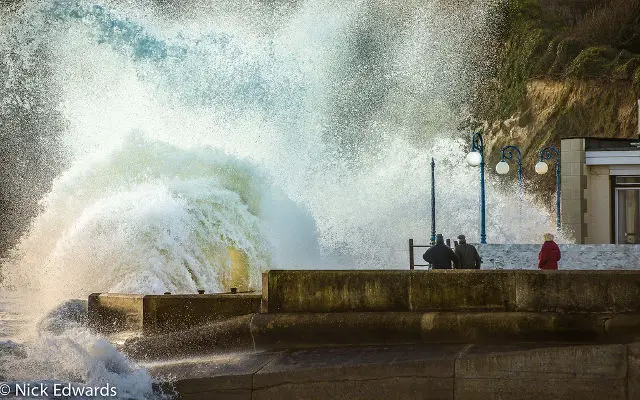
Force 8 increasing to severe gale force 9 winds are expected later. At time of high tide, wave heights are fairly large, at 3m.
The forecast tide level is typical of a normal spring tide, but wind and waves will cause some spray overtopping to coastal roads and car parks, especially at exposed locations like Freshwater Bay, Shanklin, Gurnard and Sandown.
Property flooding is not expected. Keep away from the sea front at high tide. Tide levels are increasing over the next 48 hours and further Flood Alerts will be issued.
| Time and date of high water | 23:12 on 02/01/2018 |
| Predicted astronomical tide level | 1.96 mAOD |
| Forecast surge height | 0.31 m |
| Forecast high water level at Cowes | 2.27 mAOD or 4.86 mCD |
| Forecast wind direction | South Westerly |
| Forecast wind strength | Force 8 |
Image: © Nick Edwards – Wight Seen