After a night of heavy rain, the Environment Agency (EA) have issued several flood alerts around the Isle of Wight, and Island Roads have closed a road due to a landslide.
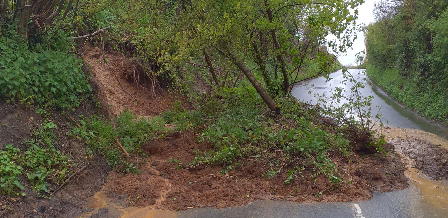
Part of the bank on Niton Road in Rookley (pictured), between Harts Lane and the Chequers Inn, collapsed overnight, closing the road.
The EA warn that flooding is expected for Whitwell, Wroxall, Horringford, Langbridge and Alverstone. The warning reads:
Water levels in the Eastern Yar are high and rising at Alverstone and Sandown. In the last 24 hours, nearly 35mm of rainfall has been recorded at Wroxall. This is over half the average month’s rainfall for April.
Levels are rising at Alverstone. From around 15:00 today (28/04/2024), at Langbridge and Alverstone Road Bridge, the river will be close to the top of the river bank.
Showers are forecast for the remainder of today (28/04/2024). The next couple of days are forecast to be dry. Water will be ponded on low lying land adjacent to the river.
Road, cycle track and footpath flooding is expected.
We continue to monitor the forecast. Avoid walking or driving through flood water. Please continue to take action to protect property.
You can see the flood alert on the EA website.
General alert for Eastern Yar
Another alert for Eastern Yar reads:
Water levels in the Eastern Yar are high and rising at Alverstone and Sandown. In the last 24 hours, nearly 35mm of rainfall has been recorded at Wroxall. Levels are rising at Alverstone.
From around 15:00 today (28/04/2024), at Langbridge and Alverstone Road Bridge, the river will be close to the top of the river bank. Levels are rising at Sandown and will continue to rise until around 01:00 tomorrow (29/04/2024).
Flooding of Golf Links Road and Moreton Common Road is expected. Ditches around Fort Holiday Park will struggle to drain. Showers are forecast for the remainder of today (28/04/2024).
Water will be ponded on low lying land adjacent to the river. Road and footpath flooding is expected. We continue to monitor the forecast. Avoid walking or driving through flood water. A Flood Warning is currently in force for Whitwell, Wroxall, Langbridge, Alverstone. Please continue to take action to protect property.
You can see the flood alert on the EA website.