We’ve often thought that the Isle of Wight would be an ideal testing ground for technology. It’s a totally ideal, self-contained nirvana, untroubled and unspoiled by a connection to the mainland (and of course, that’s the way we love it).
30+ enthusiasts expected
Well, others have been obviously drinking from the same fountain, as 30+ enthusiasts are coming over from the wider UK, Norway and Germany tomorrow to map the whole of the island and under a Creative Commons licence, plan to give away all the data for free.
They will be hopping on their bikes, revving their car engines, or simply donning their walking boots to set off and map the entire 381 square km of the island. Once collated, the information will be entered into the OpenStreetMap system for all to share.
Visit Digital-Lifestyles.info for the story in full.
Get involved
If you want to be involved there’s still time … get in touch with OpenStreetMap through their website (although it’s down at the moment … keep trying, they’re in the middle of changing kit).
And don’t forget to say you heard about it on VentnorBlog.
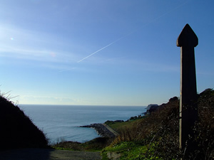
Beautiful image above courtesy of Paddy Wight …. check out the VentnorBlog Flickr Pool for more images of Ventnor and the Island.