Make the most of today’s dry weather as the Met Office weather warning for severe thunderstorms this coming week has now been extended.
It was initially forecasted for Monday and Tuesday, but now has been extended to Thursday.
The warning reads:
Some places are likely to see severe thunderstorms – but there is significant uncertainty in location and timing.
What to expect
- There is a small chance that homes and businesses could be flooded quickly, with damage to some buildings from floodwater, lightning strikes and large hail.
- Where flooding or lightning strikes occur, there is a chance of delays and some cancellations to public transport.
- Spray and sudden flooding could lead to difficult driving conditions and increased chance of accidents.
- There is a slight chance that power cuts could occur and other services to some homes and businesses could be lost
- There is a small chance of fast flowing or deep floodwater causing danger to life
Areas of thunderstorms are increasingly likely to develop over the south of the UK or nearby continent late on Sunday and will generally track north or north-westwards, potentially affecting all parts of the UK at some points during this period.
Whilst the most intense thunderstorms, in some instances associated with large hail, will most probably be those triggered by the high temperatures of the day over England and Wales, other areas of storms producing heavy rainfall, frequent lightning and strong gusty winds could reach further north at times over Scotland and Northern Ireland.
These could occur at any time of the day. Where the storms occur, rainfall totals of 30-40 mm could fall in an hour, with some locations potentially receiving 60-80 mm in 3 hours, although these will be fairly isolated.
You can check the warning on the Met Office Website each day for updates.
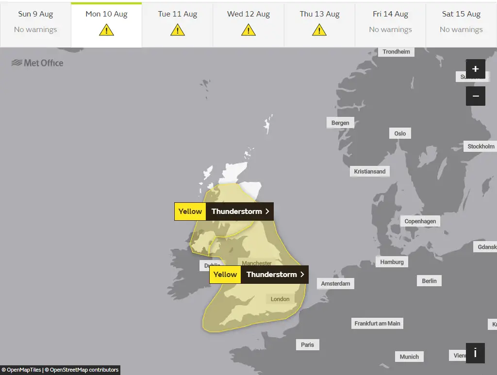
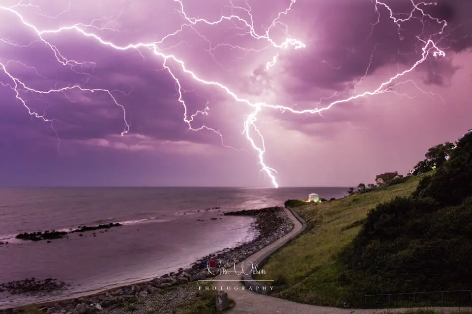
Image: © Mike Wilson