
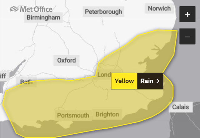
If you live in an area prone to flooding, the Met Office are suggesting you be prepared tomorrow afternoon and evening as thunder storms and torrential rain is predicted in some areas.
Valid from midday until midnight on Monday, the warning reads:
What to expect
- There is a small chance that homes and businesses could be flooded, causing damage to some buildings
- There is a small chance of fast flowing or deep floodwater causing danger to life
- Where flooding occurs, there is a slight chance of delays or cancellations to train and bus services
- Spray and flooding could lead to difficult driving conditions and some road closures
- There is a small chance that some communities will become cut off by flooded roads
- There is a slight chance of power cuts and loss of other services to some homes and businesses
Slow-moving, heavy showers, with some thunderstorms, are likely to break out during Monday afternoon.
This may lead to torrential downpours in some places with 20 to 30 mm of rain in an hour and perhaps in excess of 60 mm in some spots in two or three hours.
There is also a chance of more persistent heavy rain developing over parts of southeast England during the afternoon or evening and persisting into early Tuesday.
Were this to occur there is a chance of 60 to 90 mm rain falling in a few spots.
Stay up to date with changes by visiting the Met Office warning page.
Image: Barefoot Communications under CC BY 2.0