The vast majority of the Isle of Wight has been marked as potential fracking or oil drilling zones in maps released by the Government this week.
The whole of the Island, south of line running across the bottom of Parkhurst Forest is included, with only the land east of Brading – Bembridge and St Helens, etc – not included.
The government say they want to carry out ‘detailed assessment and consultation under the Conservation of Habitats and Species Regulations 2010’, to gather views in advance of any exploration starting.
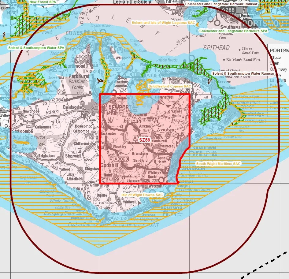
Potential zone of impact covers the whole Island
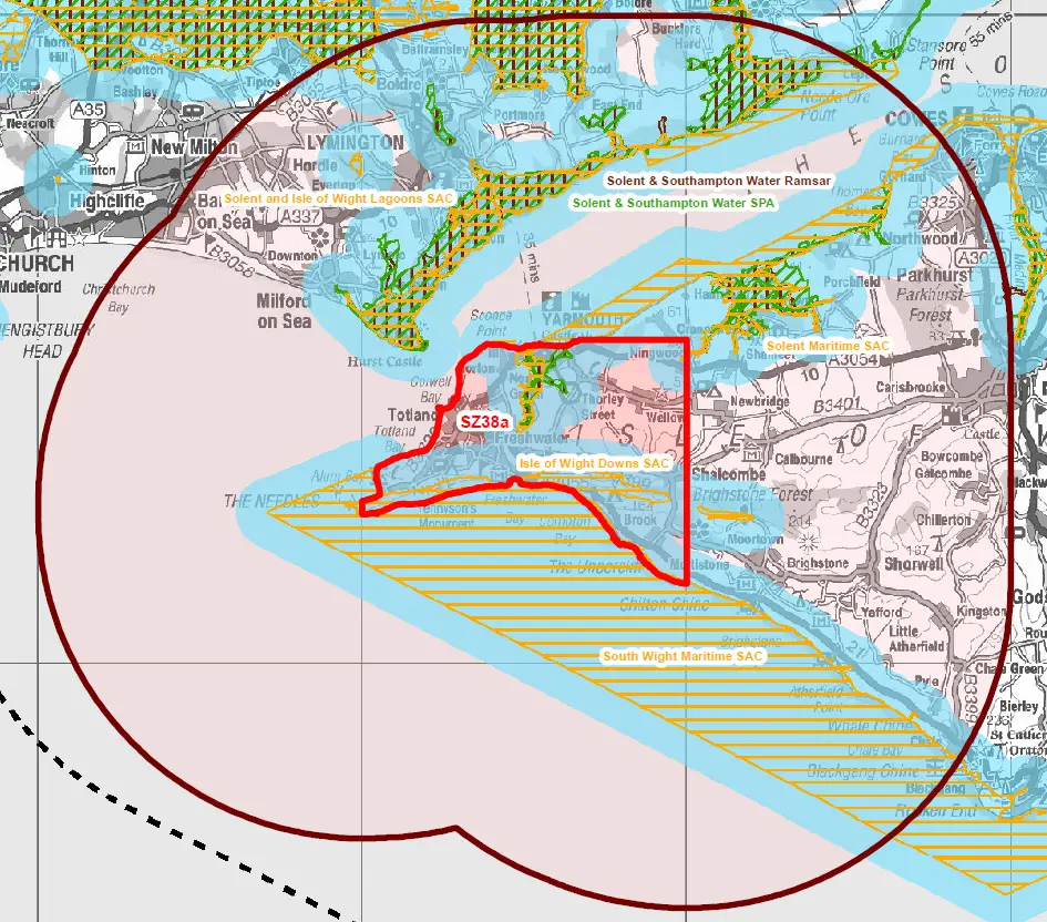
The maps also show the “Potential zone of impact” for each of the five areas, which cover the whole of the Island and way out to sea.
The blocks (detailed below) which the Oil & Gas Authority (OGA) define as ‘typically 10km x 10km’, are in many of the areas that has been hit by land instability – Headon Warren; Totland; Undercliff Drive.
Concerns
Many of those fearful of the impact of Fracking are concerned about the stability of land, as the process involves cracking rocks below ground by injecting a mixture of sand, water and chemicals at high pressure, to release the gas.
Many other European countries, including France and Germany, have banned the use of shale gas hydraulic fracturing, or fracking, due to environmental concerns.
You can comment
As many of the areas covered by these proposed Fracking zones are within the previously protected area of Sites of Special Scientific Interest (SSSI) and Area of Outstanding Natural Beauty (AONB) your opinion is sought.
A Website has been setup to gather your comments, but hurry, as you’ve only got until the end of September.
The areas
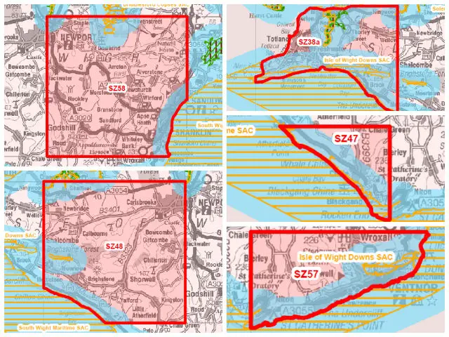
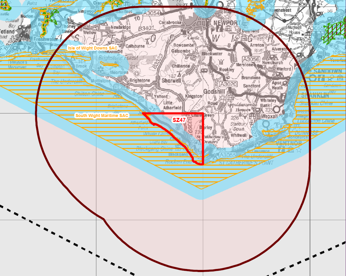
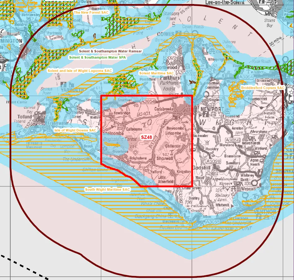
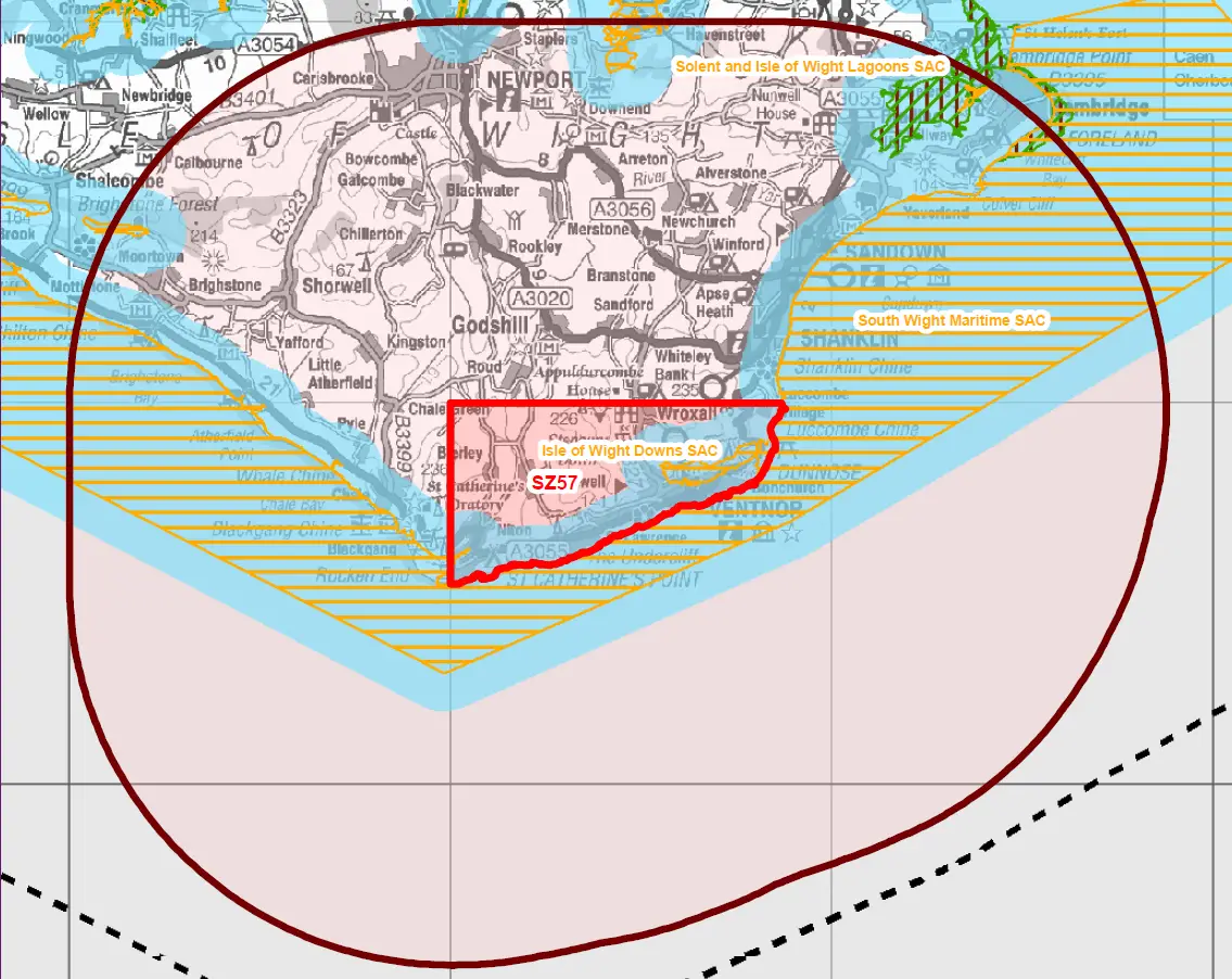
Below are the five areas – the outer grey lines show the ‘Potential zone of impact’. Clicking on the graphics show you larger versions. So you can understand the relevance of the coloured areas, there’s a key at the bottom.
SZ38a – West of Wight
SZ47 – South West
SZ48 – West of Newport
SZ57 – South East
SZ58 – East of Newport