Our thanks to Janet Shuter from the Bembridge and St Helens Harbour Association for this report from last week’s Flood meeting held at Brading Town Hall. In her own words. Ed
Brading Town Council assembled representatives of Environment Agency (EA), Southern Water (SW), Isle of Wight Council (IWC), Island Roads (IR) and RSPB to answer questions from the public on 29 January. Over 100 people attended.
The following is not a full report, just some of the issues.
Council now official Flood Authority
Under new legislation, IWC has been designated Flood Authority; can require info from other agencies; make overall plans; carry out investigations. [This is good, but of course it is more work and expense to fund with limited budget]. IWC has begun investigation.
The Government is offering emergency flood relief, but a Flood Authority has to meet a financial threshold before it will be allowed to compete for a share of the fund, with no guarantee of getting anything at all.
River maintenance
No dredging has been carried out by EA for some years. Audience pointed out lower Eastern Yar is shallower than used to be.
EA insists dredging could have little or no effect, which the audience did not believe.
Farmers told not to remove trees
Riparian owners are responsible for maintenance to centre of river. However, three farmers at the meeting said they had been warned not to remove trees growing in the river, or accumulated silt, and all said that they had been told that doing so might result in prosecutions. Where the Yar is close to the railway line, concrete posts, sleepers and other debris lie in the river.
Riparian owner of rail side bank unknown; RSPB now owns much of the seaward bank and land towards Yaverland/ Morton Common, but was not aware of that problem. Audience suggested creating a depression in this land to take runoff.
There are “pinch points” reducing flow at Alverstone Bridge (where silt and other accumulations make matters worse, and overspill ponds have disappeared or become detached) and at Yarbridge, where there is also said to be debris.
Raised water level
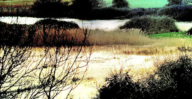
RSPB has been raising Brading Marshes water level in summer to increase wetland for waterfowl.
EA said main sluice (which can only be opened for three hours either side of low tide) was fully opened when overflow anticipated. Audience members asserted that in that case the now waterlogged soil of former dry areas would have no capacity to take up floodwaters.
Easter Yar a low priority
EA said cost-benefit analysis resulted in low priority for Eastern Yar flooding; no preventive works, only provision of flood boards and sandbags to householders.
The big priority was preventing sea incursion at Embankment Road. Nothing was said about the wind/ wave protective effect of Bembridge groyne, now said to have disappeared, which was rated low priority in the Eastern Yar strategy.
Nicholas Close near Yarbridge floods and backed-up sewage [Brading sewage works flooded] made some homes uninhabitable and all unsaleable.
Sandbags difficult for older people
Sandbags hard to obtain and too heavy for older people to place. Brading TC in process of setting up emergency response to assist householders and seeks volunteers to help.
What is apparent from all this is failure in joined-up thinking, and failure to consider the lower Eastern Yar as a single entity.
Thorough inspection needed
A way forward seems to be to get people together to do a thorough inspection and find a way to sort out river bed maintenance and overspill mitigation, by improving ability of Brading Marshes soil to take it up.
Perhaps by working together to identify what needs doing and is feasible, we, the Eastern Yar community, can arrive at a solution.
Image: MS Sports Photography under CC BY 2.0


