As previously mentioned today (Sunday) sees the return of the annual cycling event, the Isle of Wight Randonnee.
Many of the riders set off at the beginning of the day, because the weather is so darn gorgeous and they wanted to avoid the strongest of the sun.
It’s thought that many will be continue riding on until the event’s official end time of 6pm.
Detailed maps
If you want to either watch and encourage the cyclists as they make their way around the course, or take a route to avoid their path below are the maps that should help you.
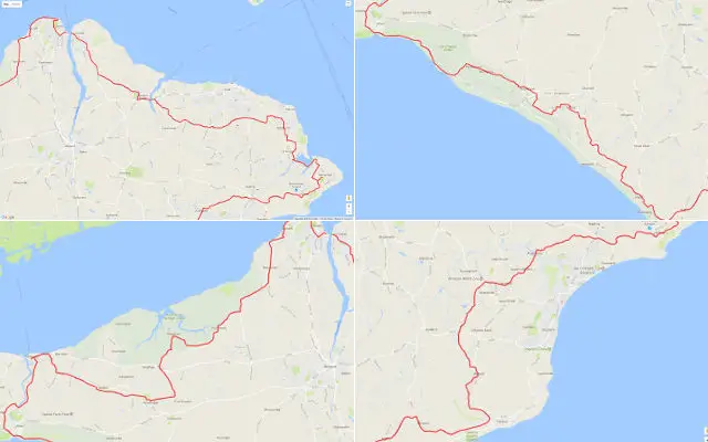
There’s an overview map to show you the whole lot. We’ve also split out the four quadrants for a more detailed view.
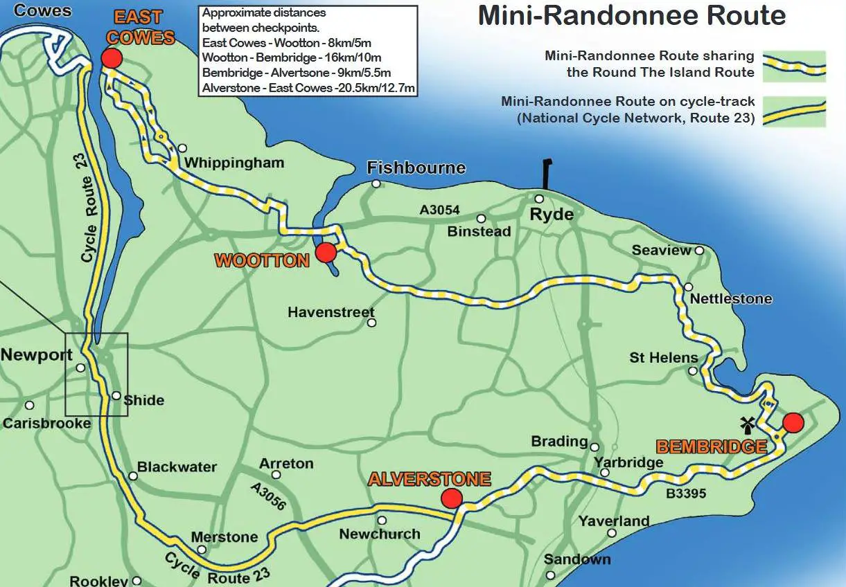
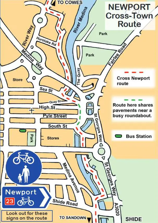
At the end, you’ll also find the Isle of Wight Mini Randonnee route map and its route through Newport (which avoid using the main roads).
You should be able to zoom in to look at the details too.
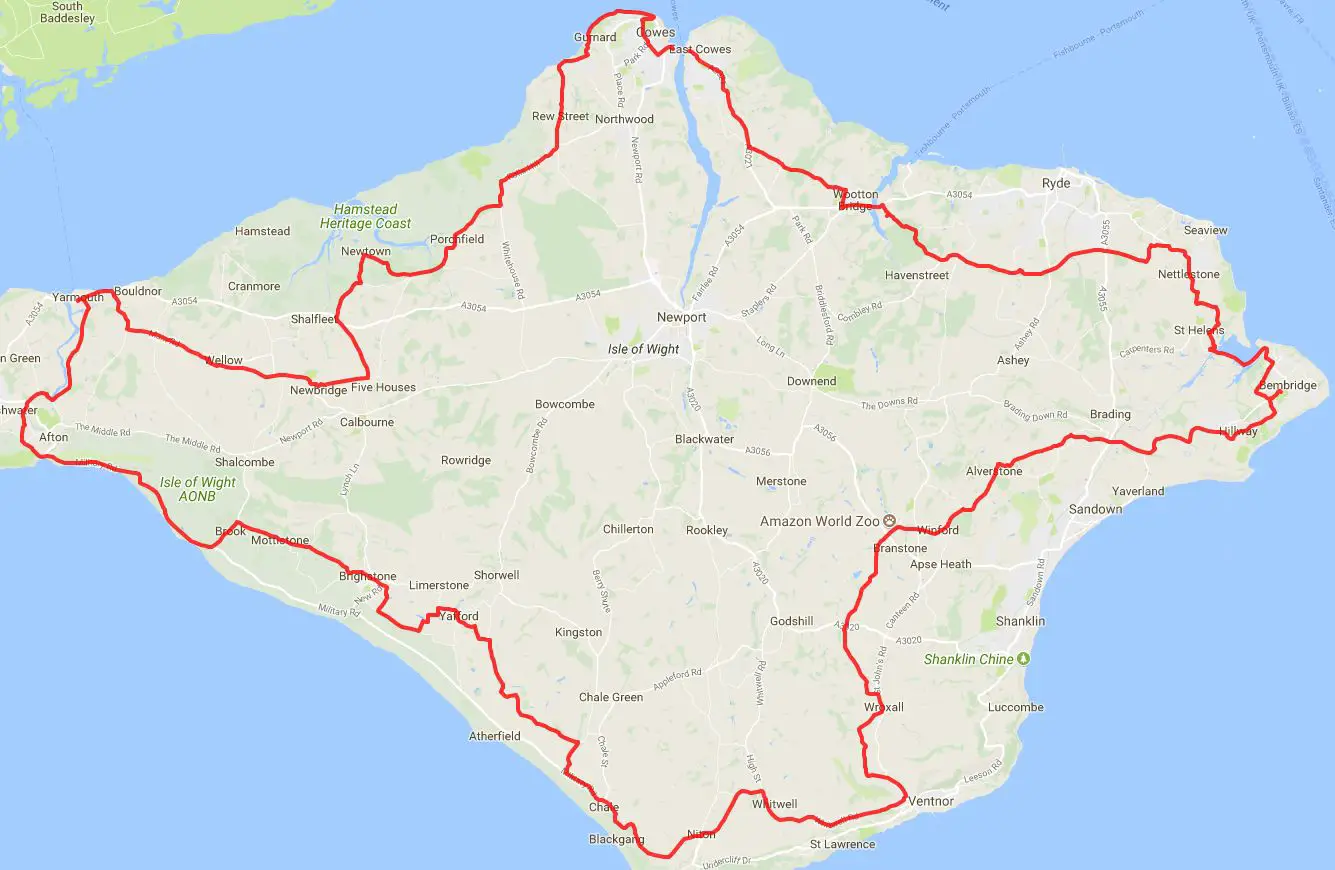
Isle of Wight Randonnee course map overview
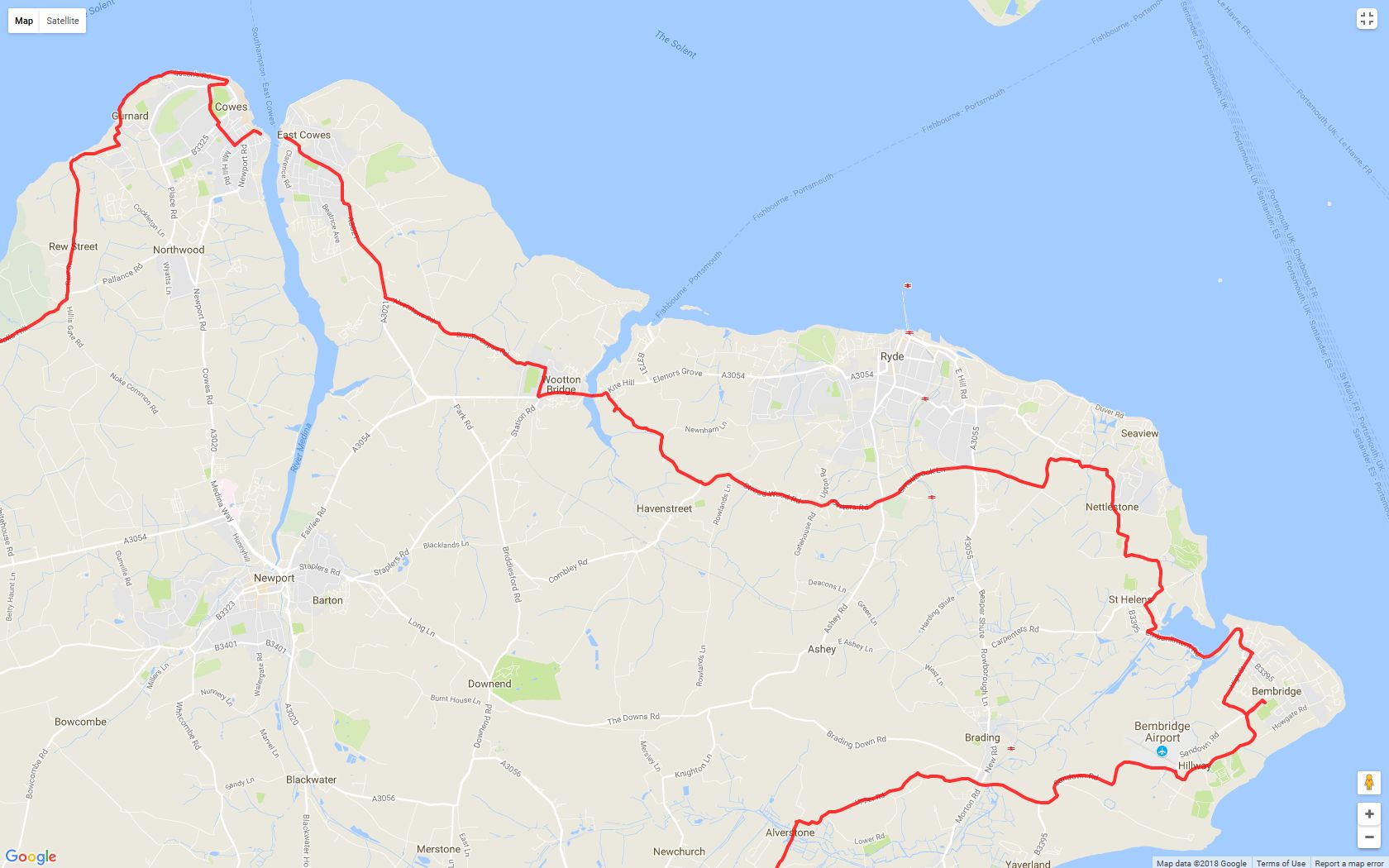
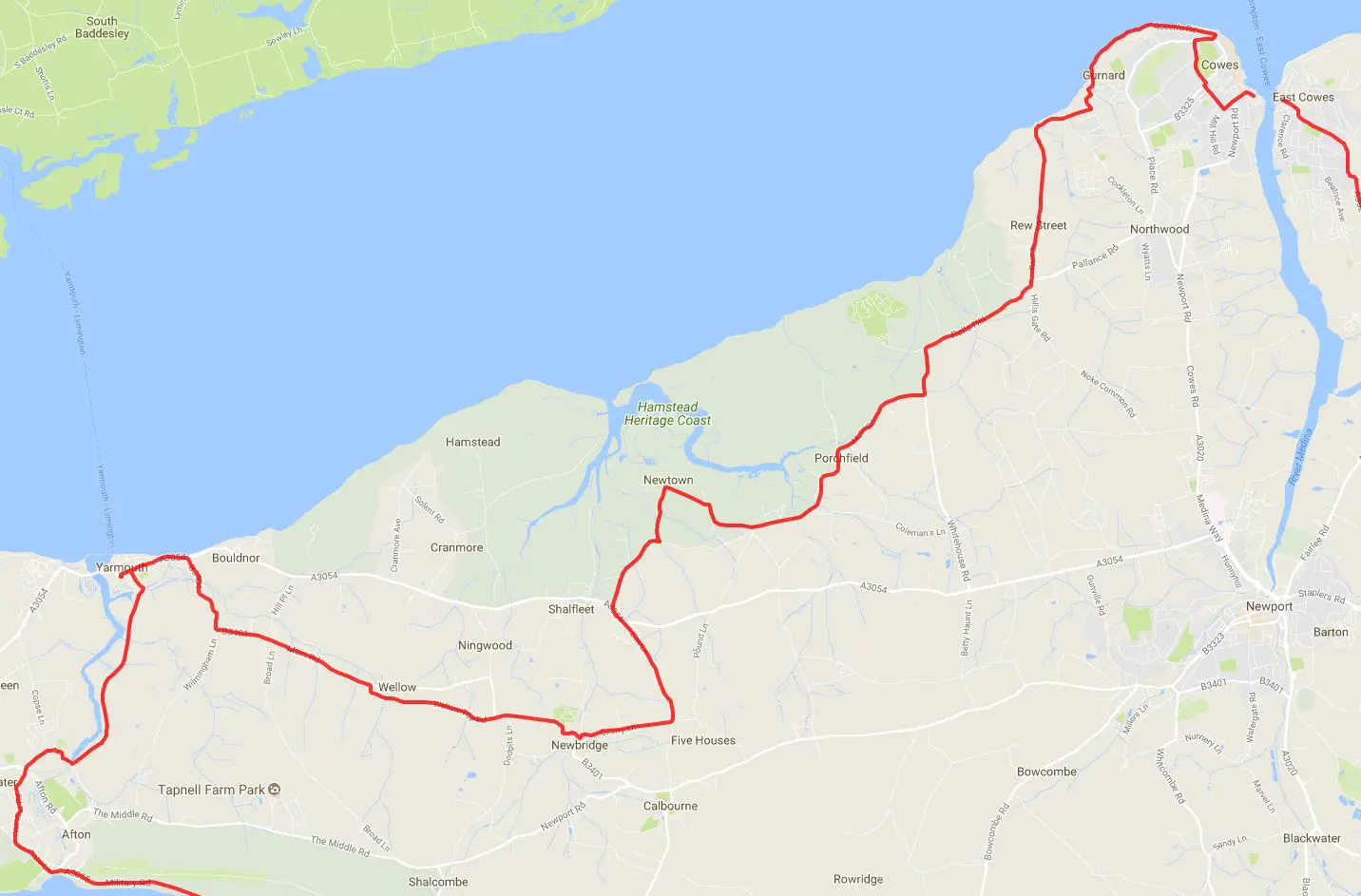
Isle of Wight Randonnee course map: North to East detail
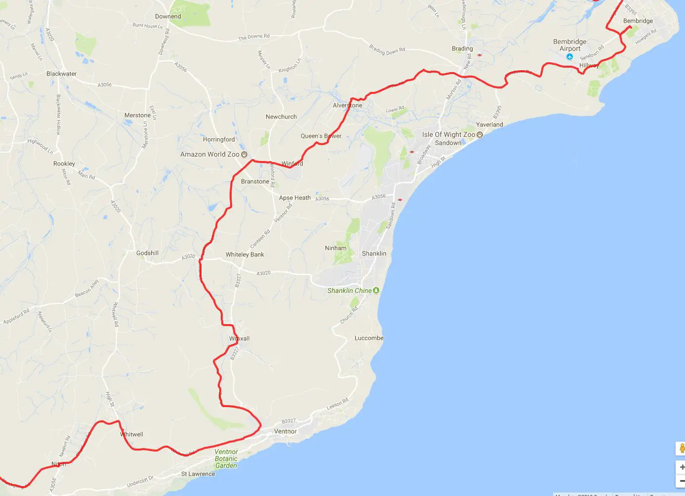
Isle of Wight Randonnee course map: East to South detail
Isle of Wight Randonnee course map: South to West detail
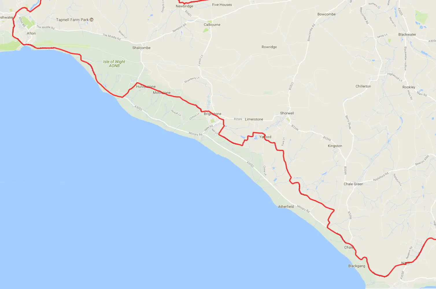
Isle of Wight Randonnee course map: West to South detail
Isle of Wight Mini Randonnee route map 2018
Isle of Wight Mini Randonnee route map 2018: Newport section
Source 1: Cycle Island
Source 2: Cycle Island