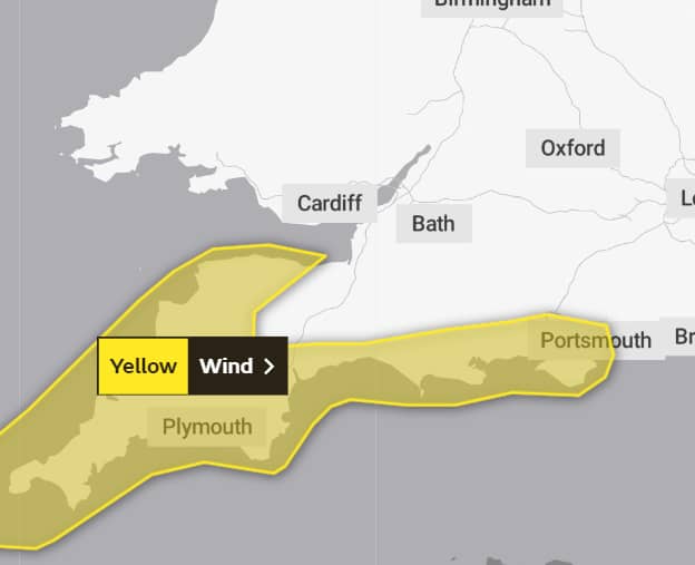
It’s been a bit of a blowy and wet week, and according to the Met Office that is set to continue.
They have issued a weather warning valid from 8pm on Thursday to midday on Friday for more gale force winds.
It reads:
An area of strong to gale force winds are possible and may cause damage to infrastructure and lead to travel disruption.
What to expect
- There is a slight chance of some damage to buildings, such as tiles blown from roofs
- There is a small chance of longer journey times or cancellations as road, rail, air and ferry services are affected
- There is a small chance that some roads and bridges could close
- There is a small chance that injuries and danger to life could occur from large waves and beach material being thrown onto sea fronts, coastal roads and properties
Whilst there remains a lot of uncertainty in the detail at this stage, there is the potential for a swathe of strong winds to arrive in the southwest of England during Thursday evening and then track eastwards along the south coast of England through Friday.
Winds may reach 55-65 mph across the Isles of Scilly and parts of Cornwall late Thursday into Friday morning.
The strongest winds will then transfer along southern England coasts through Friday morning, weakening as they do so, with coastal gales and gusts of 45-50 mph possible.
Heavy rain will accompany these strong winds, with 20 to 30 mm possible widely, especially across the southwest of England where 40 to 50 mm could fall.

To follow any updates to the weather warning, visit the Met Office Website.
Image: PROCarlo Scherer under CC BY 2.0


