A key section of the Isle of Wight’s picturesque Military Road could be rescued from the perils of erosion if a stabilising plan is approved.
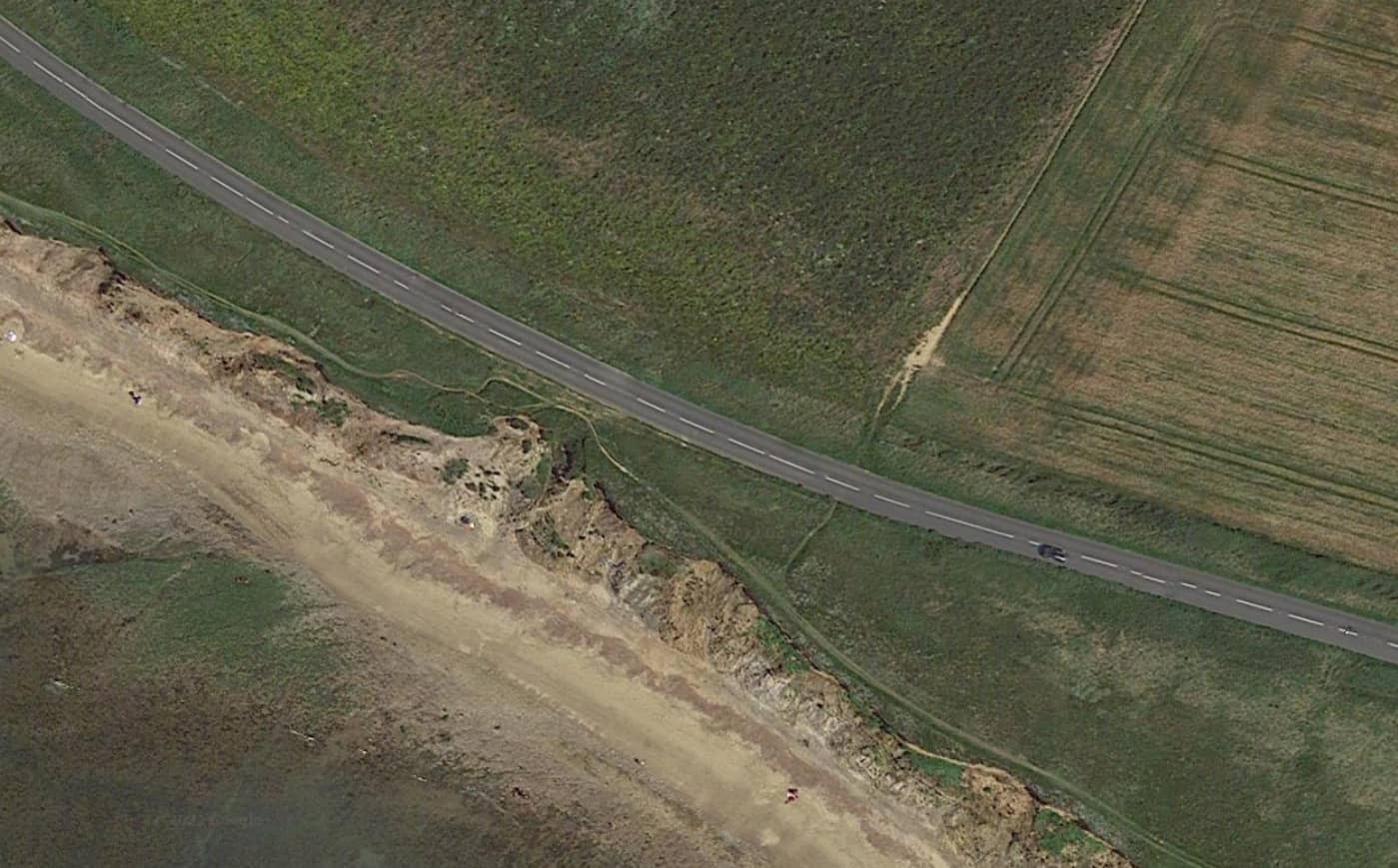
The Isle of Wight council and Island Roads are still trying to fix a section of the ‘strategic route’ between Brook and Hanover Point, where some parts are less than 5m away from the cliff edge.
Seven years for cliff edge to meet the road
If the rate of erosion continues it is said the cliff edge would meet the road in as little as seven years.
To extend the usable life of the section, a retaining piled wall structure, bored into the ground, had been proposed along a 26m long section, which used to be a lay-by.
Piles 21m into the ground
It would comprise 49 alternate-length piles going up to 21 metres into the ground and once it had been completed would be covered with earth and local vegetation to replicate the existing landscape.
If the works were to be approved, the installation would require a complete road closure likely to last between eight and 12 weeks.
The highway plans, however, have gone through multiple revisions and faced a number of challenges.
Designated land
The site falls within the Area of Outstanding Natural Beauty (AONB); a Special Area of Conservation; a Site of Special Scientific Interest and the Tennyson Heritage Coast.
Each of these designations protects the natural features of the landscape and highlights how important they are.
Previous objections
In previous submissions, objections have been submitted by the National Trust, Natural England and the Isle of Wight AONB Partnership, who all raised concerns about the impact the work may have on the area.
The AONB said the gradual exposure of the piled wall would have an alien and incongruous appearance and detract from the area, which is designated and protected for its natural beauty.
Push for long-term strategic solution
The National Trust has been pushing for a long-term strategic solution, but accepted there may be a need for short to medium-term interventions.
It said plans submitted earlier this year were still lacking in detail, contradictory and did not provide clear assessment of the environmental impact of the proposal.
In the latest documents, Island Roads and the Isle of Wight council have tried to address the issues, but said this was a temporary measure while a longer-term solution was determined.
View the plans
You can view the plans, 20/01281/FUL, on the council’s planning register.
The public consultation runs until 6th January.
This article is from the BBC’s LDRS (Local Democracy Reporter Service) scheme, which News OnTheWight is taking part in. Some alterations and additions may have been made by OnTheWight. Ed