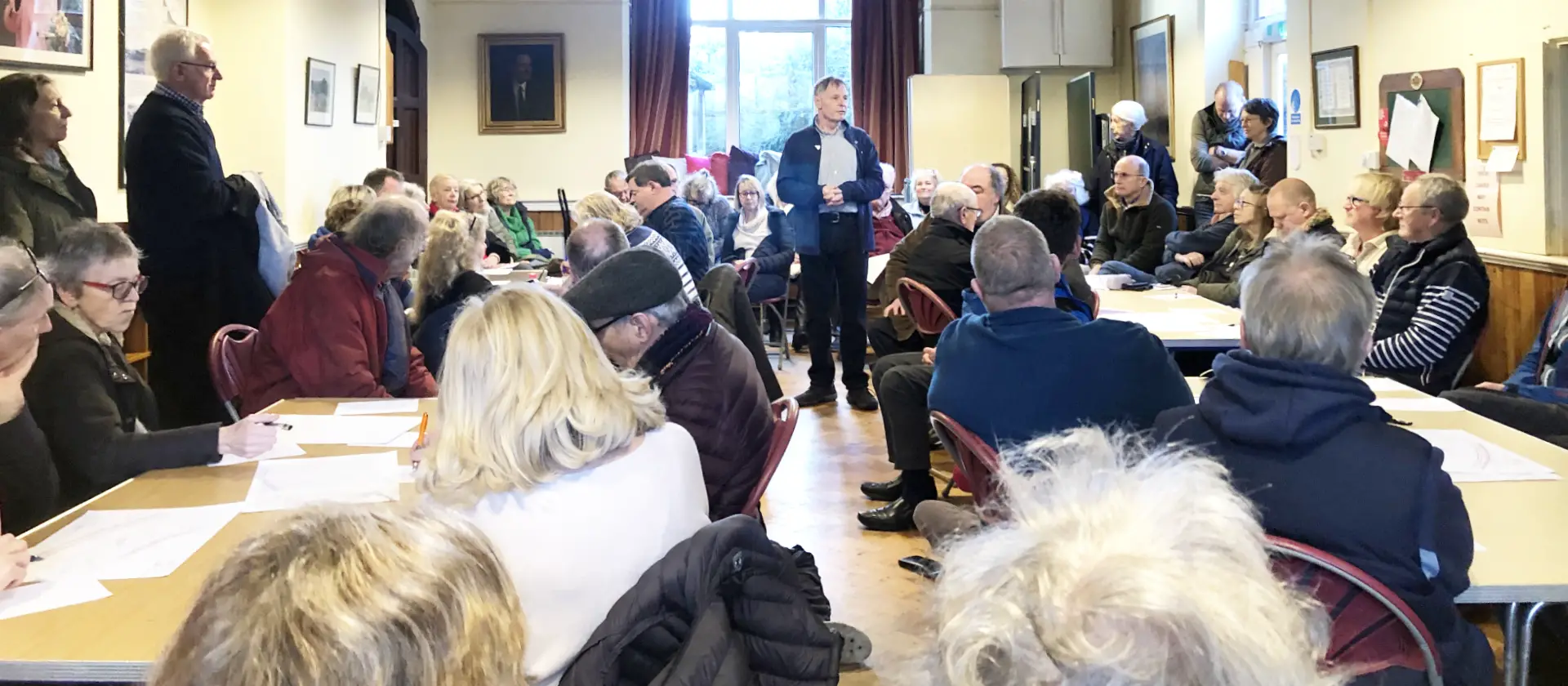
More than 150 people attended the first ‘Save the Military Road’ meeting on Sunday afternoon. There was standing room only at the village hall in Brook, with many residents having to wait outside for a second session to take place.
The meeting had been arranged by Councillor Nick Stuart, the Liberal Democrat ward councillor for Brighstone, Calbourne and Shalfleet, who began by sharing some history about the road, explaining that Military Road, which is part of the A3055, was first built as a road for the military in the 1860s and then rebuilt again in the 1930s.
Three options
Keen to get straight to the point, Councillor Stuart outlined what he saw as the three available options for the future of the road:
- Do nothing
- Maintain the road where it is at the moment with some diversions (of approx 25m) around sites 14 and 15 (these are between Brook and Hanover Point). He said although no formal plans were in place for diversions, all organisations involved are looking into them (IWC, National Trust, Island Roads, English Nature, etc). He said he’d been told that the cost to maintain the road would be around £5 million.
- Realign the road, taking it back a couple of hundred metres. He reiterated there are no plans in place for this at the moment and the anticipated cost would be around £20-£30m.
Pilings must be removed by 2053
He pointed out that the underpinning carried out in the late 1990s/early 2000s on the Afton Down section of road (where the void in the verge has occurred) was subject to a lease from National Trust that expires in 2053 – meaning the pilings would have to be removed by that date, if the coastal erosion had not already claimed the road.
Councillor Stuart pointed out that there may be a case for extending the lease once we reach that date, but if the road falls in the meantime, there will be no second option.
As readers may remember, much of the land in the area was sold to the National Trust in 2015 by the owners of Dunsbury Farm.
Drainage solutions
Councillor Stuart spoke next about the drainage solution that was put in place near Brook in 2010, which takes the water from the land and diverts it out to sea.
Listen to our 2010 podcast with Professor Bruce Denness who came up with the drainage idea that has since helped save that part of the coast.
Councillor Stuart said he believed that water travelling through the land was the major reason for slippage, rather than coastal erosion from the sea, which he said is a much slower process. He highlighted the heavy rain fall experienced last summer and autumn as an indicator of the type of weather we might expect in future years.
‘Queen Victoria’s Coastal Road’
Linda Sullivan, a Niton resident who is part of a group of people campaigning to have Undercliff Drive reopened to through traffic, explained that one of the ideas they’d had was to save the entire A3055 from Ryde to Freshwater, establishing it as a road of national importance. She suggested collaborating with the group looking to save the Military Road.
Linda explained that branding experts were working up designs for ‘Queen Victoria’s Coastal Road’. She believes that the name for the road would resonate around the World, but welcomed,
“Any better ideas if there are any.”
MP’s suggestions
Isle of Wight Conservative MP, Bob Seely, said two decisions made by the council in 2010 needed to be looked at. The first was that the IWC would only deal with the road on its existing route. Secondly that,
“Nobody was going to be touching the coastline to try to hold back coastal erosion.”
He said the council decisions would need to be overturned, as they voted over a decade ago to “do nothing”. This action was part of the Shoreline Management Plan, approved by the Conservative council in 2010.
Road built on shifting geology
The MP stated that at Brook Chine (section 14) and Compton Farm (section 15), as well as sea erosion, there is water erosion coming from the Downs forming chines. He said the road has been built on shifting geology,
“I’ve had it described to me by Natasha Dix from the council as the difference between, the white cliff is the biscuit, it’s quite hard, and the orange wealden rock, where we have the dinosaur finds, is a bit like a cheesecake base and gives away very quickly. So we have to design something for all three pieces and then my advice was we try to get the money for the first two, which are most at risk, section 14 and 15.”
He added there was “a little bit of money in Island Roads currently”, that the “council can loan itself money at low interest”, and “I can go and find Government grants”.
Seely: Pace of erosion is quickening
He finished by saying that the pace of erosion is quickening,
“I think we have to ask the Environment Agency to look again at the coastline, not to put some horrible concrete structures like there is between Bonchurch and Ventnor, but actually to look at whether we have to do sensible things, kelp beds, concrete structures invisible to the eye out to see 50 metres out at low tide, all of which can break the power of the waves. Because the reason why our coastline is eroding as such speed is one because it is soft, clay and sandstone, but also because the fetch of the waves goes deep into the Atlantic and they produce a great deal of kinetic energy.
“So in order to buy ourselves more time for that coastline, and to save 10s of millions in the future, we may have to spend some money now building defenses which could be very good for nature, very sensitive, one’s talking about kelp, one’s talking about putting down structures that will encourage wildlife along the underside of the coast, out of the naked eye under the sea in order to buy that coastline more time and to slow down coastal erosion.”
Councillor Stuart told the meeting that as chair of the Neighbourhoods and Regeneration Scrutiny Committee that this is something they are already looking at, as reported by News OnTheWight in Monday.
Price: Do you not think that we should take Planning decision back?
Councillor Matt Price (Con), who sits on the Planning Committee and is the Isle of Wight councillor for Fairlee and Whippingham, said,
“I was on that Planning Committee where the decision was made not to carry out the works at Brook [he voted in favour of the scheme], which we understand was a fully funded scheme that could be put into action pretty quickly. The three areas we’re talking about, that would at least have solved one of them for now.
“Do you not think that we should take that decision back, look at it again and potentially be approving that scheme? Which is to pile, I know that, but it’s successful in many places and that may be the only other option. If there is no option to divert the road, surely all people here would like to see something done there now?”
Alternative scheme to address issues
Councillor Stuart said that scheme was dead, it had been refused and that it was refused in line with national planning policy and environmental legislation.
Councillor Claire Critchison (Green/Alliance) the Isle of Wight councillor for Chale Niton and Shorwell added,
“We are waiting for another scheme to come forward from Island Roads that does address those issues, so until we get that … but this is good to try and speed that up.”
Councillor Stuart also told the group that
“Moving it, realigning the road, is not the easiest option, because there are all sorts of hoops that you have to go through because of national planning legislation. And so, the habitat requirements, the national legislation issues, and you ain’t going to change that very quickly or necessarily should. So we have to recognise that we are living in a structure of legal requirements, but doesn’t mean you can’t rescue it.”
Diversions through Brook
Further points were made by members of the public about how Brook and other villages would cope with all the excess traffic should the Military Road fail.
The council consultation that took place in 2010 highlighted two possible bypass routes to the east of Brook to ensure that the narrow roads were not unnecessarily impacted by any additional traffic [I’m looking for the plans and will add once I find them. Ed].
Facebook group
Councillor Stuart paid tribute to Lisa Buck and others who had set up the Save the Military Road Facebook group that has been responsible for garnering support from the national papers.
Lisa told the group that although she’d only moved to the Island last summer, she has been a tourist for 15 years and loved the Military Road. The group is run by several administrators.
Meetings have been arranged for the end of the month for members of the group to start drafting and planning a way forward. See the events section of the Group to find out more.
Not the first
However, this is not the first Facebook Group set up to campaign for the road to be saved. Another was set up in 2010 when former former Liberal Democrat Parliamentary candidate, Jill Wareham, urged the council to realign the road.
Her calls were ignored by the then-Conservative council led by David Pugh and George Brown.
Sharing views
Those attending the meeting on Sunday were handed sheets of paper when they entered the hall and asked to share:
- What is your ideal outcome?
- Can you provide reasons for and against each option?
- What knowledge help or expertise could you offer?
- Any other thoughts
As residents left the meeting they were also asked to add to a board an indication of which of the three options they would like to see actioned – the same has been asked of members of the Facebook Group which overwhelmingly have voted for realignment of the road.
Another public meeting is planned for Brighstone in the near future – we’ll update you once we know the details.