Those behind the campaign for a fixed link tunnel between the Isle of Wight and the mainland have today (Friday) revealed the proposed routes (see maps).
Following discussions with mainland local authorities, the locations of the entry and exit points of the proposed tunnel beneath the Solent have been updated since last year.
Those behind the plans explain that “site visits have concluded the best areas for a ‘three portal’ tunnel scheme, which will create an effective and fast north/south route of vehicular access that at present does not exist in Hampshire”.
Whippingham to M27
The entry and exit locations have been described as:
This axis will extend directly from the M27 East of Whitley, to the coast at Lee-on-the-Solent and then on to Whippingham on the Isle of Wight.
The scheme will incorporate approximately, just 3kms of exposed surface road. All other construction will be subterranean.
Cost of build and use
Carl Feeney of Pro-Link says,
“The proposal for the Northern element of the tunnel, is firmly dependent on the toll income derived from the Solent Freedom Tunnel element.
“Without that substantial SFT toll income, it is presumed the construction costs of the Northern Tunnel to reduce existing land traffic, would make it unviable.
“Both private and public funding is envisaged as the most likely way to pay for the project – two thirds and one third respectively. It is estimated that the Solent crossing element of the project will generate an annual revenue of circa £200million, with a further smaller amount of toll revenue (to be assessed) from the mainland element.”
£3billion estimated build costs
Going on to explain that tolls will raise two thirds of the estimated £3billion build costs, Carl says Pro-Link are confident that,
“More than a £billion of project regional economic regeneration benefits, increase tax revenue and healthcare savings, will be achieved to the UKPLC purse within just a few years of operation.
“Ultimately, this project will pay for itself. At present, the two IOW ferry companies have a yearly revenue of over £110million, operating sporadically just a few hours of the day.”
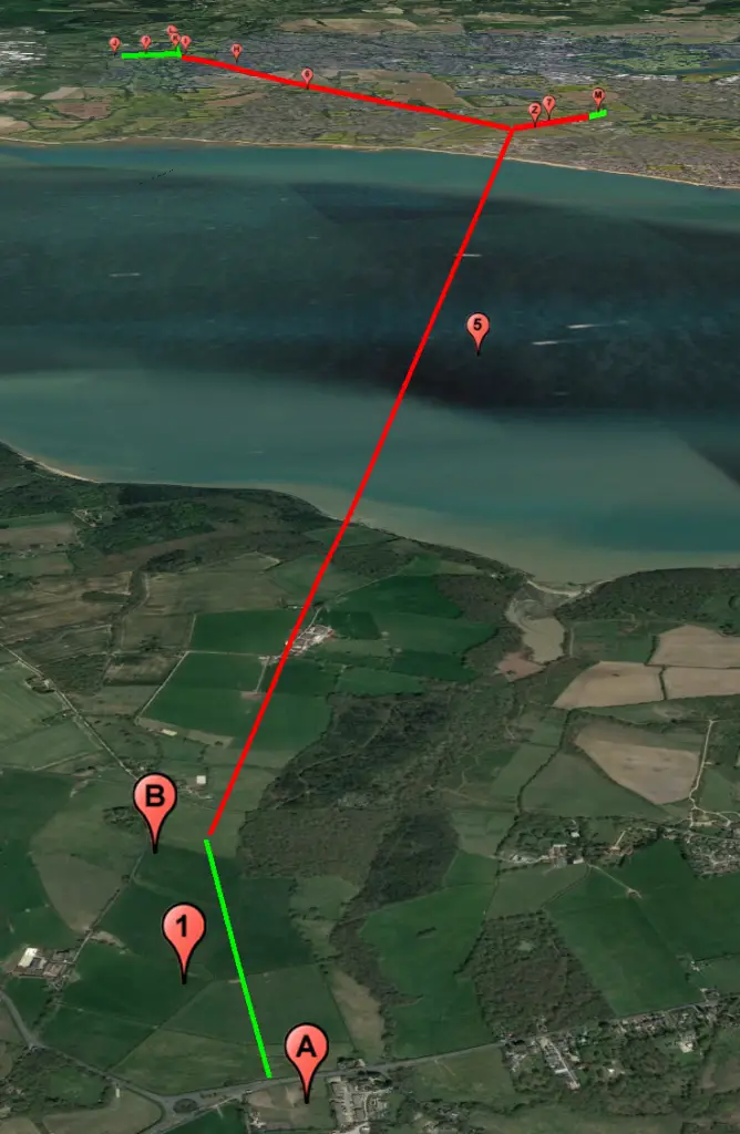
The routes
The proposed line of route.
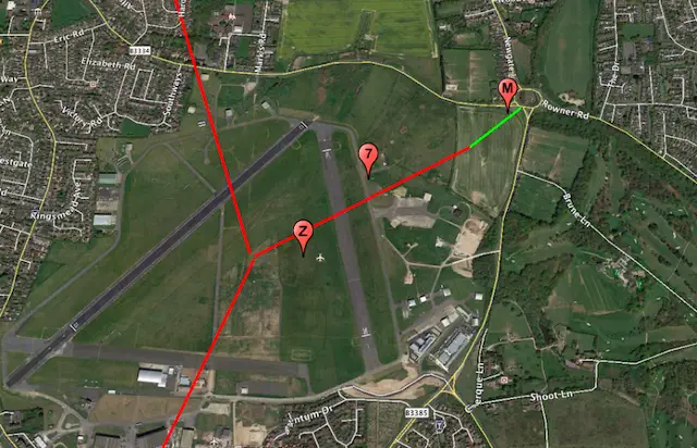
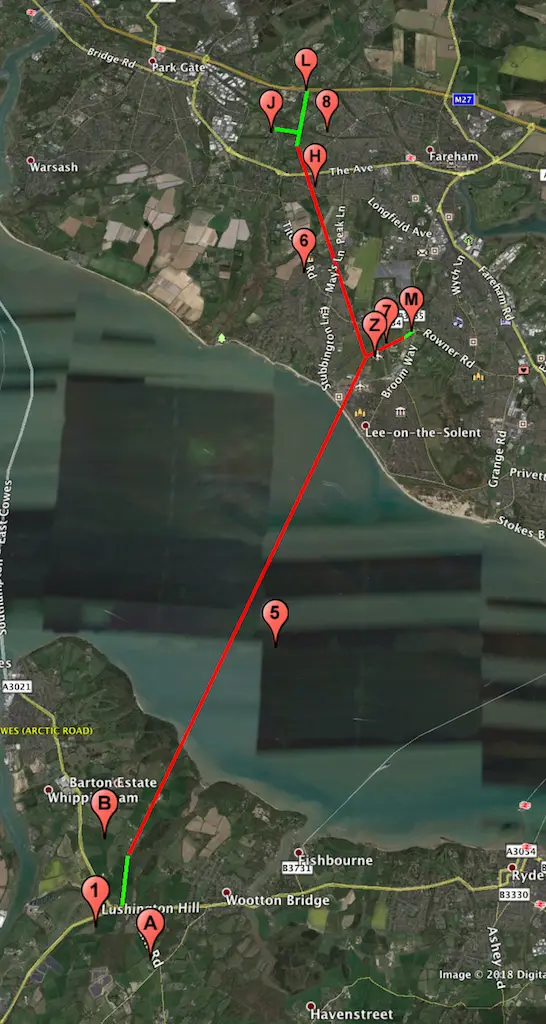
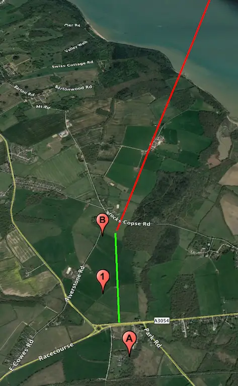
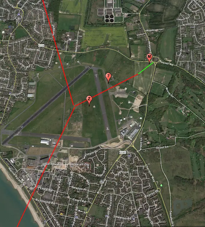
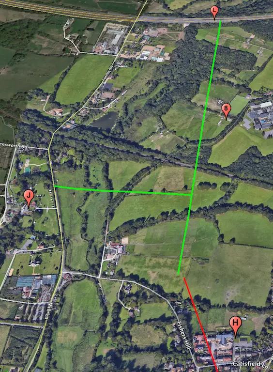
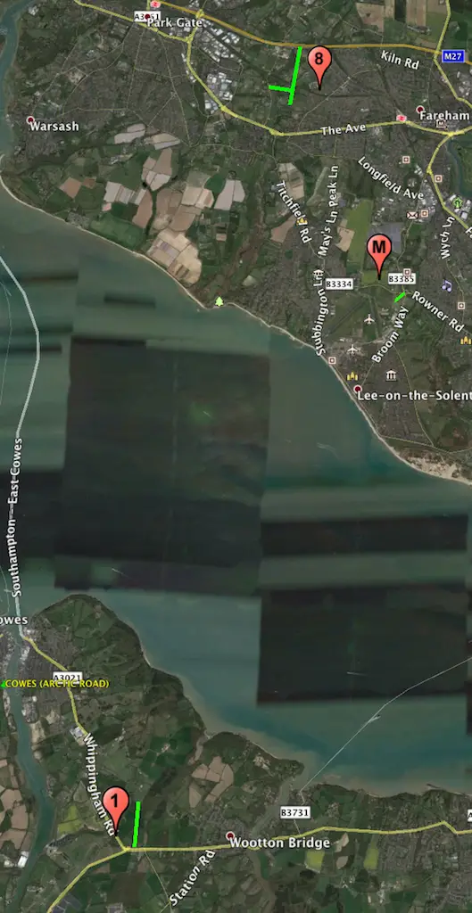
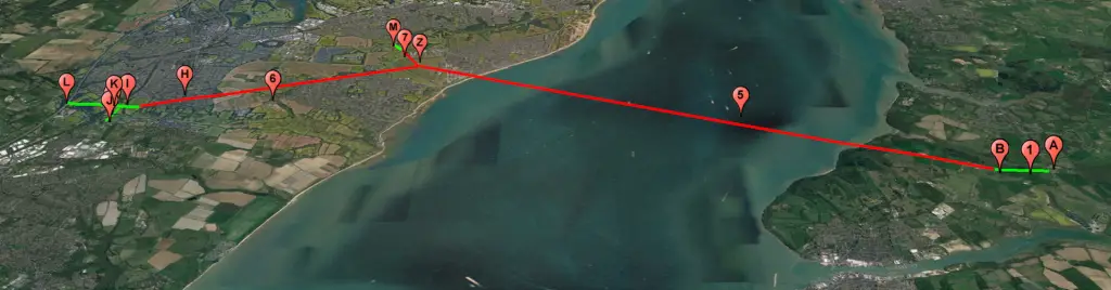
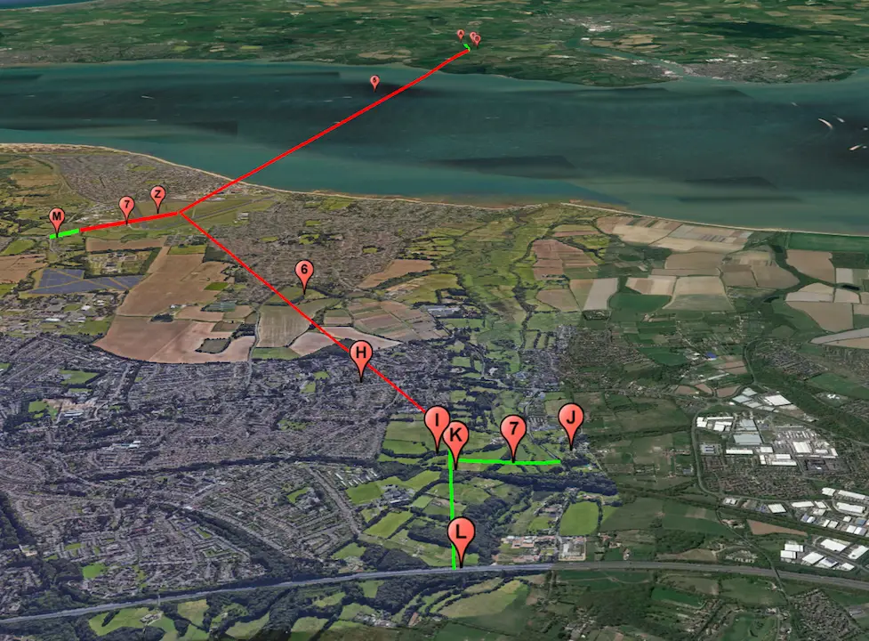
Index to markers:
- L – New M27 Junction (design to be defined). Elevation above highest astronmical sea level – 14 metres.
- 8 – Dual carriageway from M27 Junction to North Portal – approximately 1.28kms.
- J – Slip roads and junctions between Mill Lane and new dual carriageway. (Other alternatives will be possible)
- H – Northern Tunnel Portals (exact position to be defined). Elevation above highest astronmical sea level – 25 metres.
- 6 – Dual bored ‘mainland element’ tunnels – approximately 4.78kms.
- Z – ‘Cut and cover’ central intersection portal at DEZ (connecting surface road infrastructure – to be defined). Elevation above highest astronmical sea level – 8 metres.
- 5 -Dual bored tunnels – approximately 9.95kms.
- B -Dual Southern Tunnel Portals. Elevation above highest astronmical sea level – 30 metres.
- 1 -Dual carriageway from South Portal to new Junction at the A3054 Lushington Hill – approximately 0.82kms.
- A – New junction at the A3054 Lushington Hill (design to be defined). Elevation above highest astronmical sea level – 25 metres.
More information
Full details and explanation can be found on the Solent Freedom Tunnel Website.