Bestival 2016 kicks off this Thursday (8th September).
As the festival attracts tens of thousands of revellers, residents can expect some disruption to traffic over the first two days of the festival and the Sunday night/Monday morning.
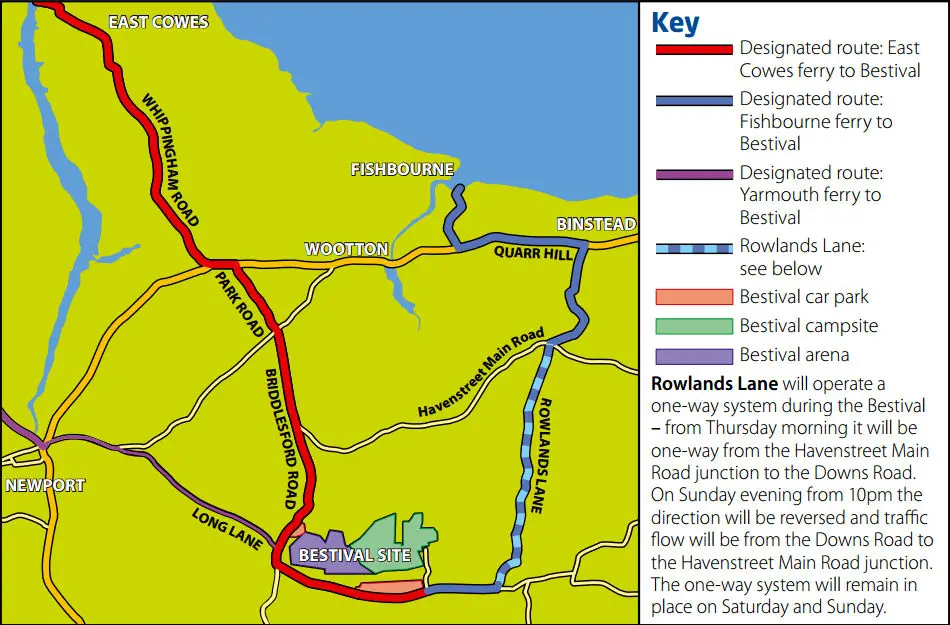
Designated ferry routes
The Isle of Wight council have produced a map showing the designated routes for Bestival traffic between the East Cowes, Fishbourne and Yarmouth ferry terminals and the event site at Robin Hill.
These routes are expect to be very busy on Thursday, Friday and Monday, so residents are advised to plan their journeys to avoid these routes if possible, in particular the Robin Hill roundabout and Hare and Hounds junctions.
Parking will be restricted along some of the routes to assist in the free flow of traffic.
Vehicles illegally parked on roads designated and signed as ‘clearways’ will be towed away.
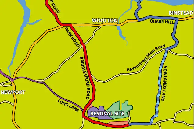
One-way system for Rowlands Lane
Rowlands Lane will operate a one-way system during the Bestival – from Thursday morning it will be one-way from the Havenstreet Main Road junction to the Downs Road.
On Sunday evening from 10pm the direction will be reversed and traffic flow will be from the Downs Road to the Havenstreet Main Road junction.
The one-way system will remain in place on Saturday and Sunday.
Click on images to see larger versions