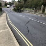
The Isle of Wight council have confirmed that the installation of specialist equipment to monitor any movement around Leeson Road, following the Bonchurch Landslide four months ago, is to begin next week (from 15th April 2024).
Data from nearly 30 pieces of equipment will enable the Isle of Wight council and Island Roads to make informed decisions on the future of the strategic route between Shanklin and Ventnor.
They say that the equipment will measure any vertical and horizontal movement, and also monitor any widening of existing cracks.
The council also say they would like to make the following points absolutely clear:
- It remains the intention of Island Roads and the Isle of Wight council to re-open Leeson Road as soon as it safe to do so.
- Before making any decisions, they need additional, reliable, data to help them understand both the ongoing geological movement in the area and also, the potential risk of further failures.
- While they cannot at this stage state a timescale for the re-opening, they will ensure that the public is regularly updated with all the information relevant to this important, and difficult, decision.
Why can’t the road be open now?
The council say that the safety of road users is – and always will be – their priority. Their consultants, two world renowned consultants in this field – Atkins and Jacobs – have advised that further specialist monitoring is required to inform a decision on when – and indeed if – the road can be re-opened.
Only this data will enable them to understand the nature and pace of ongoing movement and anything happening deep below the surface and therefore calculate – as best, they say, as they are able – the risks of further failures to the area including Leeson Road.
Why can’t the road partially open – perhaps with single lane under traffic lights or to cyclists and pedestrians only?
The council say that all the advice from their consultants is that more information is needed before they can properly assess the risks around re-opening the road. They are not prepared to expose road users to risk by re-opening the road without the necessary data being available to support such a decision.
They add that it is also important to remember that the risk of further collapse is down to the wider geological movement in the area – not necessarily the weight of any traffic using it. In that respect, it does not matter if the road was fully open or fully closed: the risk, and subsequent need for a wider review, remains the same.
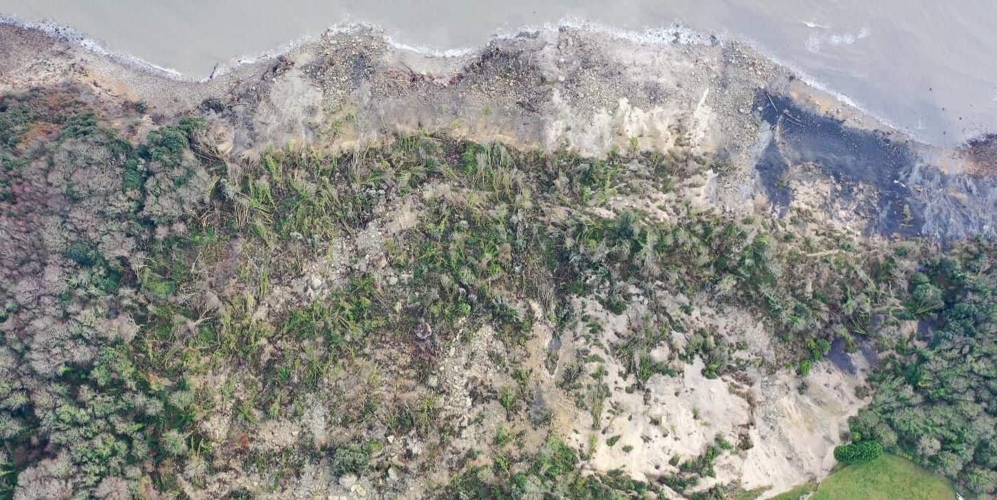
This failure area has acted differently to other landslips in that it happened very quickly and in a vertical direction. Landslips experienced previously in the Undercliff for instance are rotational failures that show a progressive slip, rather than the sudden downward drop experienced at Bonchurch.
Leeson Road FAQs
The council and Island Roads have followed in News OnTheWight’s footsteps and also produced a page dedicated to Frequently Asked Questions (FAQs) about Leeson Road.
The aim of the page is to highlight latest information on Leeson Road and other access issues affecting Ventnor given ongoing issues at locations such as Newport Road (the graben) and lower Gills Cliff Road.
Road remains closed until more is known
The upper section of Leeson Road has remained closed since a ‘catastrophic landslip’ in December 2023 when 16 hectares – some 14million cubic metres of land – was displaced in what was one of the largest landslides recorded on the South Coast of England.
Leeson Road passes close to the back of the landslide and expert advice has recommended the road remains closed until more is known about the risk of further major movement.
This is particularly so given that the heavy rainfall that was identified as a cause of the original landslip has persisted.
The monitoring equipment
The council say that subject to no further movement, favourable weather and the necessary permissions being given to install the equipment on private land, preparatory work is being undertaken this week followed by the installation of the equipment itself in the week commencing 15th April 2024.
The type and number of equipment and the locations at which it will be placed has been decided in consultation with industry experts. The array comprises three extensometers to measure and record changes to visible cracking, 22 tiltmeters recording lateral ground movement, three global navigation satellite sensors providing remote monitoring of vertical and horizontal land movement.
You can read more about the Bonchurch Landslide by visiting the News OnTheWight archives.