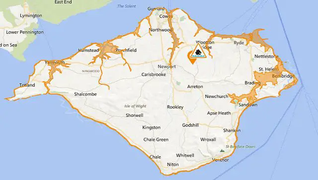
As you’ll already be aware, there’s a severe weather warning for Saturday.
Late this afternoon the Environment Agency issued a flood warning for the Isle of Wight’s coastal areas that talks of the possibility of minor overtopping (ie, water coming on to the road) of coastal roads.
It might be hard to understand looking out of the window at the sun that’s now shining, but of course the weather can change rapidly.
The main text
Potential for minor overtopping into coastal roads around midnight tonight, more so at Yarmouth and Ryde. At Yarmouth, minor overtopping may occur at the ferry terminal car park as wave heights begin to increase from early evening.
Wave heights will continue to build through Saturday so similar minor overtopping impacts might be experienced at high water tomorrow lunchtime, expected around 1230hrs.
Here’s the details:
Time and date of high water: 00:37 overnight Friday/Saturday
Predicted astronomical tide level: 1.9 m
Forecast surge height: 0.26 m
Forecast high water level: 2.16 m
Forecast high water level in Chart Datum: 4.75 m
Forecast wind direction: South Westerly
Forecast wind strength: Force 5


