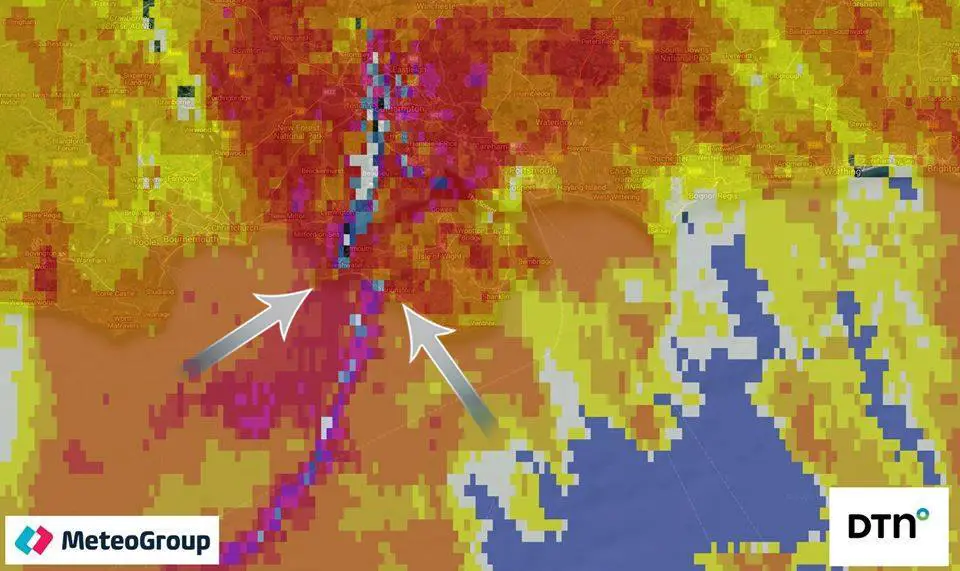
Meteorologists who have analysed radar images say they have ‘high confidence’ the Isle of Wight did experience a tornado last night (Wednesday).
MeteoGroup – a private weather organisation based in Europe – have shared this radar image, which has been studied by Jamie Russell from Isle of Wight Met Service.
Jamie told OnTheWight,
“That tiny slot (within the arrows) with less precipitation is indicative of circulation.
“The slot here can be seen near to Freshwater. The slot moved NE or ENE towards Cowes and out into the Solent.”
“High confidence it was a tornado”
He went on to say,
“A gap in a line of precipitation or a squall line can often be indicative of circulation.
“So that combined with the damage reports gives me high confidence that it was a tornado.”
Image: © MeteoGroup


