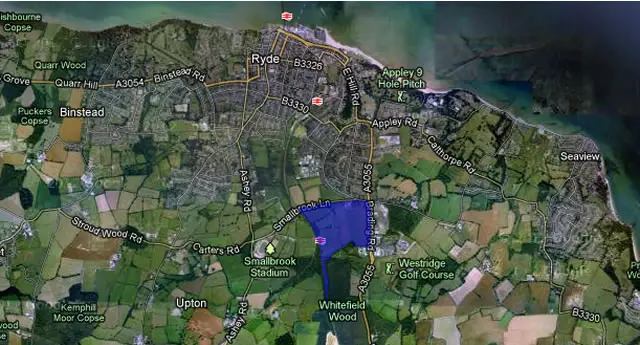
A scheme proposing to develop the Pennyfeathers site on the outskirts of Ryde has been lodged with the Isle of Wight council, reports the CP today.
The 900+ homes scheme would see significant remodelling over the 130 acre site over the next ten years, including the moving of the Westridge garage, which would be replaced with a community centre, incorporating a GP’s surgery.
Mini-town
The new mini-town would have its own 420-pupil primary school, shops, business park and own energy plant.
Of the proposed 904 new homes, 35% of them (316) would be ‘affordable’.
Various infrastructure changes
Infrastructure changes would include changing the current Westridge traffic lights to a roundabout, building an underpass below Smallbrook Lane, a footbridge over the railway line, to connect to Smallbrook Stadium and the Smallbrook Lane road bridge would be rebuilt and realigned.
Little is currently known about the company behind the scheme, Pennyfeathers Property Company Ltd.
Previous opposition
Residents of the area have for years been concerned about the potential development of the site.
Most recently in February last year (2012), concerned residents launched an online petition, with one of their major concerns being the loss of the greenfield site.
See it on a map
To understand the possible scale of the proposal, we’ve created an interactive map, below, based on the Isle of Wight council’s own research (PDF) when plotting out potential sites around the Island for housing development.
View Pennyfeathers: IWC proposed development land in a larger map
Image: Google Maps, based on IWC proposed development areas


