This advice in from the Environment Agency. Ed
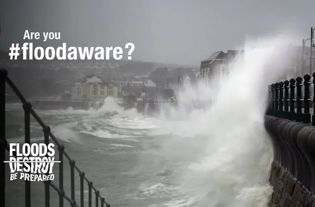
As Storm Brian approaches, strong winds are expected along southern and western England Friday and into Saturday which is coupled with high tides.
We’re urging people near the coast to take extra care due to the risk of large waves, spray and possible coastal flooding in these areas.
Don’t risk lives with ‘storm selfies’
We warn against putting yourself in unnecessary danger by taking ‘storm selfies’ or driving through flood water.
If driving, remember that just 30cm is enough to move your car.
Are you affected?
You can check whether you’re affected by visiting the Website.
This warning has been issued for the Isle of Wight:
Tide levels forecast through Friday 20th October will not cause any overtopping of coastal defences or flooding. However, Storm Brian will arrive by the early hours of Saturday morning.
This storm will cause a high tide on Saturday lunchtime with larger amounts of water expected to impact roads, promenades and coastal car parking areas.
This Flood Alert for the IOW coast will be updated and re-issued at 1900hrs this evening (Friday 20th October) and will contain forecast information along with expected impacts for the tide on Saturday.