
Isle of Wight council has created their own services on the Web showing a live video feed of the Floating Bridge, as well as showing its current position on the Medina.
Existing services
Two existing Isle of Wight-developed services already offer these features – Ferry Spy and Floaty Finder.
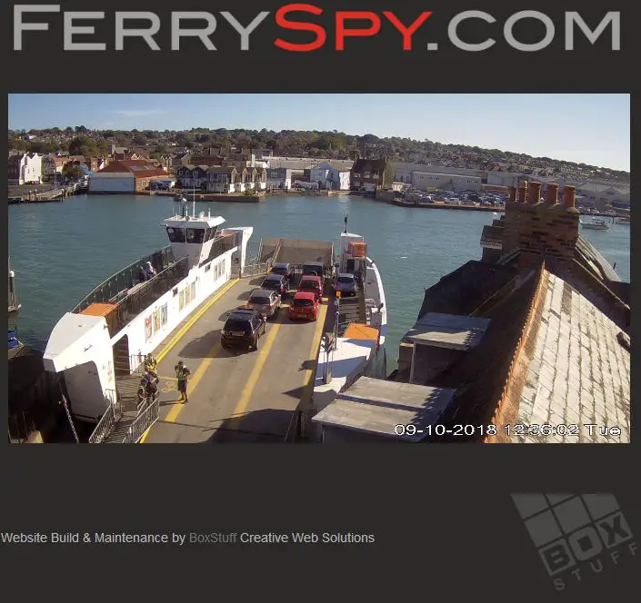
- FerrySpy has been showing a live video feed of the Floating Bridge’s journey across the Medina since November 2015 – Nearly three years.
- Floaty Finder automatically monitors the position on the Floating Bridge, letting people know which side of the Medina it currently is and if it’s in service.
Both of these services were built and are run with the expense bourne by the individuals / businesses behind the services.
Questions to council
News OnTheWight contacted the council to ask if they’d considered using the already existing services and what the council’s development/setup and ongoing monthly costs were.
At the time of publishing they’ve failed to respond.
Pros and cons of IWC video feed
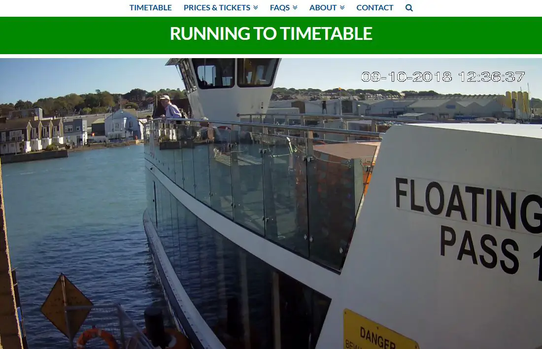
The council’s video feed does appear to be of a superior quality.
Given its low placement, it has disadvantages compared with the Ferry Spy camera, such as not being able to judge how busy the service is while loading on the west side at high tide, as the view is obscured by FB6’s prow.
Click to see the comparison
Its positioning does however give a clear view of why the current floating bridge, with its chains having been lengthened (after Cowes Harbour Commission lodged a formal complaint) in an attempt to stop yachts snagging on them, needing the additional assistance of a tug at certain times. Without this it floats off course.
The assistance of the barge wasn’t needed with the previous floating bridge.
Floaty Finder approach
Floaty Finder (on Web, mobile and App) takes a simple and stripped down approach to showing the data, displaying a graphic of which side the Floating Bridge is currently loading and if the service is running.

IWC approach: Mapped
The council’s approach is to embed the maps of an external service, MarineTraffic, which plot the current position of the Floating Bridge in real time.
If it’s static the bridge is shown as a blue dot. If in movement, the graphic changes to a rectangle, with an arrow showing the direction of travel.
Above this is displayed the council’s view on the current operating status of the service.

What Floaty Finder devs says about it
News OnThewight asked the developers of Floaty Finder what their view of the new IWC offering was:
“We applaud any effort by the council to improve their customer service, but we think they’ve kind of missed the point.
“Most people don’t care too much where the bridge is right now – they’re much more interested in whether it’s is actually *in service*.
“During the recent floating bridge outages, the council’s ‘live status’ page has been happily saying ‘RUNNING TO TIMETABLE’ 12 hours after the bridge has been withdrawn from service!”
They went on to say,
“We created Floaty Finder because Floating Bridge users needed a more reliable data source that would show at a glance whether the Floating Bridge is running.
“Across the Website, Android and iOS apps we’ve had nearly 200,000 page views so we think and hope we’re doing something right.
“If the council want some support getting their site up to scratch we’d be more than happy to help.”
The services
IWC Floating Bridge video feed and AIS positioning
Ferry Spy live video
Floaty Finder
Image: kaoticsnow under CC BY 2.0