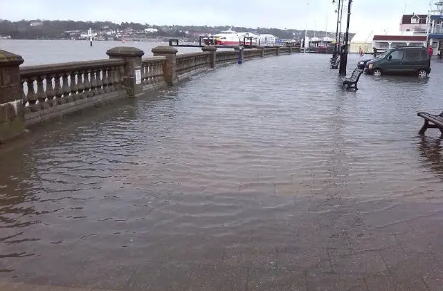
With the prospect of 80mph winds tomorrow (Tuesday) morning, it’s no surprise to see the Environment Agency have issued a flood alert for the Isle of Wight coast.
They say,
Flooding is possible for the coast around the Isle of Wight. Low lying coastal land and roads will be affected first. Be prepared.
This forecast is for Cowes
Time and date of high water 06:20 on 22/11/2016
Predicted astronomical tide level 1.41 mAOD
Forecast surge height 0.61 m
Forecast high water level 2.02 mAOD
Forecast high water level in Chart Datum 4.61 mCD
Forecast wind direction South Westerly
Forecast wind strength Force Gale Force 8
Yarmouth and Ryde
Another deep low pressure crosses the area tonight with a surge of 0.61m.Waves come from a southerly direction and could be 4m for a time before high tide and 3m at high tide. The forecast tide level at Yarmouth is 1.66mAOD or 3.66 mCD.
The forecast tide level at Ryde is 1.86 mAOD or 4.59mCD. There is the potential for very minor overtopping of sea defence walls at Yarmouth and Ryde which are more exposed to wave action.
The tide will not be as high as it was on Sunday morning.
Property flooding is not expected.
Image: © Dave Miller