
Further to the severe weather warning from the Met Office at the beginning of the week for snow and ice across many parts of the country including the Isle of Wight, as expected updates have been issued.
There are several warnings in place, which you can keep an eye on via the Met Office Website, but details for the Island at time of publishing are as follows:
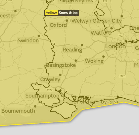
Tuesday/Wednesday
Valid from Tue 17:00 and Wed 12:00:
The start time of the warning has been brought forward to cater for some snowfall during peak travel times Tuesday evening and the expected amounts of snow have been reduced.
A band of rain pushing east across parts of England is likely to turn to snow during Tuesday evening, with snow continuing into Wednesday. Accumulations of 1-3 cm are possible, particularly over parts of East Anglia and the high ground of Surrey, Sussex & Kent, with accumulations of 5 cm in places. As this clears, ice is likely to form on some surfaces on Wednesday morning.
Thursday/Friday
Valid between Thu 15:00 and Fri 12:00:
Rain and snow is expected to move in from the southwest, moving across England and Wales through Thursday into Friday. This is likely to fall as heavy rain at first across the far southwest of England, but as it meets the cold air established over the rest of the country snow becomes more likely.
There is a chance of 2-5cm of snow for some places, timings are currently uncertain. 10cm is possible in places, though there is uncertainty at this stage on where is most likely to see the greater snowfall accumulations.
Overnight Thursday into early Friday ice may also become a hazard on any untreated surfaces as temperatures fall below freezing.
See the Met Office Website for further updates throughout the week.
Image: © chi_bellami