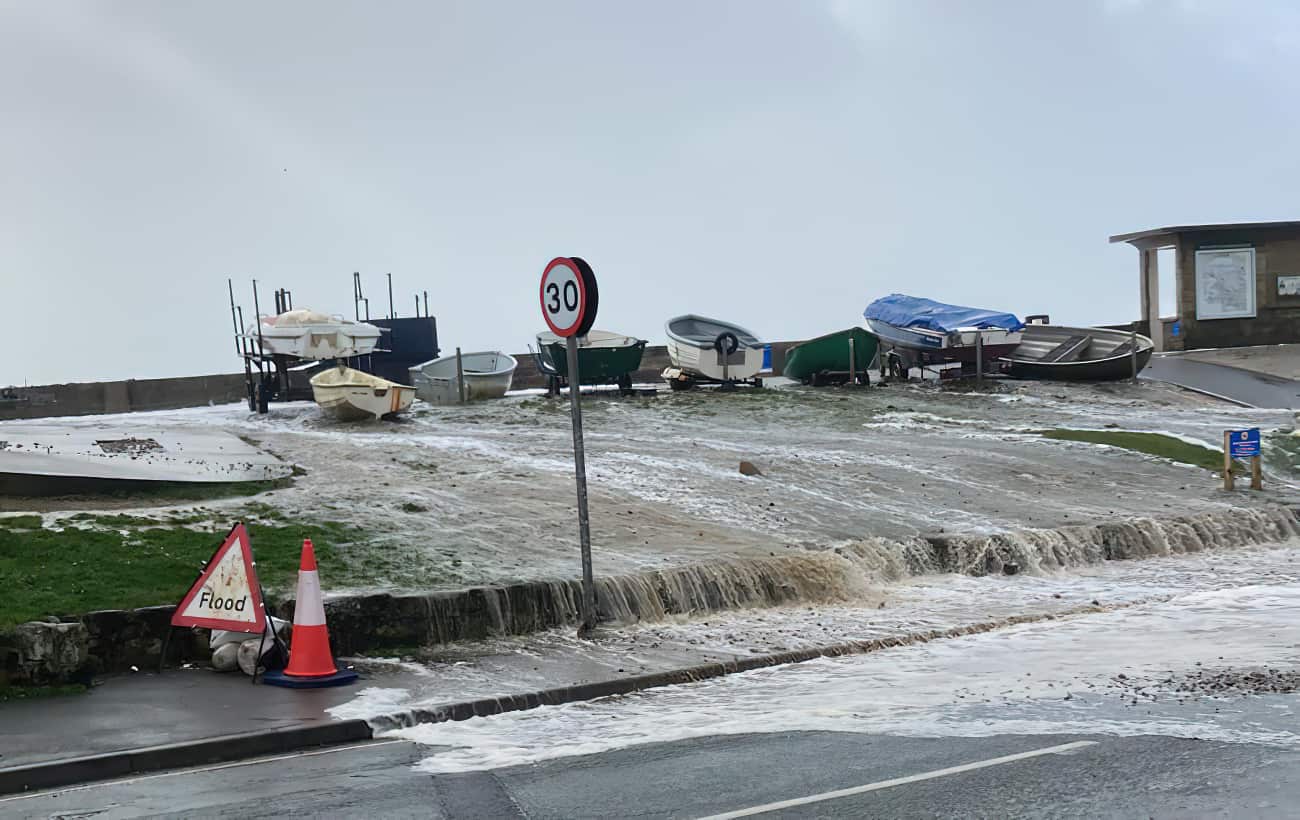
As well as a general flood warning for the Isle of Wight coastline, the Environment Agency have also issued several separate flood alerts around the Island.
Yarmouth
At 1.18pm EA issued a flood alert for Yarmouth, which reads:
Monday evening’s tide at 23:25 on 08/04/2024 is higher than normal due to unsettled weather with strong Southerly Force 6 winds and large waves. The weather increases tide table values by 0.57 m. The total forecast tide is 3.98 metres Chart Datum (1.97 mAOD) at Yarmouth. For 1 hour either side of high water, overtopping will occur at Quay Street, Pier Square, Mill Road and Gasworks Lane. The ferry terminal car park and ticket office will also be flooded. After this tide the weather becomes more settled but minor impacts could continue until Thursday (11/04/2024).
Wootton
At 1.26pm EA issued a flood alert for Wootton, which reads:
Tuesday’s early morning tide at 00:00 on 09/04/2024 is higher than normal due to unsettled weather with strong Southerly Force 6 winds. The weather increases tide table values by 0.82 m. The total forecast tide is 4.60 metres Chart Datum (1.86 mAOD) at Ryde. The tide level will be higher than on 14 Feb 2014. For 1 hour either side of high water, the tide will flood a small number of properties at Mill Square and Wootton Bridge near the Sloop. After this tide the weather becomes more settled but minor impacts could continue until Thursday (11/04/2024). We continue to monitor the forecast. We recommend that flood protection is installed at Mill Square on the water’s edge at Wootton Creek 1 hour before high tide.
Cowes, East Cowes, and Newport
At 1.26pm EA issued a flood alert for Cowes, East Cowes, and Newport, which reads:
Tuesday’s early morning tide at 00:00 on 09/04/2024 is higher than normal due to unsettled weather with strong Southerly Force 6 winds. The weather increases tide table values by 0.57 m. The total forecast tide is 5.29 metres Chart Datum (2.70 mAOD) at Cowes. The tide could be the highest recorded. For 1 hour either side of high water, property flooding is expected at the bottom of Medina Road, near the floating bridge, Cowes High Street, Albany Road, Well Road, York Avenue, Castle Street, Ferry Road East Cowes and at Little London Quay, Newport. The Esplanade, Parade, Egypt Point and sea front parking areas will be flooded and impassable in places. After this tide the weather becomes more settled but minor impacts could continue until Thursday (11/04/2024). We continue to monitor the forecast. If you have it, please install flood protection 1 hour before high tide. Move cars from sea front car parks.
Freshwater Bay
At 1.27pm EA issued a flood alert for Freshwater Bay, which reads:
Monday evening’s tide at 23:25 on 08/04/2024 is higher than normal due to unsettled weather with strong Southerly Force 6 winds and large waves. The weather increases tide table values by 0.57 m. The total forecast tide is 3.98 metres Chart Datum (1.97 mAOD) at Yarmouth. The tide is very high, and close to historic maximum recorded levels. For 1 hour either side of high water, overtopping at Freshwater Bay sea front is expected. The tide will flood Gate Lane and the A3055 near Afton Road. Significant amounts of water will surround the Albion Hotel and Lifeboat Station which may cause internal flooding. The tide will also be high at Fort Albert. After this tide the weather becomes more settled but minor impacts could continue until Thursday (11/04/2024). We continue to monitor the forecast. Conditions are dangerous. Keep away from the sea front over high tide.
Gurnard
At 1.27pm EA issued a flood alert for Gurnard, which reads:
Tuesday’s early morning tide at 00:00 on 09/04/2024 is higher than normal due to unsettled weather with strong Southerly Force 6 winds and large waves. The weather increases tide table values by 0.57 m. The total forecast tide is 5.29 metres Chart Datum (2.70 mAOD) at Cowes. The tide level is predicted to be higher than recorded on 14 Feb 2014 when 2 properties flooded. For 1 hour either side of high tide, properties directly on the sea front at Marsh Road could flood. Tidal water will flow across Marsh Road bridge and fill the Gurnard Luck which could cause garden flooding to properties nearest to the river. After this tide the weather becomes more settled but minor impacts could continue until Thursday (11/04/2024). We continue to monitor the forecast. If you have it, please install flood protection 1 hour before high tide.