Queen’s Harbour Master in Portsmouth has issued a notice to mariners in the area that between 2 to 16 March a sonar survey will be taking place between Norris and Ryde Sands.
The survey is being conducted by the Southern Inshore Fisheries and Conservation Authority who will be will be using sidescan sonar to map seabed habitats within potential marine conservation zones.
The notice reads
NOTICE IS HEREBY GIVEN by the Queen’s Harbour Master, Portsmouth that the Southern Inshore Fisheries and Conservation Authority will be conducting a side scan survey from Norris (50 45.95N 001 16.41W) to Ryde Sands (50 44.65N 001 07.76W) in the area inshore from the main buoyed Solent south up to the shore of the Isle of Wight. The survey period is planned to run from 2 to 16 March but may extend to 31 March.
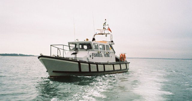
The survey will be conducted by the 9.6m catamaran Fisheries Patrol Vessel “TENACITY” towing a sonar body on a 25 metre tow, which will operate in daylight only, returning to Southampton each day.
“TENACITY” will maintain a listening watch on VHF Channels 16, 11 and 12 while operating within the Dockyard Port of Portsmouth, and will display appropriate shapes (Ball-Diamond-Ball in a vertical line) or lights (Red-White-Red in a vertical line) when it has the tow deployed.
Mariners are requested to keep well clear of the vessel while the survey is conducted.
Cancel this Local Notice To Mariners Tue 1st Apr 2014 (31 days)