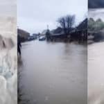
There have been a flurry of flood warnings and updates from the Environment Agency over the last 12 hours.
The most recent is that the flood alert for Carisbrooke and Hunny Hill on the Lukely Brook is not longer in force (as of 10.40am).
Sandown, Brading and Bembridge
The Eastern Yar, as always, has been impacted by the heavy rain. A flood warning issued at 9.45am today (Friday) reads:
Water levels in the Eastern Yar remain high. Levels at Sandown are rising, and will continue to rise until 17:00 this evening (05/01/2024). Currently, there is extensive out of bank flooding through the Yar Valley.
Moreton Common and Golf Links Road are flooded. Impacts are expected at Fort Holiday Park and Sandown sewage works as ditches struggle to drain to the main river.
Impacts are also expected at Nicholas Close, Brading.
This is following yesterday’s rain as 27mm was recorded at Wroxhall, which is a significant amount of rain in a short period of time. This is in addition to the prolonged rainfall which has been affecting the area over the last few months.
Bembridge sluice is operating normally.
We continue to monitor levels and will ensure the river remains free of any reported blockages.
Please ensure any products used to protect gardens and property from flooding are operating. The next five days are forecast to be mainly dry.
You can see updates for that alert by visiting the EA website.
Whitwell, Wroxall, Langbridge, Alverstone
At 10pm last night (Thursday) a flood warning was issued for Whitwell, Wroxall, Langbridge, Alverstone on the Eastern Yar. It reads:
The water level in the Eastern Yar at Alverstone is high and rising. In the last 12 hours, 30mm of rain has been recorded in Wroxall following weeks of prolonged wet weather.
The access track to Horringford will be flooded, restricting access. Golf links road, cycle tracks and footpaths across the Upper Yar Valley will be impassable. From around 01:00 tomorrow morning (05/01/2024) in Alverstone, the main road will flood near the main road bridge. Water will surround property in Alverstone and Langbridge, flooding a small number of properties. Garden flooding is expected at Whitwell High Street.
Showery conditions are forecast until later this evening. At Alverstone, the river will rise until approximately 04:00 (05/01/2024). It will remain at its peak value for several hours before the level begins to slowly fall.
We continue to monitor the forecast. We will ensure the river is kept free of reported blockages. If you have it, please install flood protection now and leave it in place until tomorrow.
You can see updates for that alert by visiting the EA website.