The Met Office has issued another weather warning for heavy rain on the Isle of Wight this week, along with further flood alerts (see below) from the Environment Agency.
Weather warning
Valid from 5am on Thursday 5th February until midnight, the yellow ‘Be Alert’ warning reads:
Rain arriving from the south overnight Wednesday into Thursday is likely to turn heavy and persistent in places for a time during Thursday morning.
Then following a brief respite for many, albeit with some heavy showers around, a further area of organised and at times heavy rain is likely to once again arrive from the south, affecting the same area.
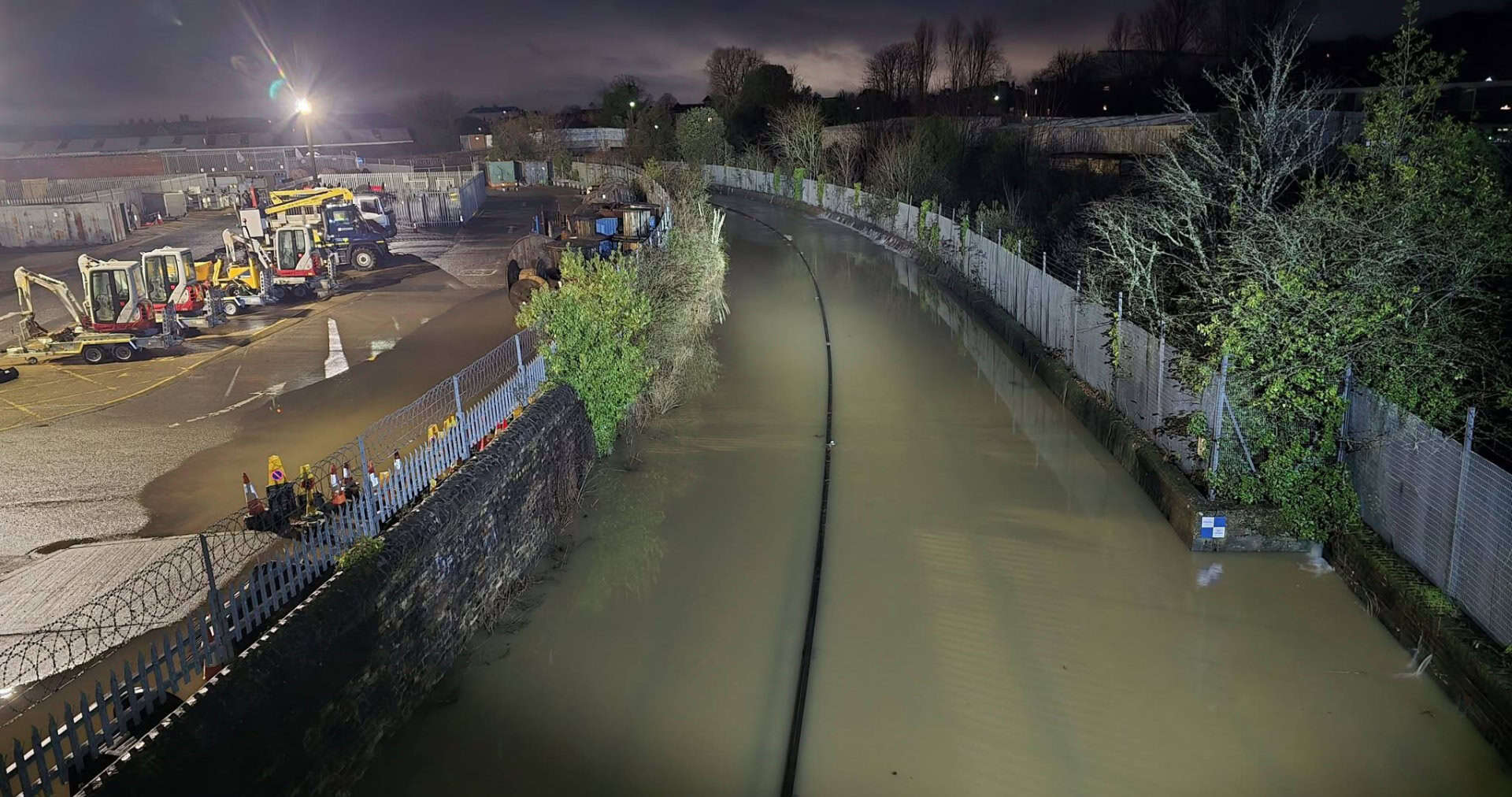
10-20mm of rain is likely to have fallen fairly widely by the end of Thursday, with a few spots seeing in excess of 30mm.
Given the widely saturated ground conditions, some low impact surface water flooding is probable, with difficult driving conditions from spray, flowing water or flooded roads in particular.
You can follow the weather warning by visiting the Met Office website.
Flood alert: River Medina
The Environment Agency have updated a flood alert for the River Medina.
Updated at 12.36pm 4th Feb, it reads:
Flooding is possible for: River Medina from Blackwater to Newport
High river levels on Thursday may lead to flooding.
Flooding is possible on 05 February 2026 as further rain is forecast (15mm).
If as much rain falls as forecast, flooding could affect land, gardens, and possibly roads at Blackwater, especially at Blackwater Hollow on the A3020 near the Mill Farm and at Sandy Lane. The river could become very high at St George’s Way, Shide. A similar event to yesterday 03/02/2026. Today is forecast to be dry. If as much rain falls as forecast tomorrow, levels will start to rise tomorrow morning. River levels will remain high for the next few days.
We are monitoring rainfall and river levels and will ensure the river is kept free of reported blockages.
Consider activating any flood protection products you may have. Avoid flooded ground, flood water could be deep.
You can stay up to date with the flood alert by visiting the EA website.
Flood alert: Lukely Brook
The Environment Agency have updated a flood alert for Lukely Brook.
Updated at 12.44pm on 4 Feb, the alert reads:
Flooding is possible for: Lukely Brook from Carisbrooke to Newport
High river levels on Thursday may lead to flooding.
Flooding is possible on 05 February 2026 as further rain is forecast (15mm).
If as much rain falls as forecast, there is a possibility the river could come out of bank at Foxes Lane and impact the aquatics centre. The river could reach bank full and it may come out of bank affecting footpaths and areas next to the river at Old Westminster Lane. A similar event to yesterday 03/02/2026. Today is forecast to be dry. If as much rain falls as forecast tomorrow, levels will start to rise tomorrow morning. River levels will remain high for the next few days.
We are monitoring rainfall and river levels and will ensure the river is kept free of reported blockages.
Consider activating any flood protection products you may have. Particularly properties next to the river at Vicarage Walk.
You can stay up to date with the flood alert by visiting the EA website.
Flood alert: Gurnard Luck
The Environment Agency have updated a flood alert for Gurnard Luck
Flooding is possible for: Gurnard Luck, Gurnard
High river levels on Thursday may lead to flooding.
Flooding is possible on 05 February 2026 as further rain is forecast (15mm).
If as much rain falls as forecast, levels will start to rise tomorrow morning (05/02/2026). River levels could be higher than normal for a few hours over high water. High tide is forecast at 00:26 and 12:30 on 05/02/2026. Flooding could affect gardens or properties nearest to the river in Marsh Road.
We are monitoring rainfall and river levels and will ensure the river is kept free of reported blockages.
Avoid low lying roads near rivers, which may be flooded. Including Marsh Road, Gurnard.
You can stay up to date with the flood alert by visiting the EA website.
Flood alert: Eastern Yar
The Environment Agency issued an update to the flood alert in force for the Eastern Yar at 6.22pm:
Flooding is possible for: Eastern Yar and tributaries from Whitwell to Bembridge
High river levels tomorrow may lead to flooding.
Flooding is possible on 05 February 2026 as further rainfall (25mm) is forecast tomorrow.
Flooding is affecting low lying land, roads, cycle tracks and footpaths close to the river. At Langbridge and Alverstone, the river will be close to bank full. Flooding of Golf Links Road and Moreton Common Road will continue to occur. Ditches around Fort Holiday Park will struggle to drain while river levels are high. River levels will remain higher than normal, and flood risk will continue into the weekend.
We are checking rivers for blockages and operating Bembridge sluices.
Consider activating any flood protection products you may have including in Alverstone.
You can stay up to date with the flood alert by visiting the EA website.
Article edit
7pm 4th Feb 2026 – Eastern Yar update added