Readers may remember the Photosphere (a 360 degrees photo) that we shared with you about the recent landslip at Undercliff Drive a couple of weeks ago.
Whilst we were there (9th February), we also took a Photoshere of the engineering works taking place.
OnTheWight revealed the extent of the previously hidden engineering works later that week, but having returned to the area today, we were taken aback to see how much more land had slipped away from the road that’d been excavated by contractors working for Island Roads.
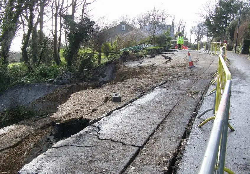
The Photosphere below shows the area on 9th February, a day after the landslip by the temporary traffic lights. The photo below that (provided by Isle of Wight council) shows the area a week later (after at least one house was condemned and nine evacuated) and the last photos show the road today (25th February).
Photosphere taken on 9th February: Click into the photo frame below and drag your mouse to move around the photo
Photo taken by Isle of Wight council on 18th February 2014 (click on photo to see larger version)
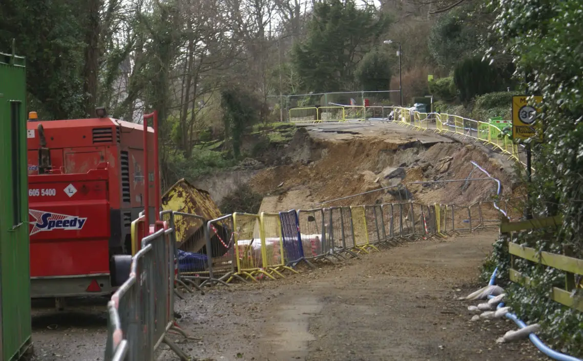
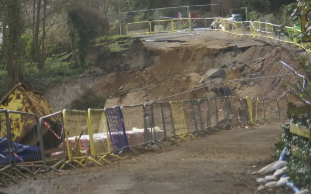
The photos below were taken on 25th February and when compared with the photo above, show the extent of the latest landslip. The large concrete retaining wall you can see in the Photosphere has now been cut in half to avoid the whole lot being pulled south westerly in the landslide.
As you can see, much more of the road has disappeared.
Click on photos to see larger versions)
Residents from the evacuated properties will be meeting with the Isle of Wight council on Thursday for an update on the situation.