The Boundary Commission for England (BCE) has this week published revised proposals for constituencies across the country and opened up a final month-long consultation, giving the public a last opportunity to share their views.
This third and final consultation on the new map of revised constituency proposals (see below) is now open until 5th December.
Further changes
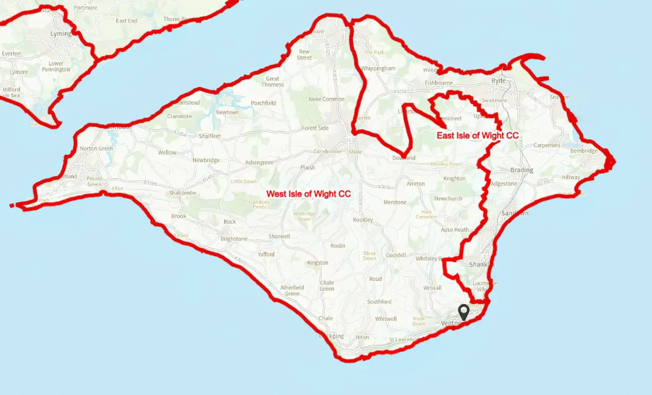
The two Isle of Wight constituencies have seen further changes since the last consultation earlier this year.
The public are invited to view and comment on the new map via the BCE Website.
You’ll find an interactive map there, where you can switch on previously proposed boundaries, wards, etc., as well as viewing comments left by residents, town, parish and community councils and politicians.
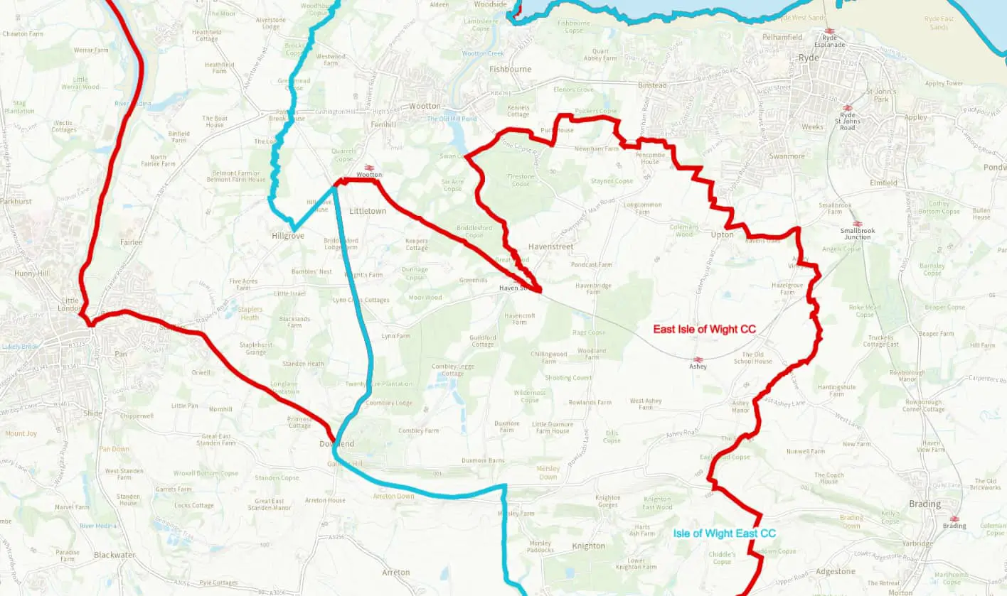
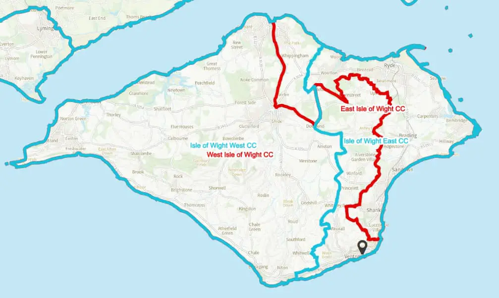
Ventnor moves to the East
The previous proposal (Jan 22) saw Ventnor and St Lawrence included in what was then termed West Isle of Wight (now changed to Isle of Wight West).
Isle of Wight Conservative MP, Bob Seely, was very keen for Ventnor and St Lawrence to be included in the West constituency (you read his comments on the BCE Website), a view the Ventnor Town Council agreed with (read their comments).
However, many residents pointed the strong links that Ventnor has with the Eastern towns of Shanklin, Sandown and Ryde, and how links with Niton, Whitwell and Chale have diminished since the permanent closure of Undercliff Drive.
Moving West
The vast majority of respondents to the previous consultation favoured an approach for the Isle of Wight where the three wards of East Cowes, Fairlee and Whippingham, and Osborne would transfer into the western constituency.
Therefore, East Cowes, Fairlee and Whippingham have now moved into the West constituency.
Supporters of these approaches
These alternatives were proposed by a large number of respondents (and supported by many others) including, but not limited to: Steven Backhouse; Cllr Geoff Brodie; Cllr Bob Blezzard on behalf of the Sandown Independents; Cllr Daryll Pitcher on behalf of the Vectis Party; David Pugh on behalf of Isle of Wight Conservative Association; the Liberal Democrats; the Conservative Party; and Matthew Ambrosini on behalf of Newport and Carisbrooke Community Council.
Where to draw the boundary line
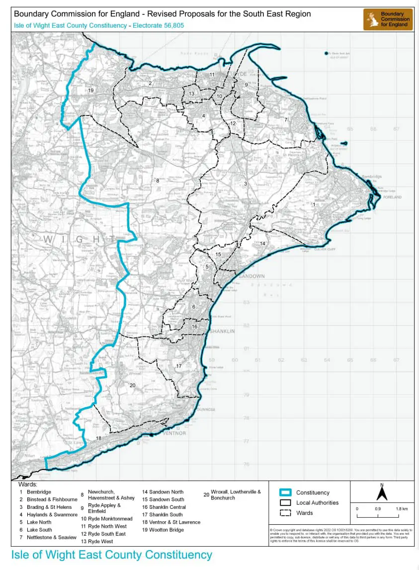
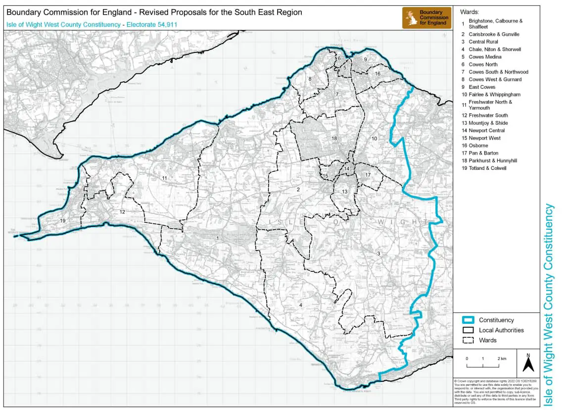
In the initial proposals, BCE took the River Medina as a geographic boundary between two distinct areas of the Island and subsequently proposed East and West constituencies that used the river as the major division.
Following the consultation stages, there was broad support for that general approach to divide the Island on an east/west basis.
There was a strong and collective response, however, that the detail of the initially proposed boundary was not optimal. Political parties (both local and national), local councillors, residents, and community organisations were largely agreed on this point.
Less support for North/South boundary
The Labour Party’s proposal for a north/ south division of the Island, drawing upon the former Medina and South Wight district councils, attracted notably less local support, and received significant challenge during the second consultation.
Change of constituency names
In addition to the boundary changes, there was also widespread dissatisfaction with the names of East Isle of Wight and West Isle of Wight.
There were some supporters of shortening these names to Wight (i.e. without the Isle of prefix) as well as some entirely alternative names such as Vectis, but almost all those who commented on the names of the constituencies simply expressed a preference for the compass point indicators to be suffixes, i.e. Isle of Wight East and Isle of Wight West.
Bowden: Have your say
Tim Bowden, Secretary to the Boundary Commission for England, said,
“We are announcing the publication of our revised proposals. Last year we published our initial proposals for new constituency boundaries – our first go at what the map should look like. We are delighted with the huge number of comments from members of the public on our initial proposals, many which included valuable evidence about local communities.
“This publication is the culmination of months of analysis and we have revised nearly half of our initial proposals based on what people have told us. We now believe we are close to the best map of constituencies that can be achieved under the rules we are working to.
“However, we still want people to tell us what they think of this latest map before we submit our final recommendations to Parliament next year. This is our final consultation and I encourage you to participate in the 2023 Boundary Review.”
For more details on the history of the Boundary Review, see News OnTheWight’s archive.