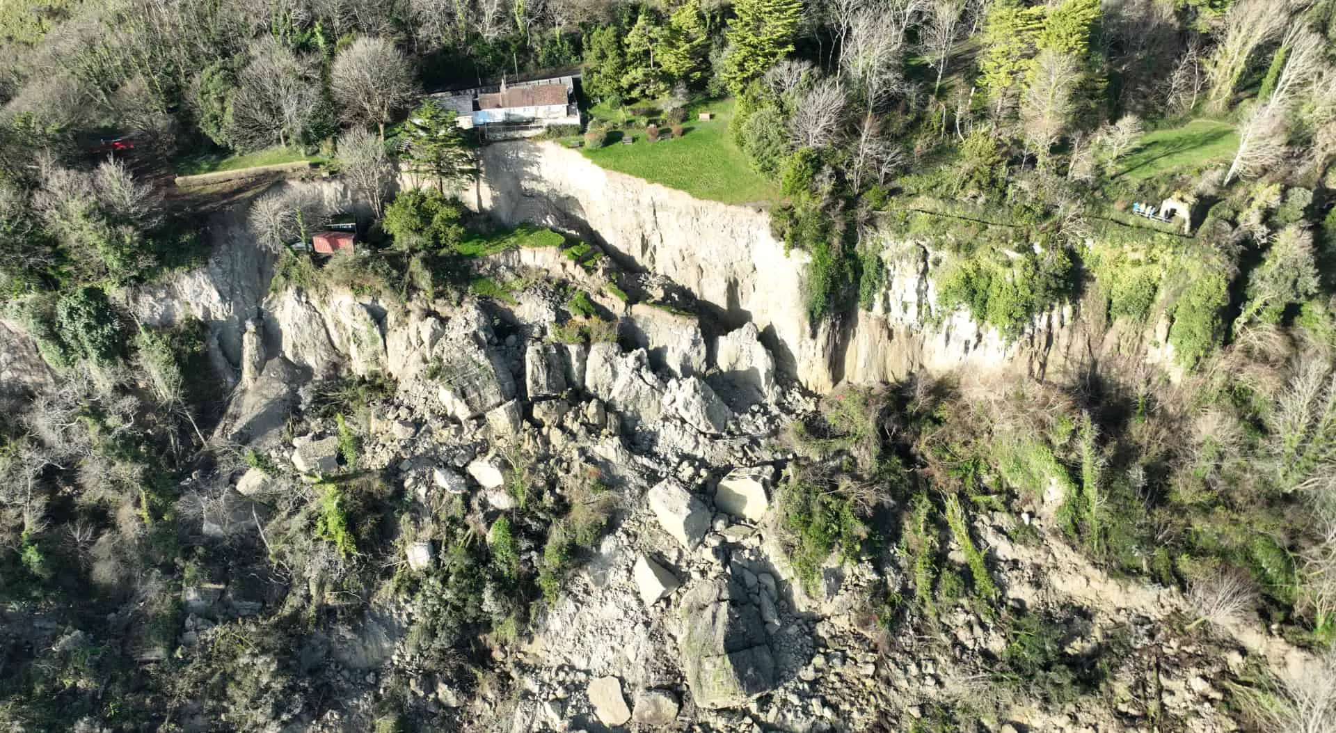
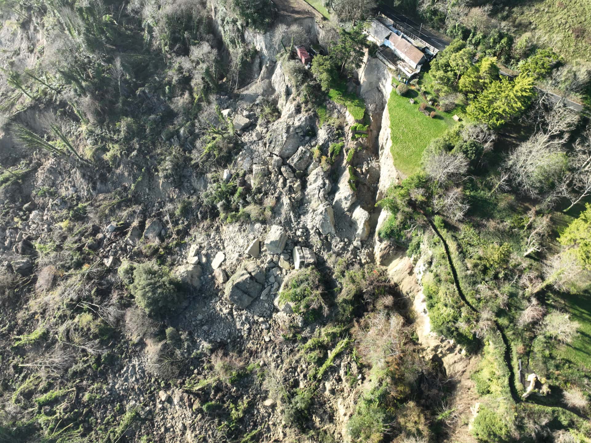
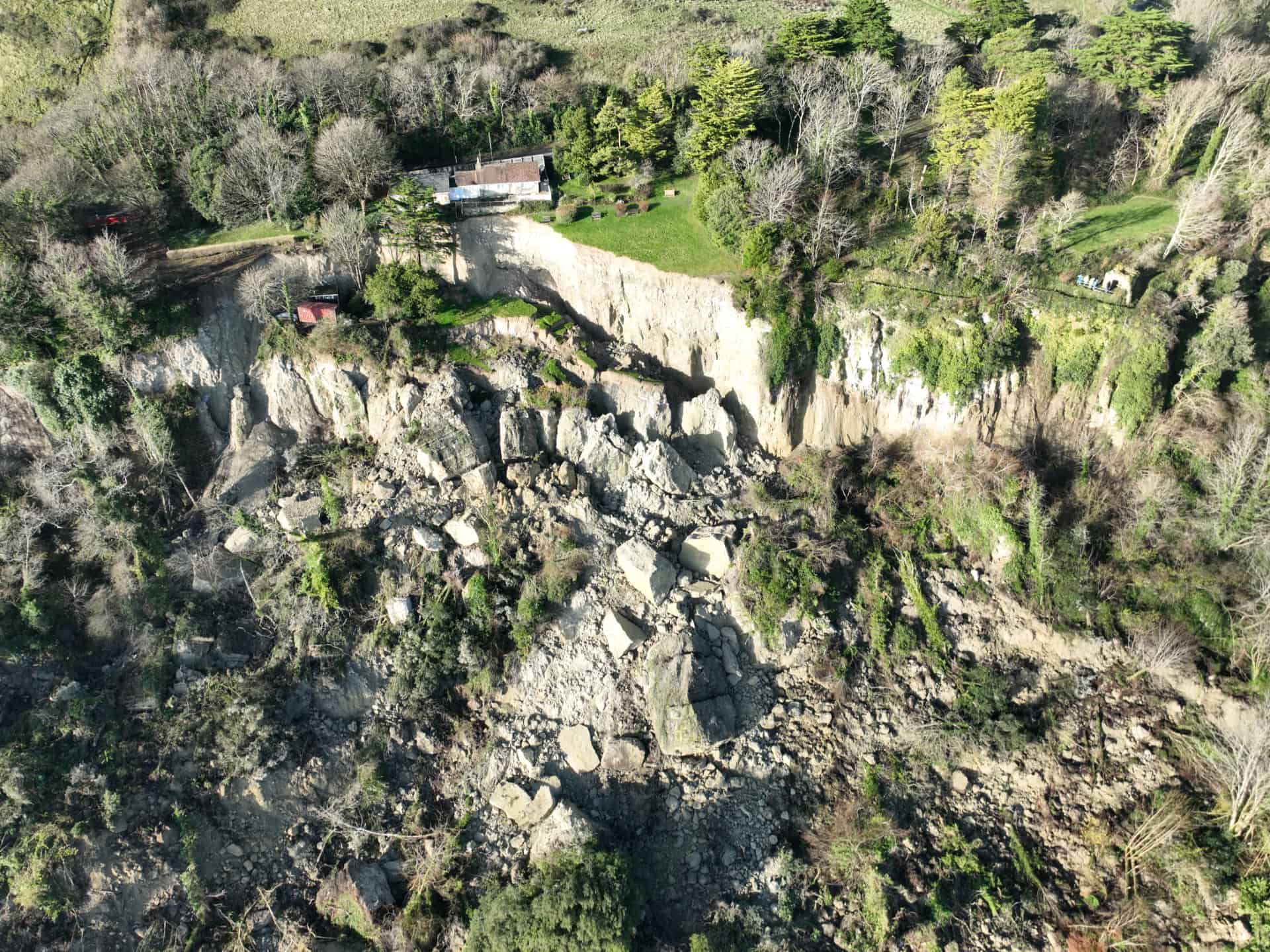
The last 20 or so hours have been filled with concern and worry for residents and their families affected by the Bonchurch landslide.
Earlier today (Monday) a council Director stated that this landslide is the biggest seen in the area for more than 20 years.
Landslide being monitored
Residents have been evacuated from more than 20 homes and Leeson Road, the main road out of Ventnor towards Shanklin, has been closed until the council are sure the landslide has stopped and the road is safe to reopen. That is likely to be at least several days.
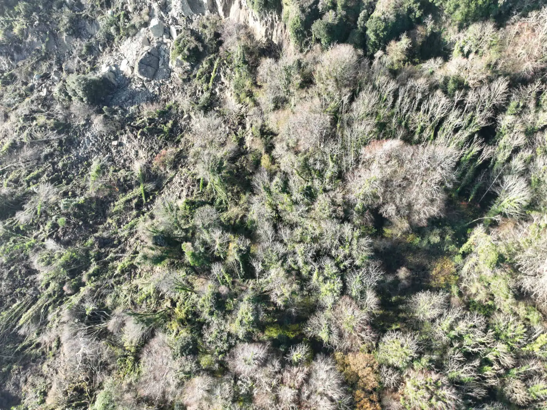
These aerial images below, shared by Isle of Wight council, really show just how vast the landslide is. Coupled with the landslide that took place last month in the area known as the ‘Landslip’ (adjacent to this area), all footpaths through the woodland are now closed to the public.
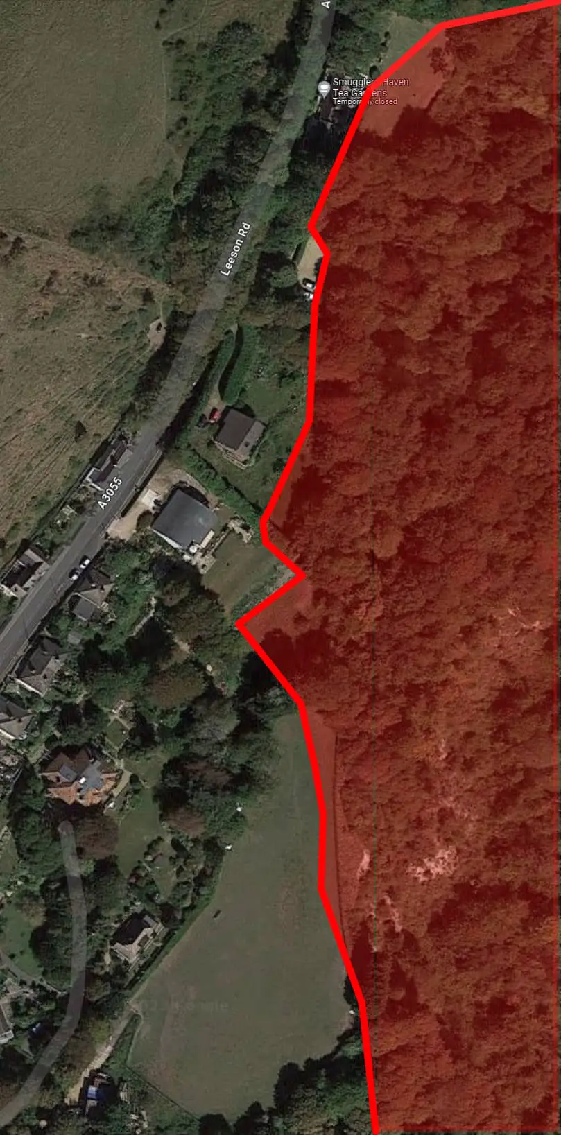
Map of movement
News OnTheWight thought it would be useful to highlight the damaged area on an aerial photo taken prior to the landslide.
Our sincerest thoughts are with the families affected by this shocking landslide.