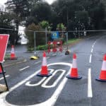
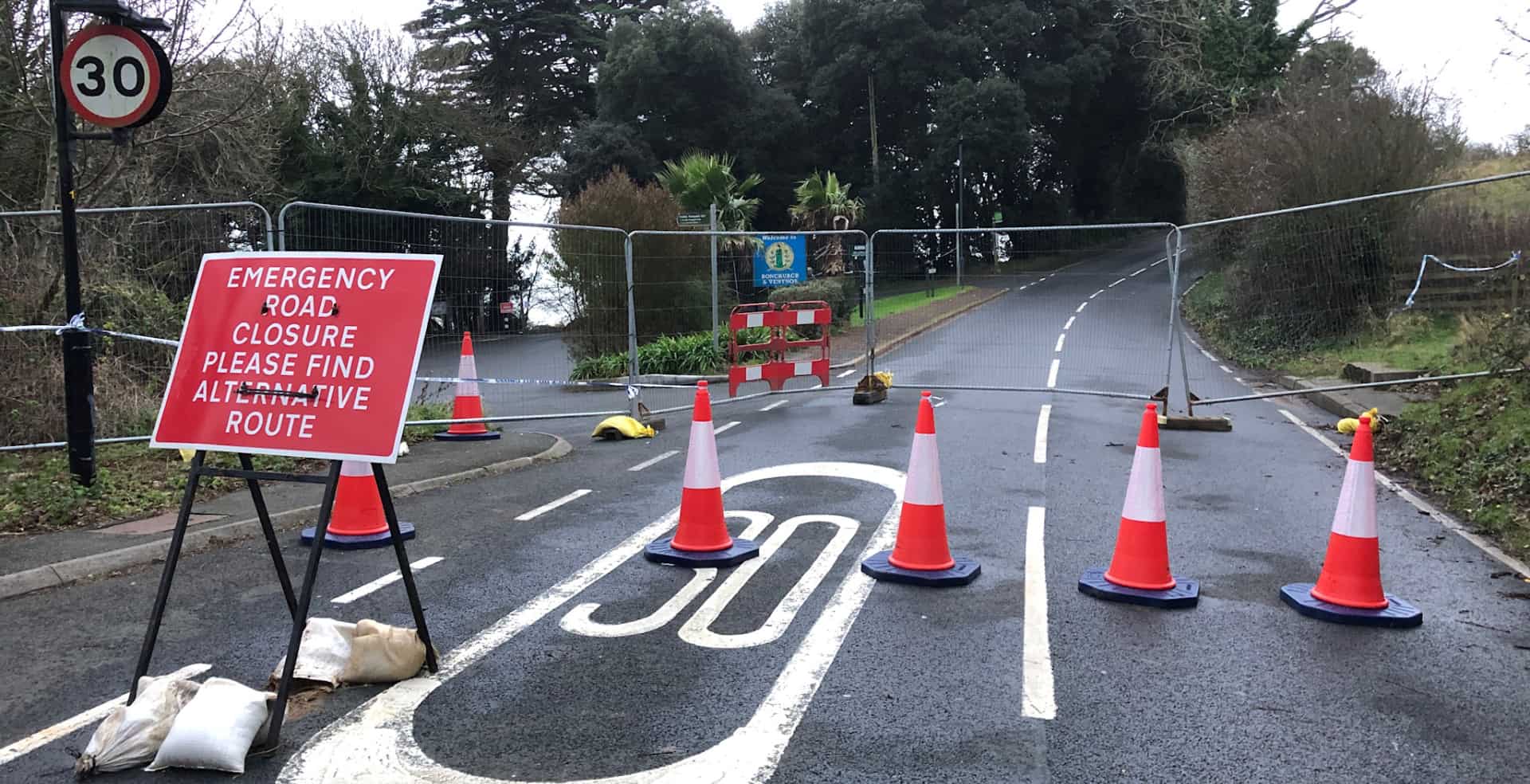
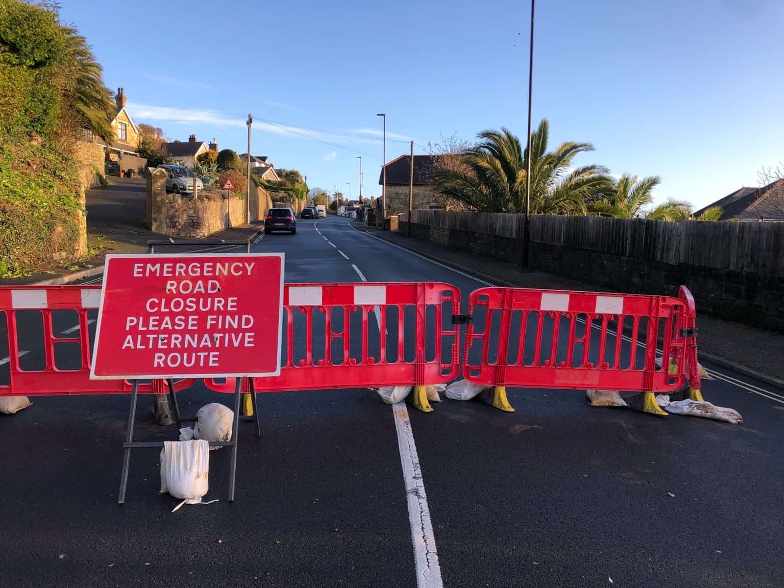
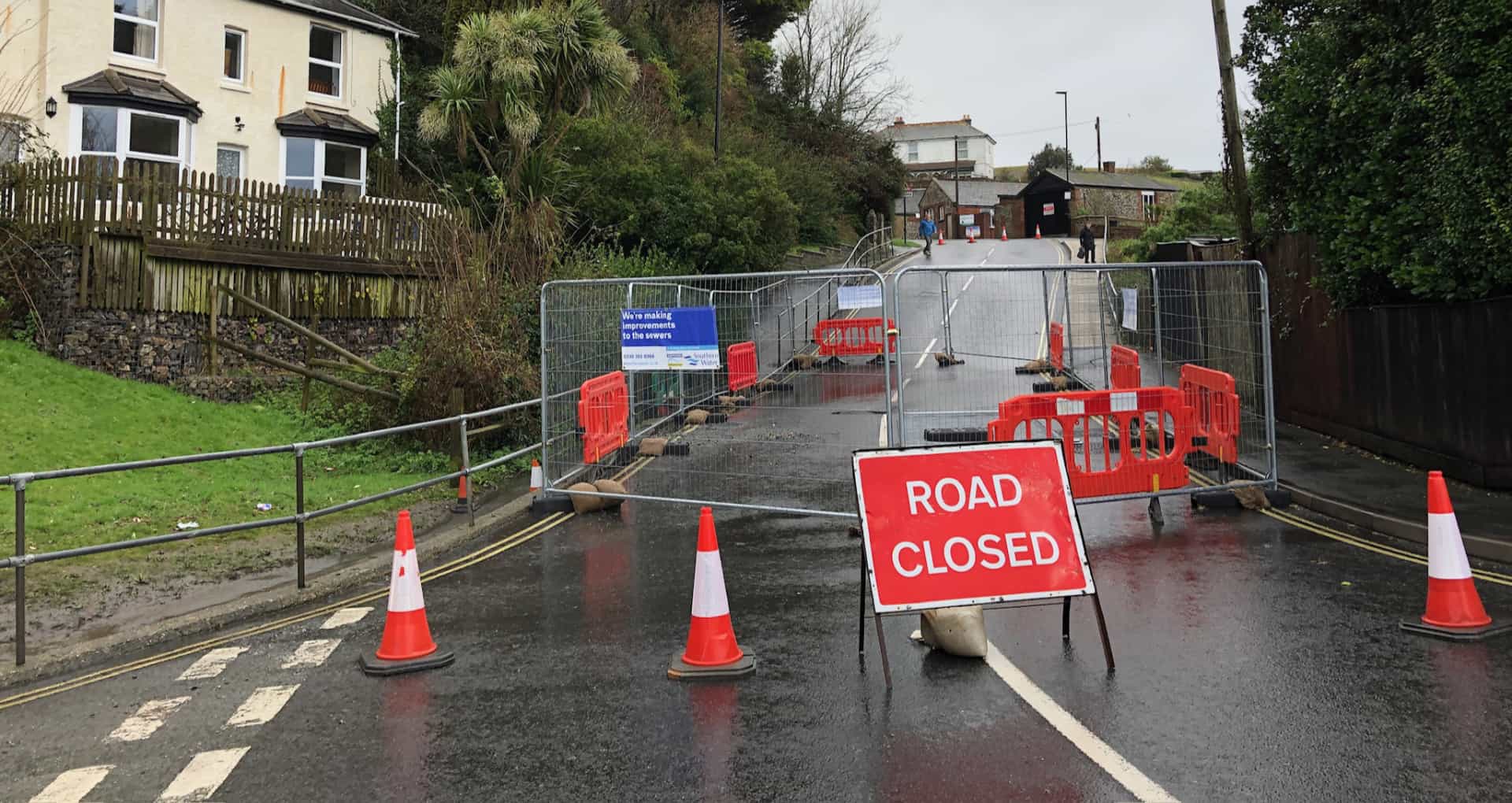
Thursday night’s public meeting at St Catherine’s Church in Ventnor attracted 100s of concerned residents keen to seek reassurance from the council and Island Roads about the impact of the Bonchurch Landslide and closure of Leeson Road – an arterial road (A3055) that connects Ventnor to Luccombe and Shanklin.
Recap of landslide event
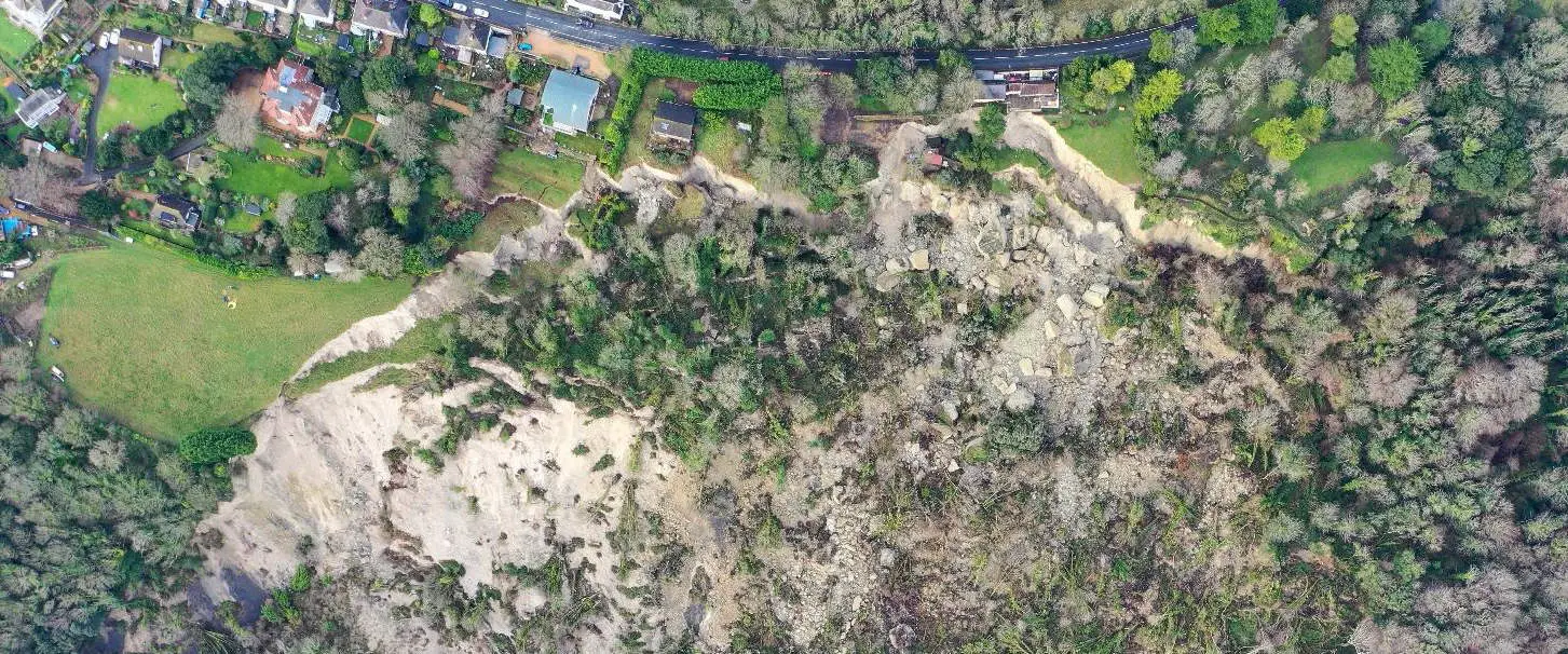
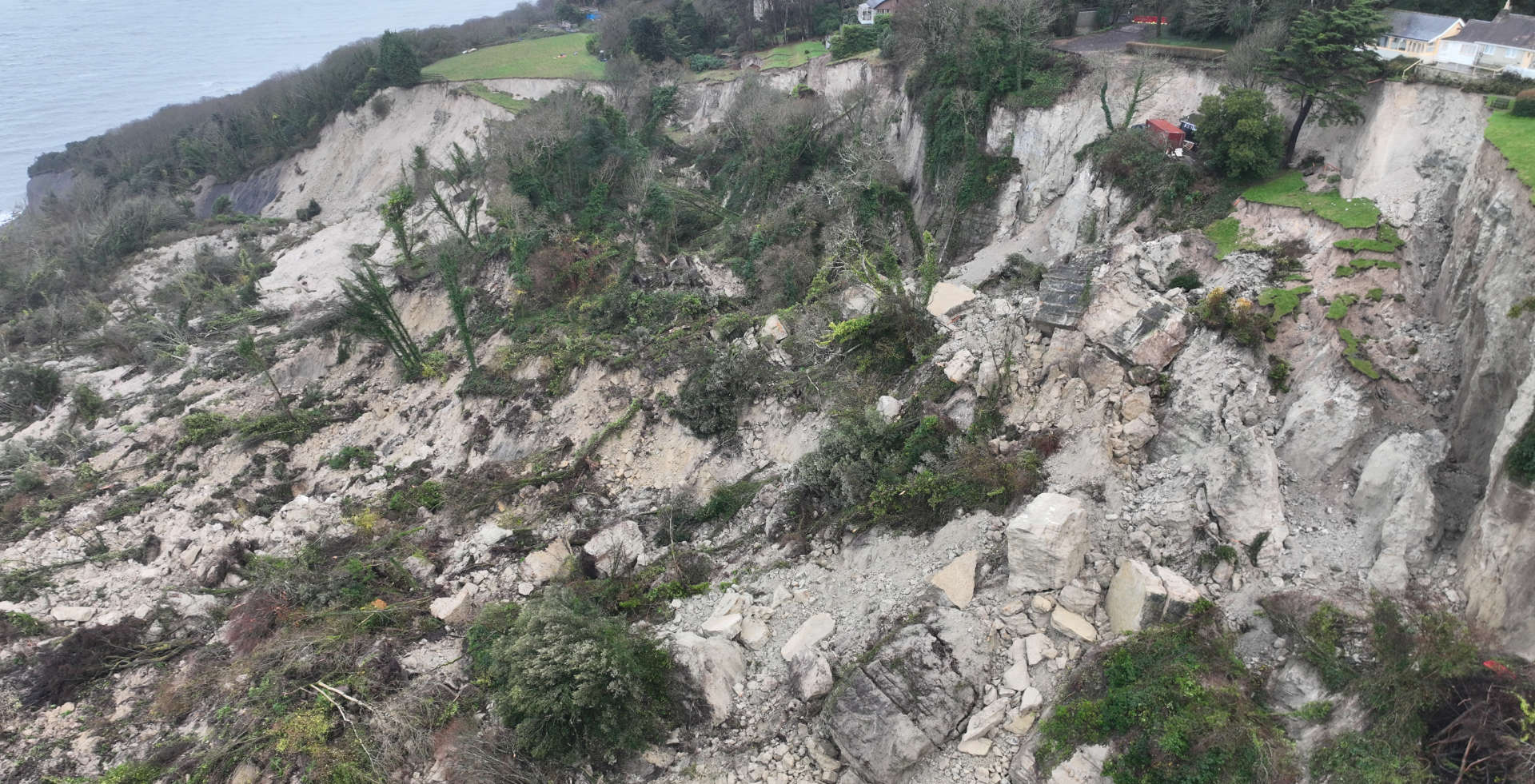
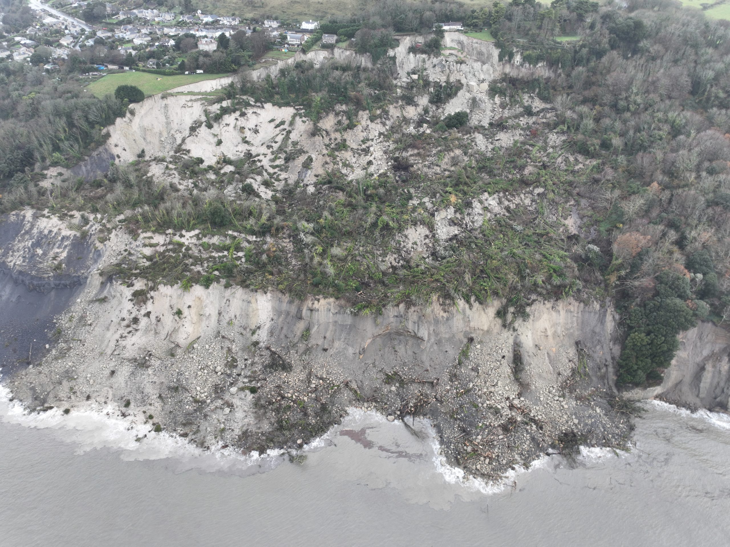
Nastaha Dix, the council’s Service Director for Waste, Planning and the Environment, gave a quick recap of the Bonchurch Landslide event on 10th December 2023. She explained this was the latest in a sequence of reactivations of an ancient landslide complex that exists in the area known as The Landslip.
There was a very large reactivation in 1995, when a significant amount of the land was lost. Over time that settled and the council rebuilt the public footpaths that went through the Landslip area with access to the Devil’s Chimney.
In 2001 there was another reactivation in the area which led to the loss of some properties on Bonchurch Shute. Once that had settled the footpaths etc were reopened.

The “most significant landslide we’ve seen in living history”
The landslide in December 2023 was “probably the most significant we’ve seen in living history and memory on south coast of the UK”.
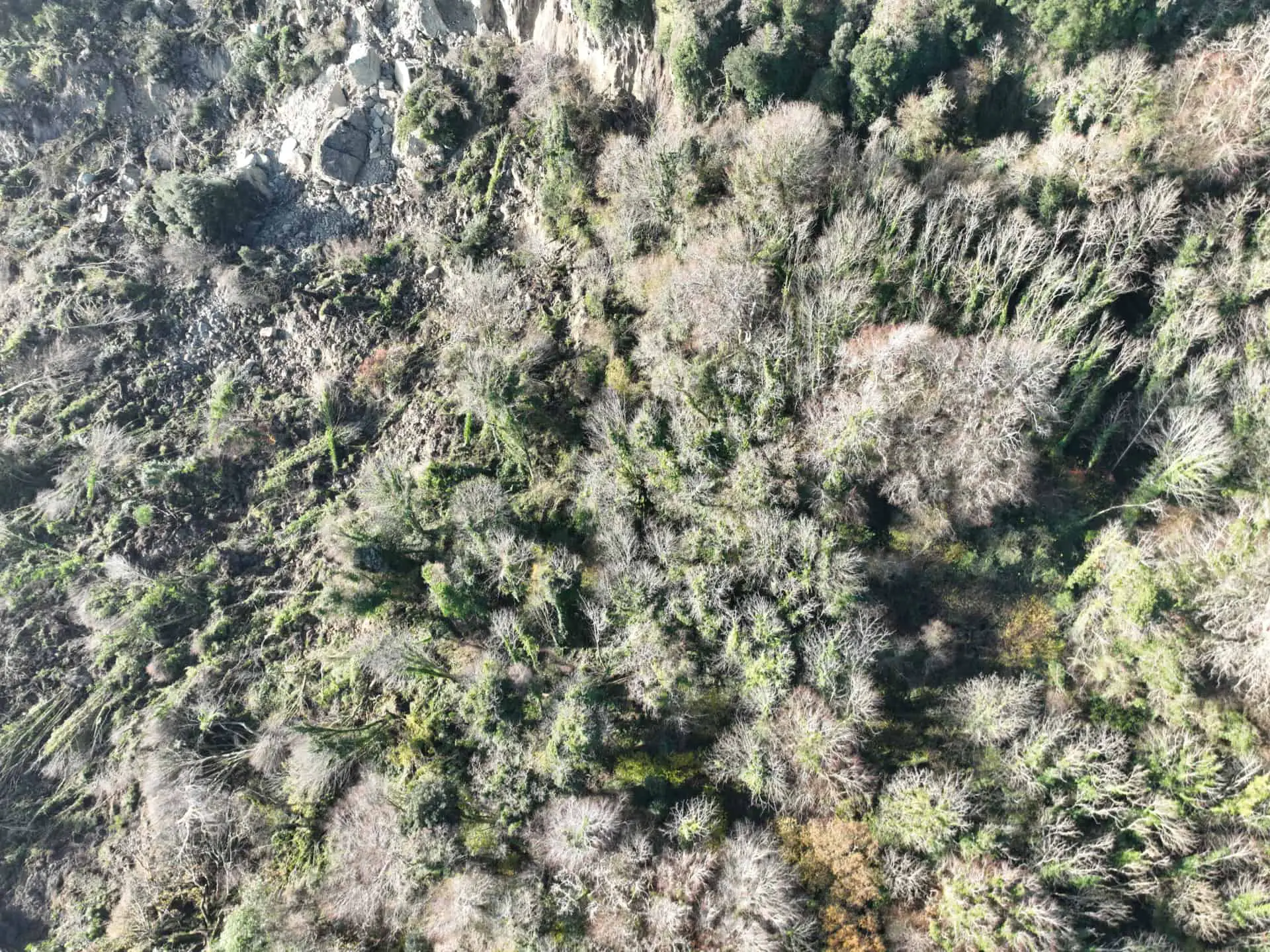
Natasha went on to explain that there has been 16 hectares of displaced land and around 14 million cubic metres of material have been displaced.
What caused it?
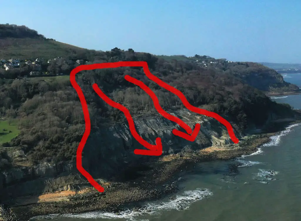
The cause has been attributed to a combination of factors, with toe erosion (marine erosion) at base of the cliff and ‘antecedent rainfall’.
Natasha explained the geology of the coastline in this area slopes westward but also moves at about one degree north towards the centre of the Island. As explained in previous articles on the subject, the rainfall which falls in the Arreton Valley takes around 12 weeks to flow through the geology to the coastline of Ventnor and Bonchurch.
The very heavy rainfall from August to November has been working its way through the system and is one of the attributing factors of the Bonchurch landslide, as well as the excess groundwater levels from that intense rainfall.
An ancient deep seated landslide complex
The landslide complex along the south coast from Luccombe to Blackgang is the largest urbanised landslide complex in North Western Europe. Natasha explained it is an ancient deep seated landslide complex, dating from the last glacial period 11,500 years ago.
When the Victorians grew the town from 400 properties to 1000s in the last 40 years of the Victorian period, it was done with the knowledge that the area was loosely unstable, but broadly seemed like a stable place on which to build.
What happened?
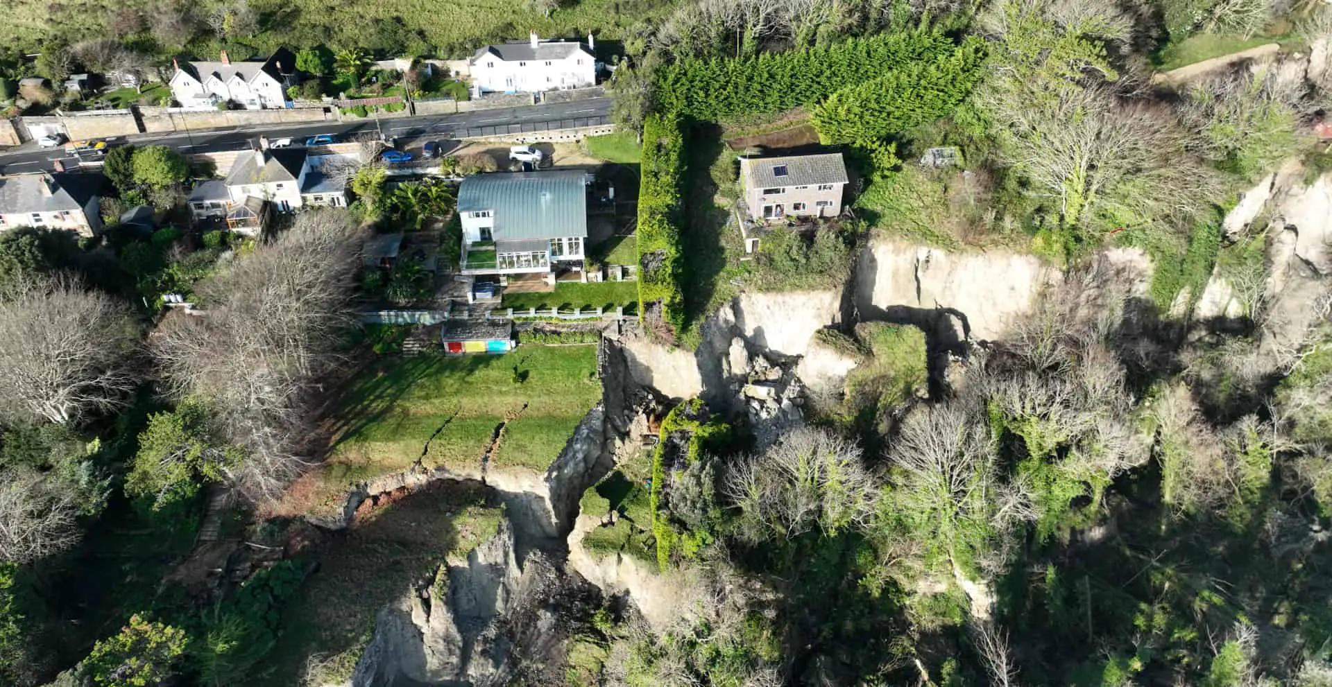
This particular failure has resulted in toe erosion at the bottom of the cliff, with the blue slipper layer moving forward.
As that has happened it’s taken the land behind it, and created a gap underneath, which resulted in the massive horizontal drop you see by the Smuggler’s Haven Tearooms.
Experts appointed
Isle of Wight council is the landowner of the area and employed consultants, Jacobs, and in particular, Professor Roger Moore, who has been working on the Undercliff complex for 35 years, to carry out landslide analysis and risk assessment. That was the first piece of work carried out.
Identified through that report are the short term risks of further collapses. Natasha explained that at present they are not sure whether there are any other voids under the greensand bench.
Rainfall still working through the system
All of the edges of the slope around the failure will take time to settle, as rainfall is still working through the system, as that dries out over summer things compress, crack and fall.
In the short-term the council say they know there are risks of further smaller collapses around the fringe of the landslide
The risks
Natasha explained another short term risk is the toppling of the cliffs at the rear of the landslide area and urged urban explorers to avoid walking around the landslide complex, warning of the dangers to themselves and others.
There is a medium term risk of further erosion from the accumulated debris on the seafront. The winter rainfall of events, now we are moving into an el nino cycle of weather may further affect land movement.
“There will be movement and we can’t pretend there’s not going to be”
The area will be monitored and analysed so the council can protect all of the community around the area.
“We are on an active landslide complex, there will be movement and we can’t pretend there’s not going to be.”
“Ventnor has come back from this before”
Natasha explained the prognosis for the area is that in the future there will be degradation, which will be influenced by the rates of erosion, drier summers, wetter winters and rising sea levels.
“We need to remember that Ventnor has come back from this before, we’ve had the 1994 landslide where we lost most of the Landslip, we had 2001, now we have 2023, but the trees will grow and hopefully we’ll get to that point where we can get those footpaths back through the Landslip and having a coastal path which we can enjoy.”
Risk zones
The immediate risk zones for monitoring include:
- The ‘active zone’ – the area that is still settling and moving
- A 20m ‘safety buffer zone’ – the potential area that could see more further movement as the land settles over time.
- ‘Watching zone’ A – Area to the west of the landslide south of Leeson Road to be kep under observation
- ‘Watching zone B’ – Area to the east of the landslide including The Landslip to Luccombe Chine
- Low risk zone – The area above the landslide which appears stable and unaffected by recent events
Next steps for IWC
The next steps for IWC will be to update their geomorphological mapping to record the new landslide complex and areas towards Luccombe.
There are a series of maps that have details of the geology of the area and how it moves and the planning guidance attached to them.
LIDAR surveys will be used to update the topography of the new landscape and the IWC are working with technical teams to install further monitoring of the landslide area. They are working closely with Island Roads on the wider traffic implications, and are in discussion with Ventnor Town Council to extend the Route 31 bus for those residents on Leeson Road.
There would be another public meeting at the end of April to update on developments.
Island Roads
Rob Gillespie from Island Roads explained they have initiated monitoring of the road to be able to see quickly whether the road is deflecting in a vertical plane. They are also working on installing further monitoring equipment for the wider geological movement of the area.
As well as Jacobs providing consultancy work in the area for the council, Island Roads have employed the services of engineering specialists, Atkins – who know the area very well, having worked on the award-winning Belgrave Road project.
The next stage of monitoring equipment will be installed in March, including 100m bore holes along Leeson Road to drop down monitoring equipment and establish whether there are any voids lurking beneath the road.
Road closure challenged by local highways engineer
Island Roads are employing a degree of caution in the way that they’re approaching the issue, something that was challenged by a highways engineer sat in the audience who lives in Bonchurch.
He stated the in his view road was entirely intact and could be used for cyclists, pedestrians and motorcycles. He said that thousands of users are being prevented from using the road. This comment resulted in large applause from the audience members.
Rob Gillespie apologised for the impact this cautious approach is having on the time the road is closed.
“The safety of the area, the safety of the people living there and the safety of the road users has to be a top priority and I hope you understand that.
“We will work as quickly as we can to use the information that comes from the monitoring in order to reach a position where we can decide, with all the agencies involved in making sure that public safety is maintained, that the road could be reopened safely. Albeit, we expect that when it first gets reopened, it will be under some level of restriction.”
Eliminate, mitigate and manage risk
He added that it is the instantaneous nature of the failure that is the concern, which is why they are working with expert consultants. He said their approach to risk is to eliminate, mitigate and manage.
He said they were eliminating the risk by closing the road, mitigating it by monitoring, and will manage the risk once they have the necessary information from the monitoring.
The next steps
The next steps, with no specific time frame given, include:
- establishing a series of monitoring and detailed measurement systems
- monitoring the captured data, maintaining restrictions to Leeson Road for the safety of the residents
- further developing contingency plans for the area, its access and amenity
- working across all agencies to ensure residents and businesses are safe, informed and where possible have fully accessible routes in and out of the town.
He said they would return at the end of April to update the town on the developments.
Public questions: Open the road at users’ risk
The first public question returned to the chartered structural and civil engineer, who said he had helped build parts of the M25 and M4, who reiterated that the situation was complex but that the IWC and IR had reduced the risk to zero.
He said the road is undamaged, strongly build, 40ft from the cliff edge and his view was that it should be opened tomorrow pedestrians, cyclists, motorcyclists and cars with two bog notices at either end of the closure of Leeson Road, advising the public there is a small risk of collapse and people use the road at their own risk.
This resulted in large applause from the audience.
IR: Public safety utmost importance
Rob Gillespie replied that risk to different people is different things and that they didn’t want to disrupt anyone. He added it was unfair to target the IWC for the closure, adding that the liability and responsibility of Leeson Road is of Island Roads.
He said they need to do as much as they can to ensure safety, adding that the current state of the landslide, they believe right risk is to not reopen the road just yet.
Wroxall route not considered
Richard Ferraro, an architect from Bonchurch (who incidentally is considered to be “one of the fathers of sustainable design in the UK”) raised the point that nobody has talked about the B road through Wroxall.
This resulted in applause from the audience. He said that at the southern end of the route, buses are grounding as they go over the graben (approaching Upper Ventnor by the chip shop) and that the situation is far more serious than being presented.
He reminded the meeting of the situation in December just after closure of Leeson Road when the graben area was also closed due to a burst water main, resulting in all traffic diverting through the village of Whitwelll (or Chale) and through the Whitwell narrows. He added that the surface of the road through Wroxall is “falling to pieces”.

“Ventnor is at serious risk of being cut off”
Mr Ferraro believes that Ventnor is at serious risk of being cut off substantially (met with large applause) and was shocked and surprised to hear that the public were not being told what overall resilience situation of the highway system serving Bonchuch, Ventnor and parts of St Lawrence.
He added,
“Yes we want to know about the A road to Shanklin and that is what you have been concentrating on, and yes there isn’t an answer and lots of monitoring to do and discussion about risk, but we are going to be cut off soon, because the only road out and in will be via Whitwell which is not fit for purpose.It is too narrow and dangerous for commercial traffic so where are we sitting with all of that?”
This was met with the largest applause of the evening.
IR: “A very difficult transportation conundrum”
Rob Gillespie said there were good points to raise, he said it is not being ignored, adding that they were asked to talk about Leeson Road.
He said it is a very difficult transportation conundrum. He said that every time there is work to do there will be a restriction, not just in Ventnor.
He said the graben is a well known complex (read more about it here) that moves almost continuously, adding Island Roads know they have to go back and visit it regularly in order to keep it in a serviceable condition. He said there isn’t an alternative route close by in the immediate area.
“We feel caught between rock and a hard place”
He said the graben as part one of the main access points to Ventnor is “really problematic”. He admitted it is in a poor shape, adding that some work was carried out on Wednesday to tidy up the northward footway by the bus stop and that Southern Water also has a lot of work to do in that area.
He reluctantly used the term, “We feel caught between rock and a hard place,” adding that not doing the work allows thighs to deteriorate even further. He said the needs of Wroxall are clear but that works there had been deferred to later in year because of the situation in Ventnor. He said they try to avoid work taking place during the holiday season because tourism is the lifeblood of the Island.
IWC: Message to utility companies – “unless essential you don’t come into Ventnor”
Colin Rowlands, the Director of Communities for Isle of Wight council said they didn’t have enough data about the risk, but were working with Island Roads to proactively manage the works for utilities that provide vital services to residents (water, gas, electricity).
“They can come in at the drop of a hat and they can do the works and there is very little we can do about it as a highway authority.
“We are trying to have conversations with utilities to proactively manage the interventions that need to take place in Ventnor. The similar message we have given to Island Roads is, ’unless essential you don’t come into Ventnor’.”
Delays to important embankment work
There is an embankment (pictured further up) on St John’s Road, Wroxall that requires serious intervention but the work has been pushed back to September, but Colin said they are eventually going to have to do that work because there is a risk of that embankment (which has homes above it) falling into the road and closing the road for a period of time.
“Please be assured we are trying our very best to manage the risks, to manage the process and try to keep the roads open as much as we possibly can.”
He added that the council were talking to the Department for Transport, the local government office for housing, the local MP, DEFRA, and trying to get all agencies aware of what’s going on in Ventnor and seeking financial support.
20mph and no parking
Another member of the public suggested that a limited solution for summer could be 20mph restriction through Upper Ventnor and Wroxall with no parking on the main roads.
Rob Gillespie explained that parking on the road acted as a form of traffic calming, and you’d have to consider the issue of where vehicles could be parked if not on the main roads. He did offer to “look at it”.
Another member of the audience noted that the road closure is not marked on Sat Nav and that drivers will head from Shanklin not realising they can’t get through.
The response was that they would look at the options and would look into the Sat Nav situation.
Why should be we confident the road will be reopened?
Another member of the audience asked why they should be confident that the road will be reopened when there has been “abject failure to do so” elsewhere (Undercliff Drive). She also asked for the council to accept the help of experts in the room and wanted to know what they are doing to get Government funding.
She asked why three different consultants were being used and when the public could see a non-redacted version of the Highways PFI contract.
Colin Rowlands repeated exactly who the council is talking to (as he’d just said beforehand).
Redacted PFI contract
Rob Gillespie explained that each of the consultants had different specialisms and that they have to work from contemporary information and couldn’t base work on reports from 1995.
He added that it was not within his gift to provide an unredacted copy of the PFI contract for commercial sensitivities and in line with agreements made over the years.
Alternative transport along old railway
Another member of the public agreed that drivers should be able to use the road, taking at their own risk, but accepted that Southern Vectis could not take that risk. He asked the panel whether they agreed that what Ventnor needs is rail link or a similar transport service using the alignment of the old railway, “as it appears to be the only possible way in and out of Ventnor that is not subject to landslips or subsidence”. He added it would safeguard transport in and out of the town, as well as people’s homes.
Colin Rowland said that they were open to considering alternative transport solutions and are in the process of developing a new transport strategy for the whole Island and awaiting further guidance from the Department for Transport as to what that would look like. He said we need to move away from reliance on the car as a form of transport, but that society is designed around use of the car.
Support for small businesses
Kirsty Chapman, from the Better Days Cafe, asked whether businesses were going to get any help. She explained two more businesses were about to close in the town and that once closed won’t reopen again.
Colin Rowland confirmed they would be appealing to Government for support for small businesses if the situation continues for period of time.
No infinite pot of money
Other points from the audience included a call for a reversal of the Shoreline Management Policy, which indicates ‘no active intervention’ in certain areas such as below The Landslip.
It was pointed out that Shoreline management policies cover the entire English coastline and there is not an infinite pot of money to protect coastlines. The Environment Agency officer also pointed out that no active intervention at the Luccombe shoreline is what creates the beaches in Shanklin and Sandown.

Building Undercliff Drive
Colin Rowland added that the IWC is committed to keeping the network open as best as they can and will look at engineering solutions for rerouting roads if practical and affordable. He said the cost of rebuilding Undercliff Drive to two-way traffic is £8-£10m.
“£8-10m to rebuild a road that might disappear again in five or ten years of rebuilding it, those are the sort of judgements we’ve got to make when looking at re-routing roads, use engineering solutions or looking at ways to bolster the existing network.”
Free parking
One member of the audience asked for free parking in Ventnor to encourage people to visit. The council officer said this could be looked at, but added that part of the problem with car parks in Ventnor is that many space are used by residents who don’t have on or off street parking.
Other questions included asking about emergency contingency plans, which Natasha explained were in place – if all roads are cut off, we can call on the Navy.
Other politicians also spoke at the meeting – an update to follow.
Next meeting
The next meeting takes place at the end of April, when there should be more information to share on if and when the road can reopen.