Residents and businesses have been suffering the consequences of the Bonchurch landslide, which struck the village on 10th December 2023 – reportedly being “probably the most significant we’ve seen in living history and memory on south coast of the UK”.
It led to the closure of the main arterial road between Ventnor and Shanklin, a route for cars, buses, freight lorries, cyclists and pedestrians. This means the only two main routes in and out of the town are via Wroxall and Upper Ventnor, and Whitwell.
A News OnTheWight reader (thanks Debbie) suggested an FAQ would be helpful to keep readers informed of any changes. So here it is. Hopefully kept as up to date as we can.
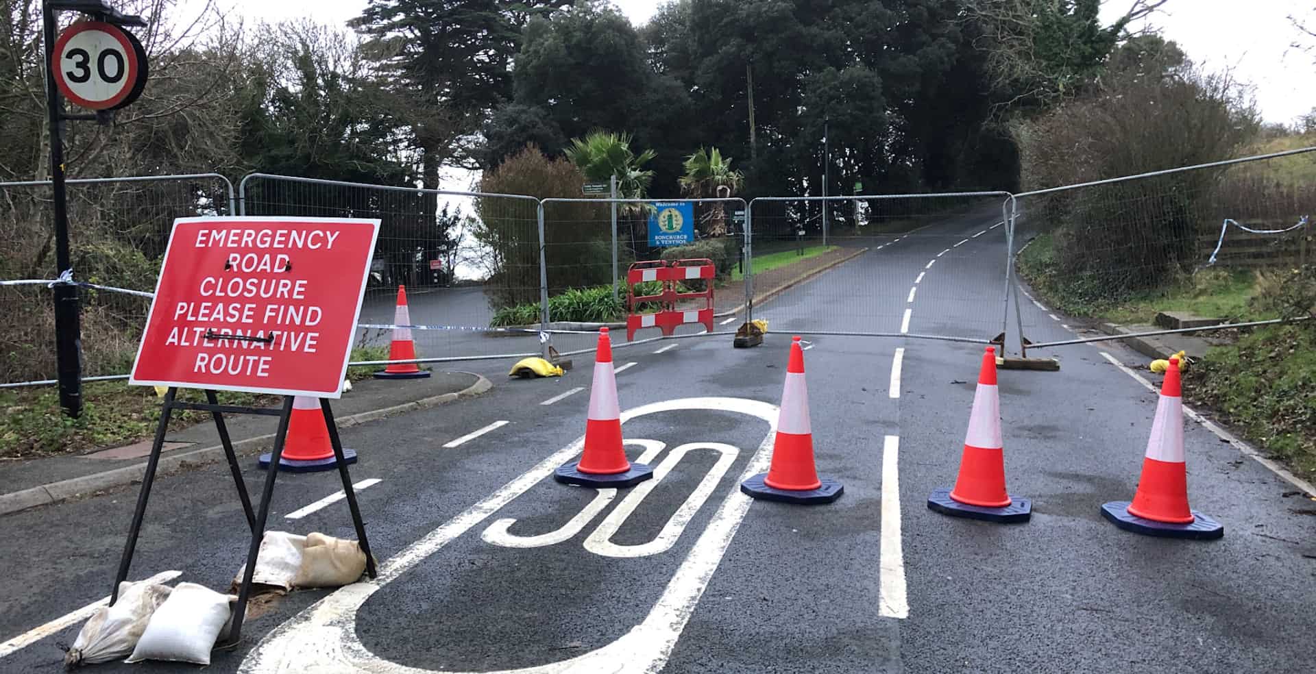
Is the road totally closed?
Yes – from The Landslip car park to Leeson Road, Bonchurch Shute.
No through route from Shanklin to Ventnor by foot/car/cycle or any other means. See alternative route below.
When will it re-open?
The road is currently undergoing monitoring for further ground movement, after which decisions will be made as to opening, possibly in stages and only when it is safe to do so.
Please read the comprehensive report for an accurate account of what was said at the public meeting on 29th February 2024.
Is it safe to come to Ventnor/Bonchurch?
Absolutely.
The town is open and the large collection of independent shops and restaurants would welcome visitors, as trade has been much slower since the landslide.
What is the alternative route for vehicles?
Coming from Newport/Cowes – via Whitwell. Follow the diversion up to the chip shop, turn right and head down into town, taking either the right turn at Zig Zag Road, the right turn at Grove Road, or the right turn at Spring Hill.
Coming from Ryde/Sandown/Shanklin – via Wroxall (an extra two miles). Follow the above directions following the road to the left after the chip shop.
Cyclists are advised to use the cycle path from Shanklin-Wroxall, dismount down Wroxall High St, turn right at the convenience store and proceed with caution down Rew Lane to Upper Ventnor. The hill down into Ventnor is quite steep, be careful.
Please take care driving through Wroxall, Upper Ventnor, Whitwell and respect the speed limit.
For the more up-to-date road closures, see the One.Network website. Do not rely on other apps eg Google or Sat Nav – as they may not be accurate.
NB: Local residents in Upper Ventnor and Wroxall who park on the main road have few other places to park, so moving them is unlikely. The parked cars also help prevent speeding.
Are buses still running to Ventnor?
Yes, see the updated online timetable for the No3 bus to/from Ryde & Newport.
See the timetable for No6 Newport-Ventnor, via Chillerton, Chale, Blackgang Chine, Niton, Whitwell.
Note – Due to roadworks all over the Island, buses can sometimes be delayed, this link shows the live position of the No3 buses and clicking the green ‘bus’ square reveals if it is headed towards Ryde via Shanklin/Sandown OR Newport via Godshill
Shuttle bus?
No. 31 bus: If you live in the Leeson Road area and do not have transport, you will already be aware that plans are afoot to extend the No.31 bus further up Leeson Rd. It is not possible for the normal No3 bus to serve this route. The bus is subsidised by council tax payers.
See the current timetable. Bonchurch Shute is currently closed for repairs to a retaining wall, but the No.31 will drive up Leeson Road, turn at the top of the Shute and drive back down, then servicing Bonchurch from the lower roads.
The graben
At the start of Newport Road (by the chip shop) where it connects Ventnor to Lowtherville (Upper Ventnor), is the area known as ‘the graben‘.
A graben is a geological fault that is opening up at the crest of a larger landslide.
The highways contractor can only carry out remedial repairs to the cracks and voids that appear, but they are aware of the importance of keeping the road open, so repairs are carried out overnight to avoid a road closure.
Emergency closures will only take place when absolutely necessary (ie. water, gas or electricity).
Lower Gills Cliff Road
Lower Gills Cliff Road has been closed since 22nd February 2024 due to a boulder falling from the side of the rockface – taking out the traffic lights in the process.
The latest news (27 Mar 2024) is that the road remains closed in light of more specialist work needed to secure the rockface, as Island Roads “are concerned we “remain concerned at the risk of further significant rockfalls”.
This closure means that those travelling from Whitwell need to take the left turn at the junction of Whitwell Road/Gills Cliff Road and follow the instructions above to reach the town.
When will the pot holes in Wroxall be filled?
Some have now been filled – there are still many that need attention.
Planned work on the collapsed bank in Wroxall has been pushed back to later in the year.
What can local residents do to help?
- Be patient – updates will appear on this website as soon as there is any news.
- Help one another eg offer neighbours a lift or with shopping.
- If you live along Leeson Road and need help – reach out and ask.
- Support local businesses.
- Consider walking, car share or using the bus for some/all journeys. This not only cuts congestion but reduces pollution in the villages eg Whitwell, Wroxall, Upper Ventnor. It also alleviates extra pressure on the Graben. It might also save you car park charges !
- If you are able, avoid/reduce driving through the villages during school term time around 8.15am – 9am and between 2.30pm – 5pm.
Read the background to the Bonchurch Landslide or The Graben in the News OnTheWight archives.
Article edit
10am 30th Mar 2024 – detail about potholes in Wroxall corrected.