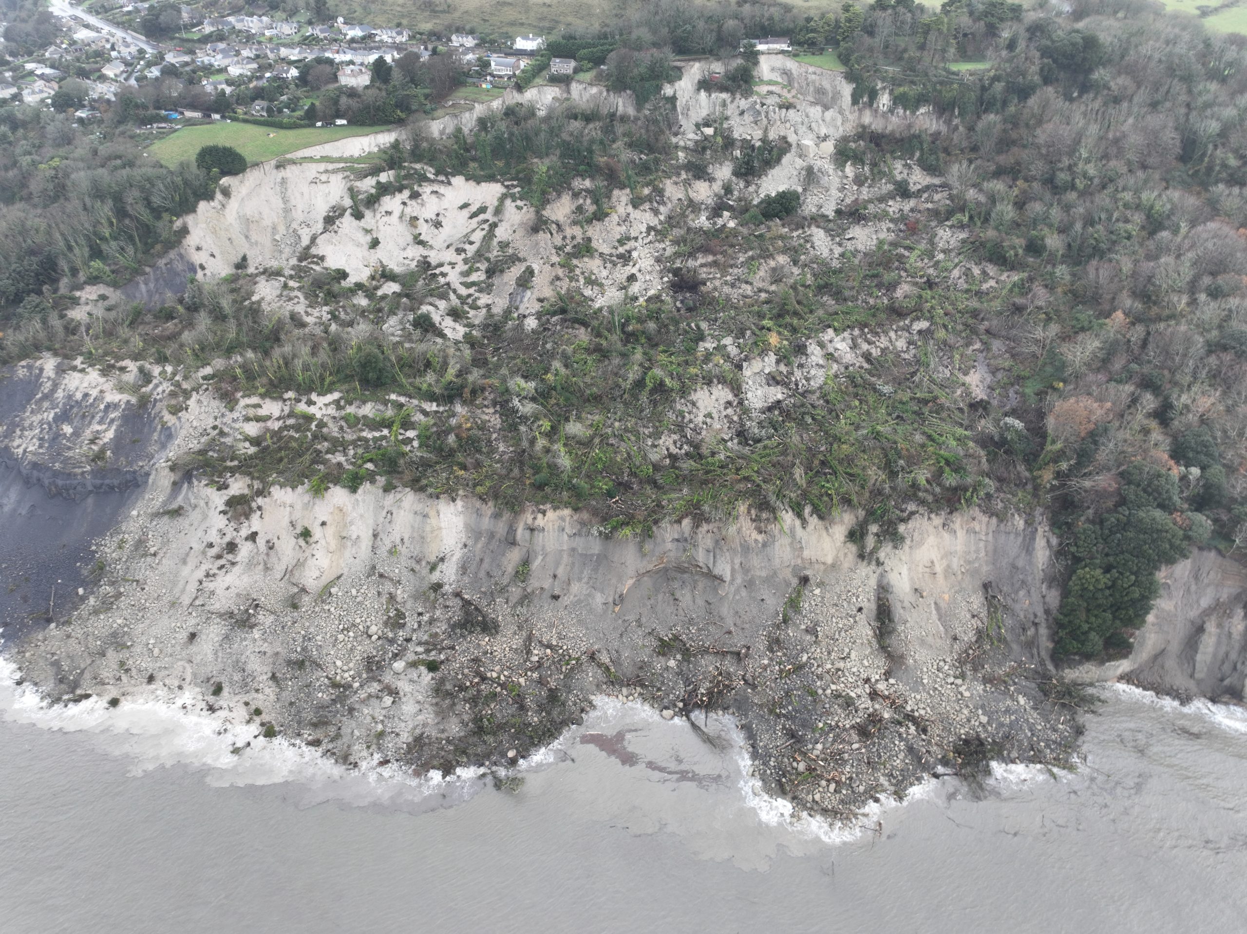
A new aerial photo, captured and shared by Mike Collins, puts the extent of the Bonchurch landslide into context.
Some residents in the area who were previously evacuated have been able to return to their homes, but those closer to the slip remain safe from harm’s way. Our thoughts are with all those affected at this very stressful and worrying time.
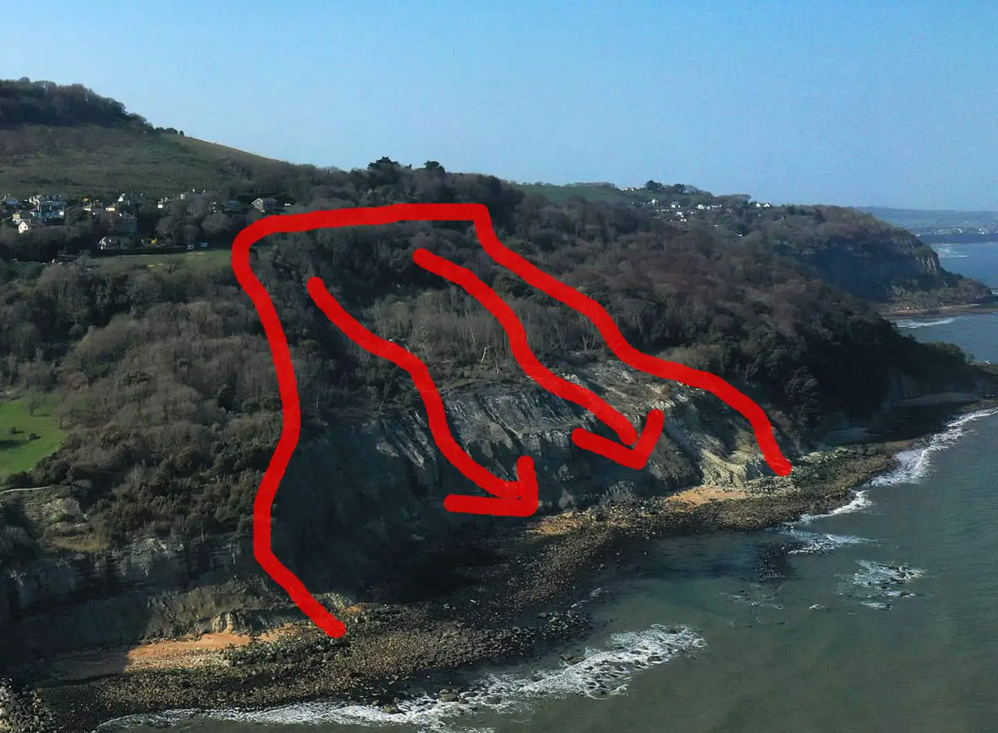
Comparing to earlier photo
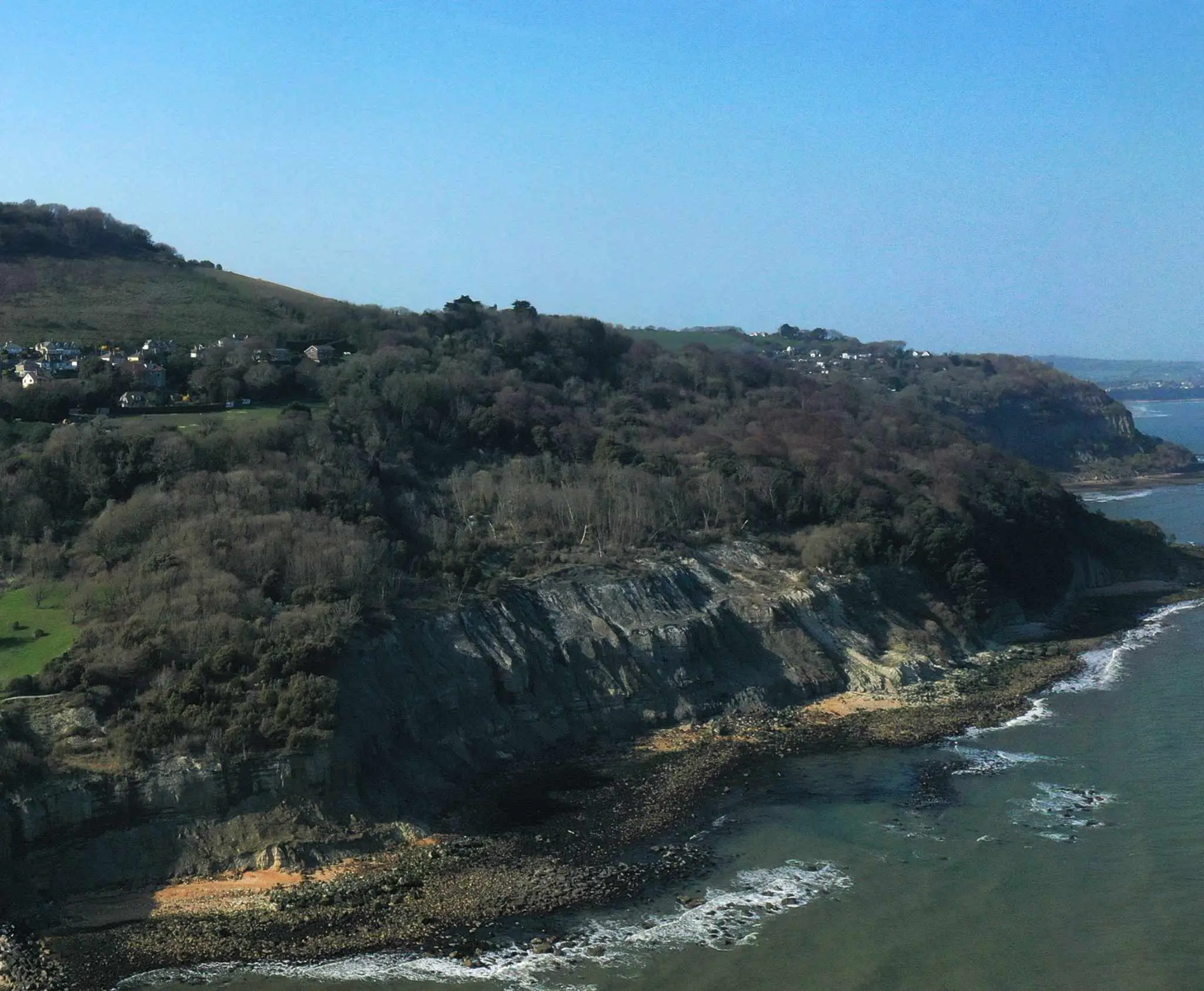
Below you can see a new high resolution image captured by Mike Collins that shows the area from a distance. News OnTheWight has also drawn (excuse the rudimentary styling) on a 2019 image, also shared by Mike but taken from a slightly different angle, which shows just how much of the area has slipped towards the sea.
Click on the images to see larger versions – our thanks to Mike for allowing us to share the shots with News OnTheWight readers.
News OnTheWight was expecting an update from the Isle of Wight council this afternoon, but at time of publishing none has been forthcoming. We’ll update you once we hear more.