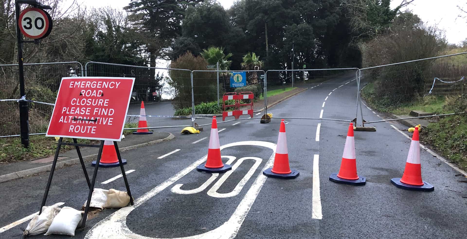
At the public meeting to discuss landslide and coastal defence work in Ventnor tonight (Thursday), Natasha Dix, the council’s Service Director for Waste, Environment and Planning, explained that it would be some time before they would know whether Leeson Road could be reopened.
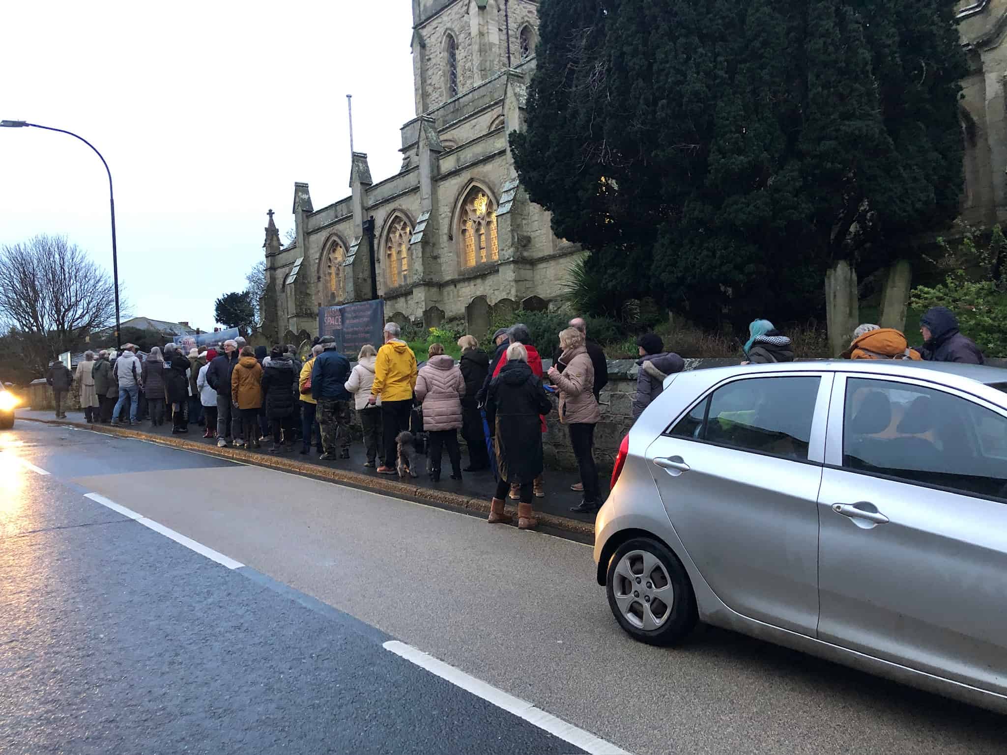
There was a full house at St Catherine’s Church as residents gathered to hear the latest news following the Bonchurch landslide in early December.
Natasha explained to those attending the meeting the history of the landslide complex and previous landslide incidents that the town has recovered from.
Still moving
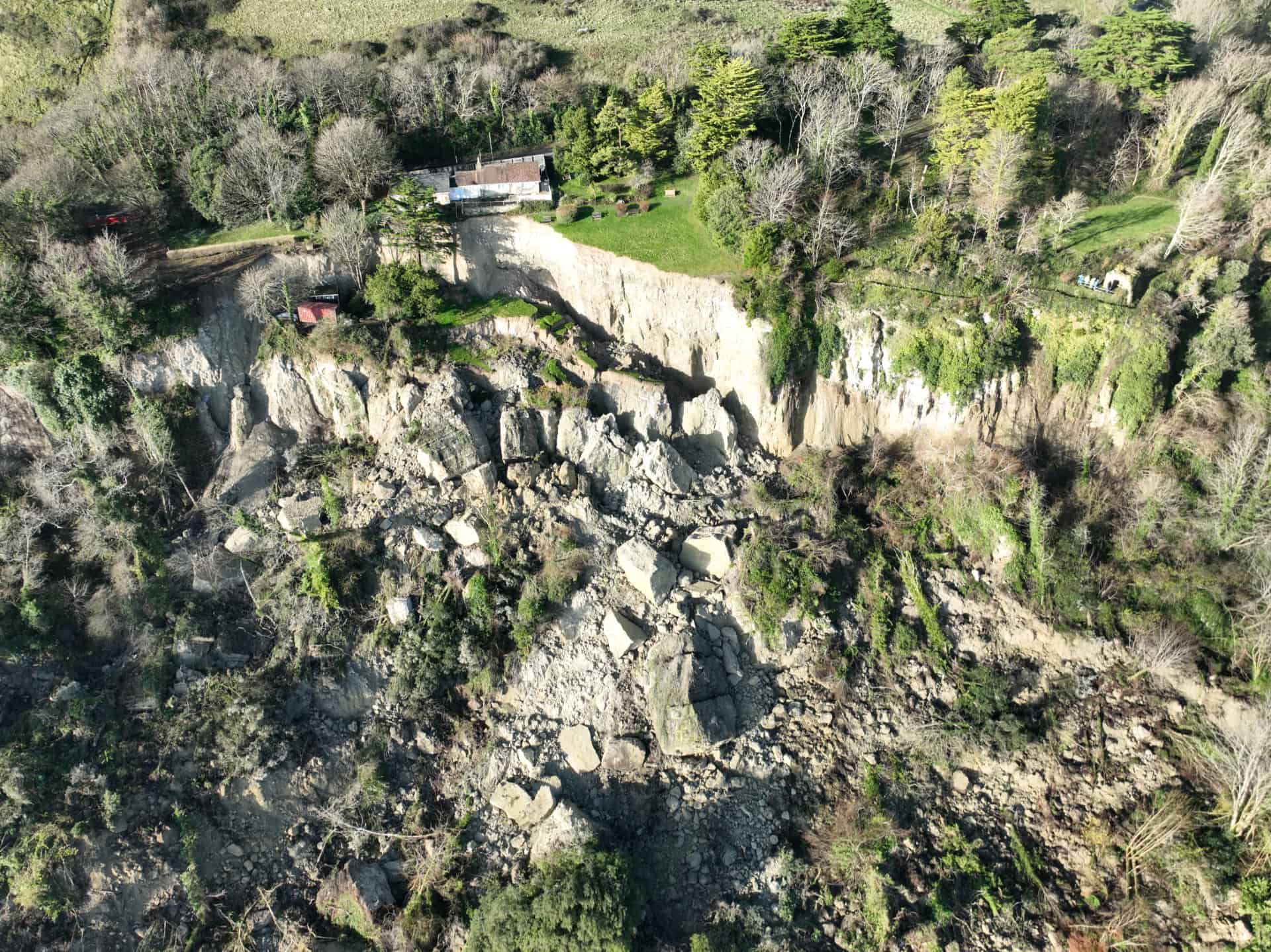
The landslide complex is still moving and it is expected that there will be further smaller collapses around the fringe of the landslide. In the meantime, a 20m safety buffer zone has been put in place.
More equipment will be installed in March to continue monitor the activity and investigate whether there are any voids under the road. This will be ongoing and no time frames were given.
Another public meeting would be held at the end of April – or earlier if there was anything to report sooner.
Read News OnTheWight’s comprehensive report from the meeting.
Impact of road closure
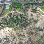
The landslide was the biggest to affect the area in more than 20 years, some say possibly 100 years.
It was explained that the landslide resulted in 16 hectares of displaced land and 14million cubic metres of material.
The Bonchurch landslide resulted in the closure of a small stretch of arterial road (A3055), leaving Ventnor with just two exit routes: Newport Road (through Upper Ventnor and Wroxall) and Whitwell Road (through the Whitwell narrows and Godshill). Although there is a route through St Lawrence, it is not suitable for buses or HGVs and includes two-way traffic crossing a narrow one-lane bridge.
Managing the graben site
The Newport Road route (by the chip shop) sits across a geological fault called a graben (more information about what a graben is can be found on Dave Petley’s Landslide Blog).
This stretch of road linking Ventnor to Lowtherville (upper Ventnor) is a key route in and out of town, but subject to regular closures. Island Roads can’t halt the geological movements at this site, just simply manage them, which is why residents will see the cracks or voids being filled and surfaced. It sometimes only requires half the road to be closed and have temporary traffic lights in operation. Other times it requires the road to fully close.
Now that Leeson Road is closed, when the closure of Newport Road is necessary it puts additional pressure on the village of Whitwell and impacts the flow of traffic through the narrows.
Article edit
12.20pm 1st Mar 2024 – Link to comprehensive report added