Mike Slater from Isle of Wight Ramblers shares news of their latest campaign in relation to the King Charles III Coast Path. Ed
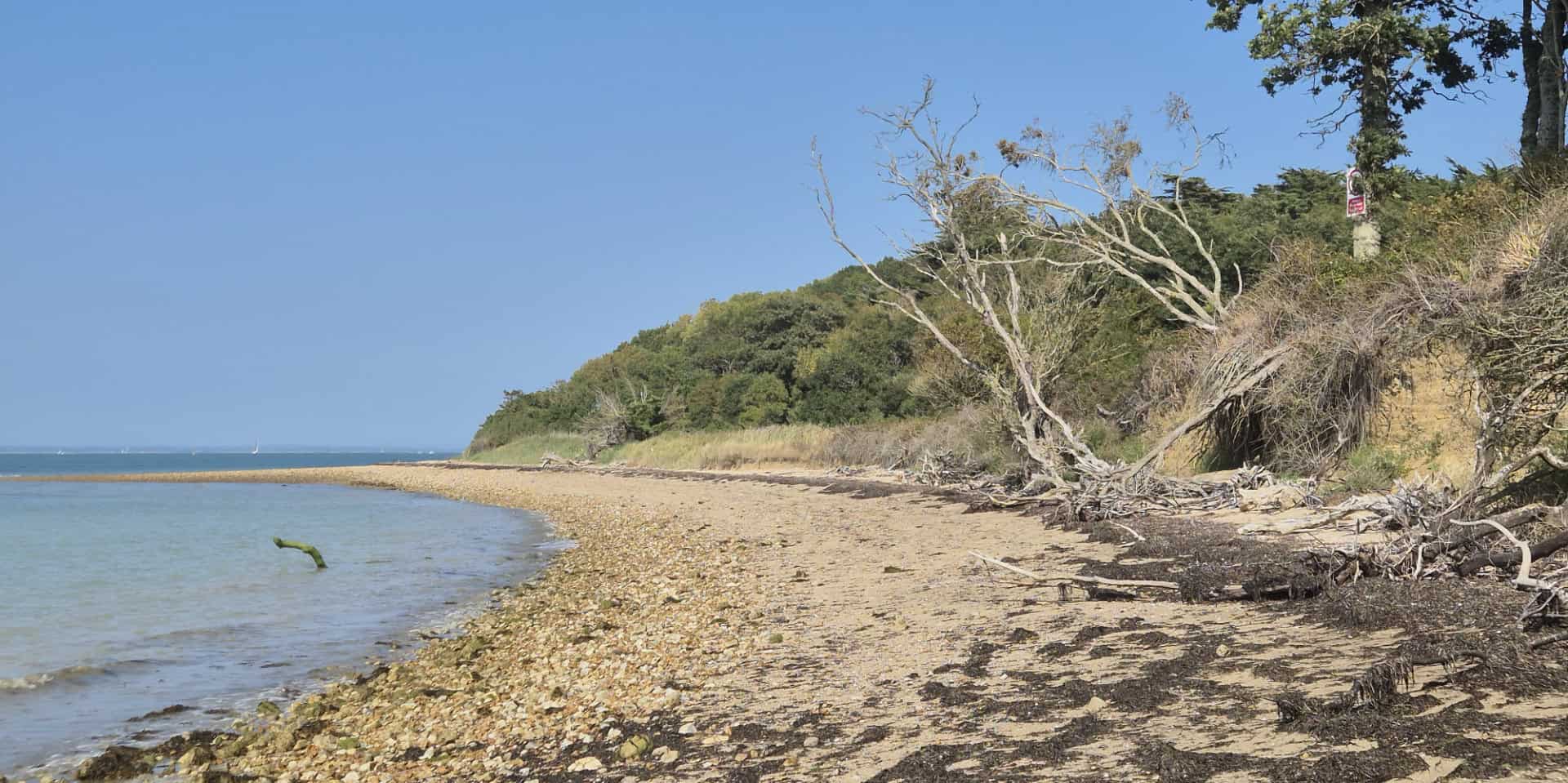
1) Why is this Isle of Wight Beach not part of the Coast path?
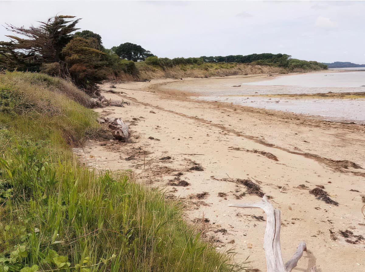
2) Why can’t people follow a path over this grassland to Newtown harbour?
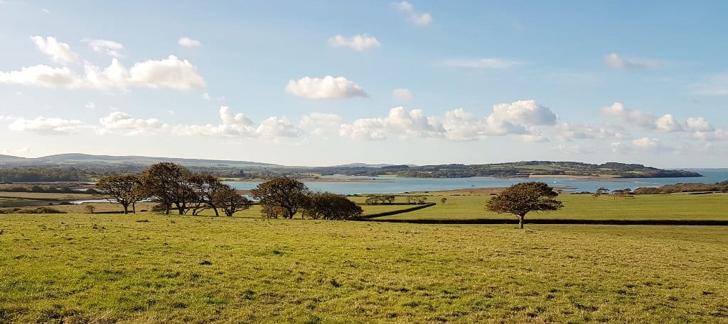
3) Why is this stretch of countryside and coast still closed to public access?
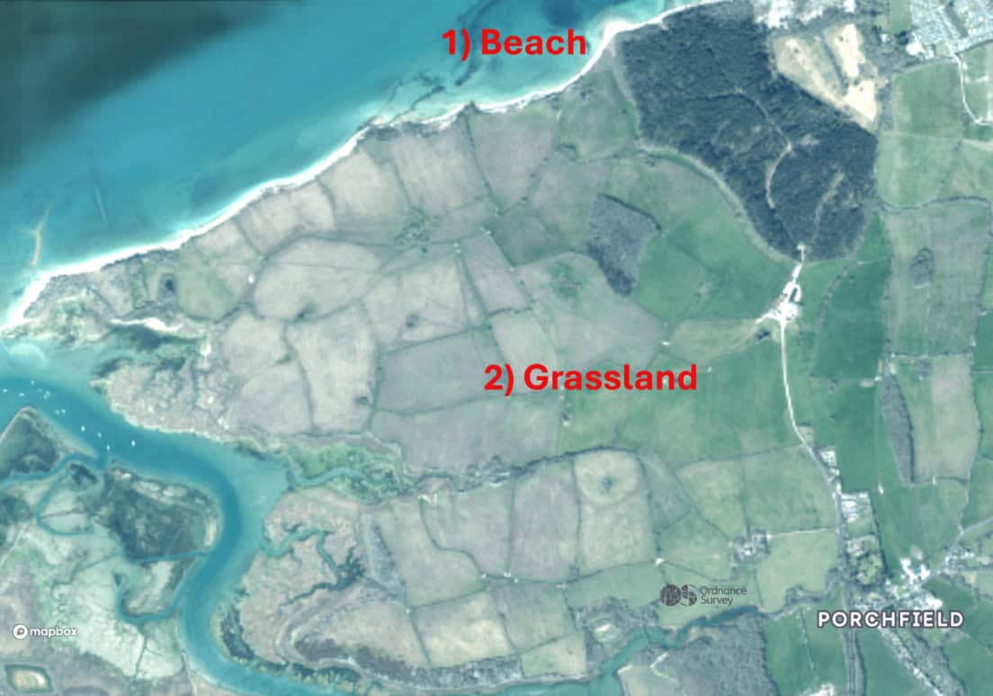
4) England Coast Path East of Newtown Harbour
In May this Year Steve Reed MP Secretary of State for Environment, Food and Rural Affairs (DEFRA) confirmed the route for Isle of Wight 7A and 7B a stretch of the King Charles III Coast Path: A National Trail around 2,700 miles of England’s coastline.
The Isle of Wight Council Rights of Way Department are now planning the work required to establish this route on the ground. Click on the following maps to see details.
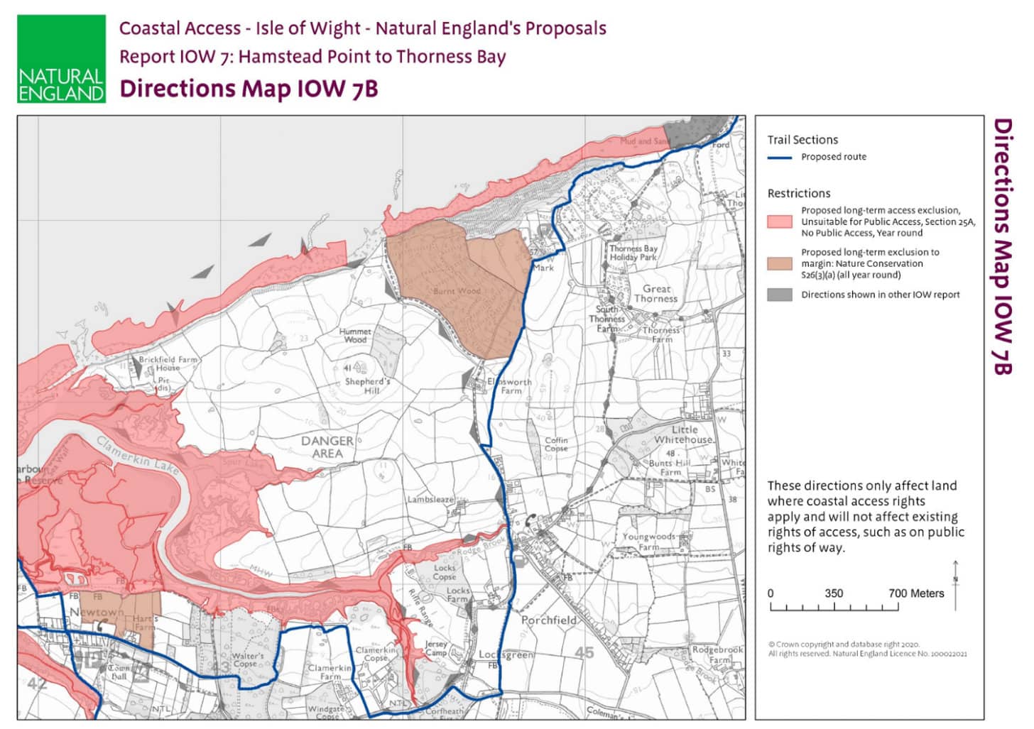
This Isle of Wight 7B map shows that we will thankfully no longer be walking along busy roads. Unfortunately, however, two public organisations Natural England and SERCA (South East Reserve Forces’ and Cadets’ Association) have decided this part of our new coast path will still be routed inland away from the shoreline, with no coastal views, and diverted around areas of coastal grassland and woodland.
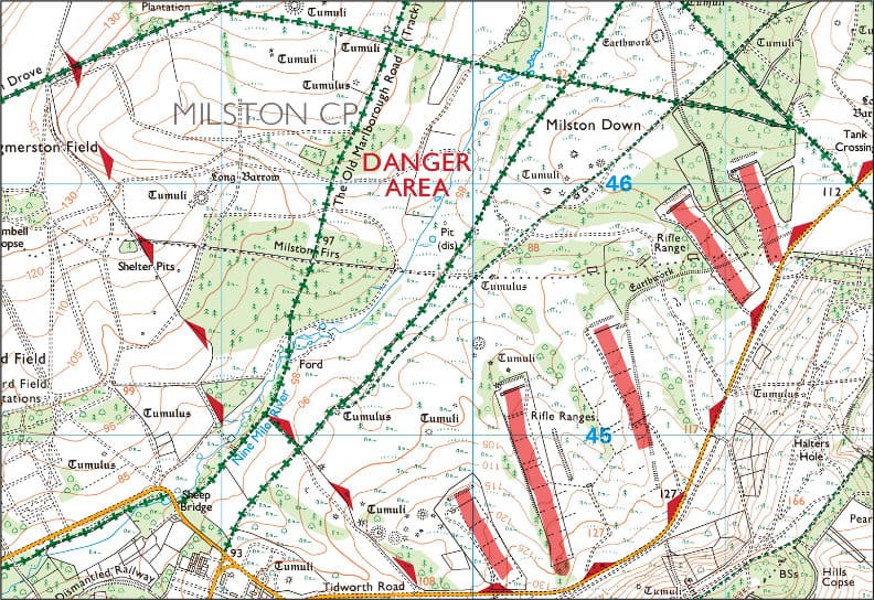
Yes, there is a SERCA rifle range at Jersey Camp. But at many other locations around England, the MOD Ministry of Defence safely mange public access routes adjacent to firing ranges. Two examples you may be familiar with in our region are the Southwest Coast Path through Lulworth Ranges and the extensive public access provisions available over the Salisbury Plain Training Area.
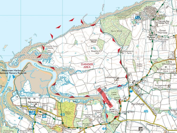
Porchfield SERCA Training Area has no Public Access – Firing Range
Part of Salisbury Plain Training Area – Lots of public access
5) England Coast Path West and South of Newtown Harbour
Full details available through Natural England website.
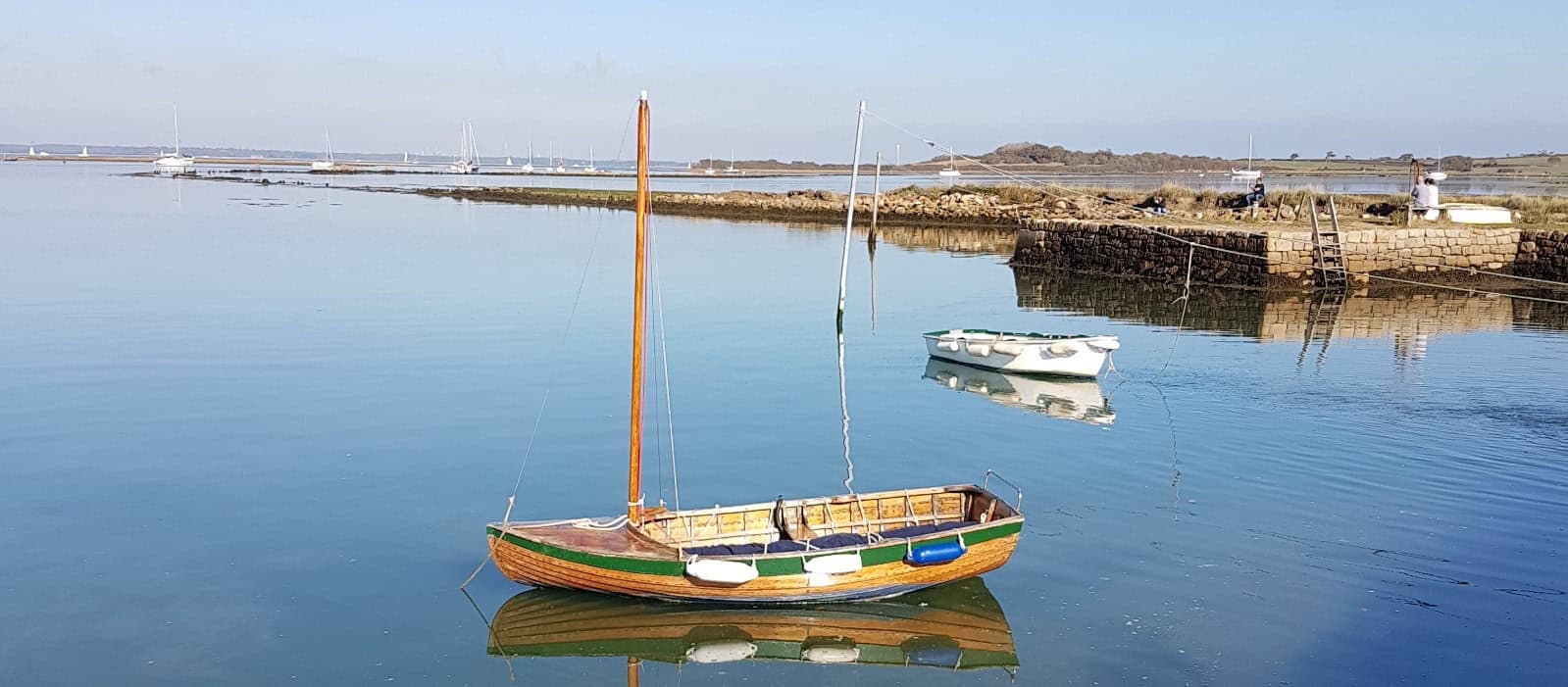
National Trust Newtown Harbour and Nature Reserve
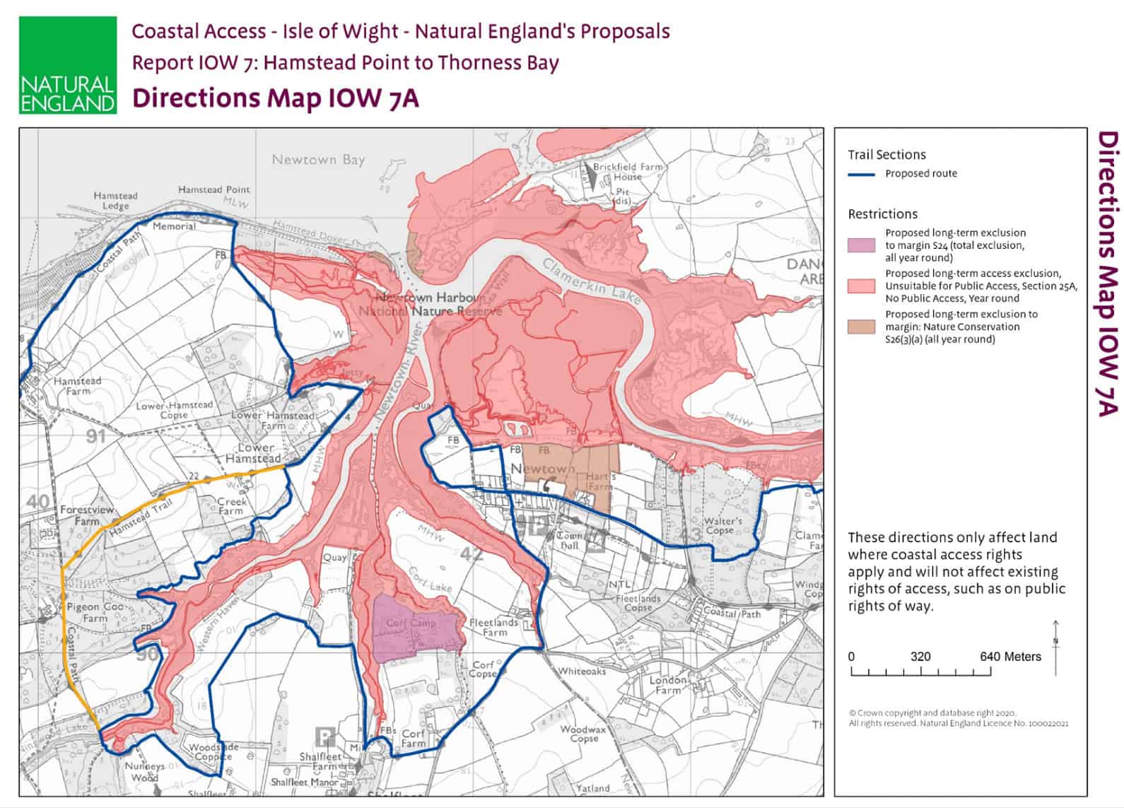
The National Trust and other landowners are supporting a number of significant route improvements west and south of Newtown (Isle of Wight 7A):
- The boardwalk around Hampstead marshland will be replaced.
- A new path will open up alongside Western Haven, available at times of the year when nesting seabirds and pheasants will not be disturbed.
- A cross-field route will lead towards the Quay at Shalfleet Lake replacing the path along the A3054 verge through Shalfleet.
- The Coast Path route will extend around parts of the Newtown Nature Reserve. Providing opportunities for trail users to gain a better understanding of conservation.
- Another new section of path will lead through Walter’s Copse to provide new access with views over Clamerkin Lake (adjacent to the SERCA rifle range!).
6) Ramblers Campaigning for Improved Access
On a crowded Island we need to develop a smart approach to sharing our countryside for a range of activities; this includes – farming, military training, nature conservation and public access for healthy recreation. Between 2010-2013 Isle of Wight Ramblers campaigned for our Island to be included as part of the England Coast Path. In 2020 we formally identified and submitted a range of the best coastal route opportunities to Natural England. Unfortunately many of these practical improvements are not being implemented.
We continue to campaign for valuable public access improvements like the coast and countryside to the east of Newtown.
For more information visit the website.
If you have suitable skills, dedication, and time available; perhaps you could help:
- Identify high value opportunities to improve our public rights of way network.
- Liaise with landowners, public bodies and local politicians about these potential improvements.
- Research and claim unrecorded paths.
- Lobby for changes in legislation.
Please contact us at: [email protected]