You know how these days we’ve got to the point where we think that Google knows everything?
Well, they’ve made it apparent that their all seeing eye goes a bit wonky when it comes to the Isle of Wight.
‘The Motorway’
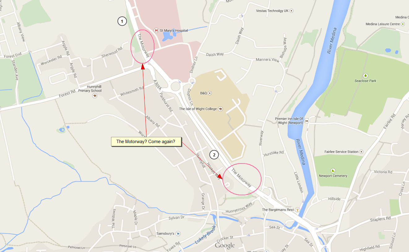
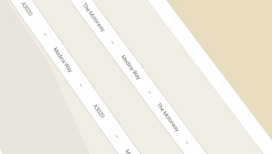
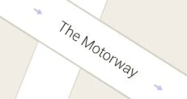
The latest version of their Maps service show the Isle of Wight having a road called ‘The Motorway’.
It’s going to be of little surprise to Islanders where they’ve mistakenly put that tag. Some people call it ‘The Dual Carriageway’, but we’ve often heard it jokingly refer to it as ‘The Motorway’.
And there’s more …
As you might expect, Google’s mapping of ‘The Motorway’ has it running between Coppins Bridge roundabout up to the B&Q one, but also beyond there, passing St Mary’s hospital too.
However, confusingly ‘The Motorway’ only appears to be on the Southbound carriageway when you zoom in.
Check it out for yourself on Google Maps
Thanks to the IslandEgo Twitter account for spotting it.